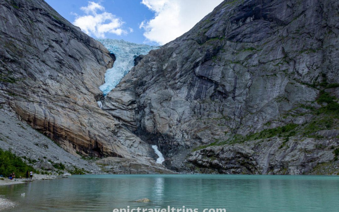
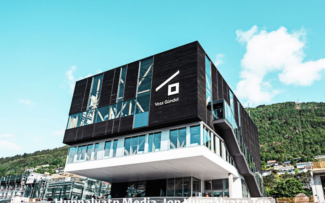
Norway Travel Itinerary – Road Trip
Our dear fellow travelers and followers, please rise and shine. Another epic road trip is ahead of us between the mountains, fjords, and sky of beautiful and picturesque Norway.
Day 1 & 2: Visit Oslo
We have been living in Oslo for over a decade. So we will try to present highlights of our city and be as objective as we can.
There are many attractions worth visiting, and we will try to group them based on their geographical location.
Oslo Fjord In Bjørvika
Nearby the Oslo Railway station on the Oslo fjord coastline is the Opera House, New Oslo Public Library, New Munch Museum building, New residential area, and Barcode project. We can describe The Barcode as “Oslo City”, where many big companies have offices.
In the photo below we can see the Opera House in the middle, the new Munch Museum building on the right, and part of the Deichman Public Library building on the left.

Karl Johan’s Street
From there you could walk Oslo’s main street, Karl Johans Gate, and pass by Norwegian Parlament (Stortinget), Grand Hotel, National Theather, and all the way to the Royal Palace on the hill.
Lots of people in front of the Royal Palace during Constitution Day celebration on the 17th of May.

Oslo Fjord In Aker Brygge
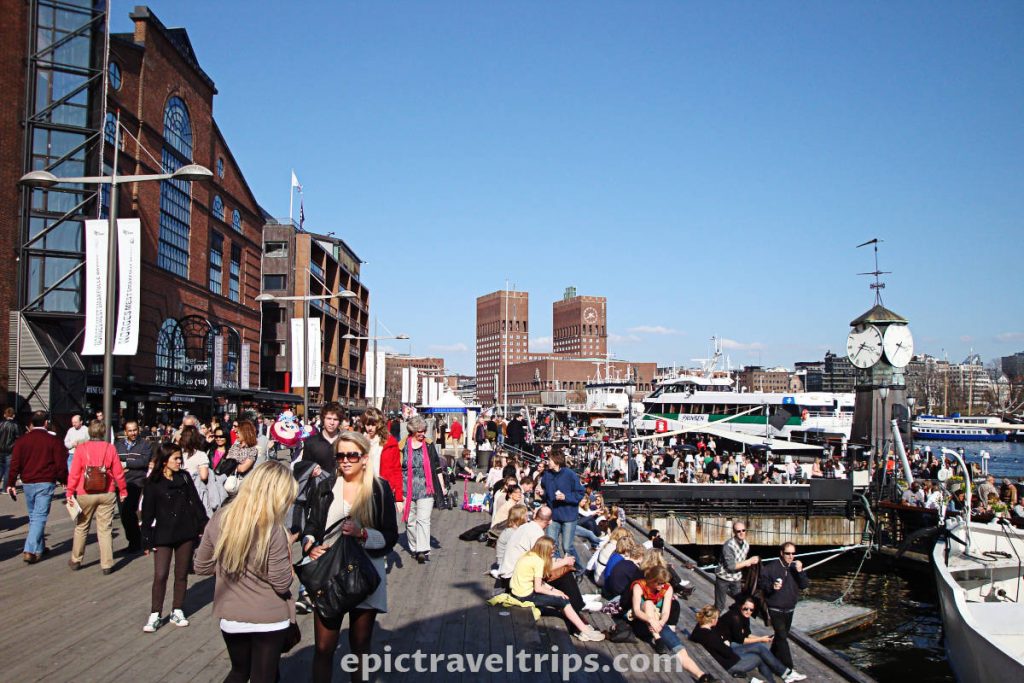
From The National Theater, is a short stroll to Aker Brygge and another part of Oslo Fjord. There you can visit City Hall (Rådhuset), Nobel Peace Center, Akershus Fortress & Castle (Akershus Festning & Slott), and the Aker Brygge pedestrian area with many yachts parked there.
The sunny day attracts lots of people to the Aker Brygge pedestrian zone with City Hall’s square red building in the background.
Bygdøy Island
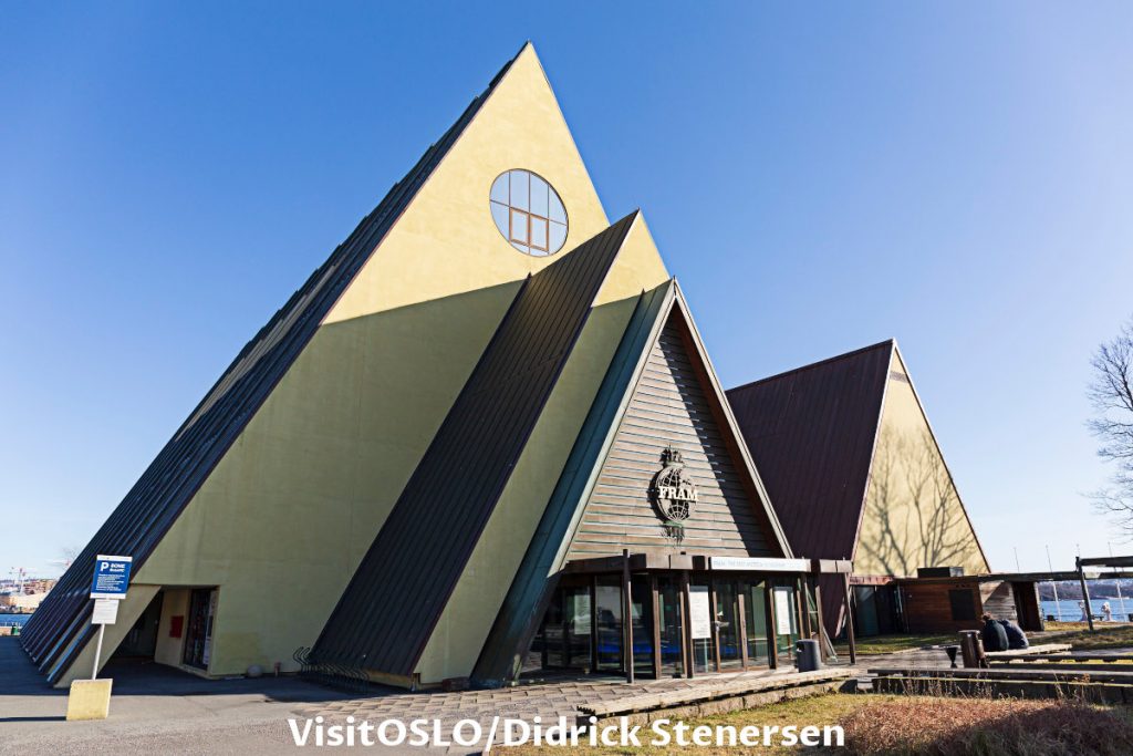
From Aker Brygge you can take a small boat to Bygdøy Island. On the island’s shore are many famous museums such as Fram (Polar Explorations) Museum, Kon-Tiki, and Maritime Museum. Further inland are Viking Ship Museum, Holocaust Center, and Norwegian Ethnographic Museum (Norsk Folkemuseum).
Fram Museum on Bydgøy island has a Fram polar explorations ship inside. Fridtjof Nansen and Roald Amundsen used the ship for Arctic and South Pole expeditions.
Oslo Parks
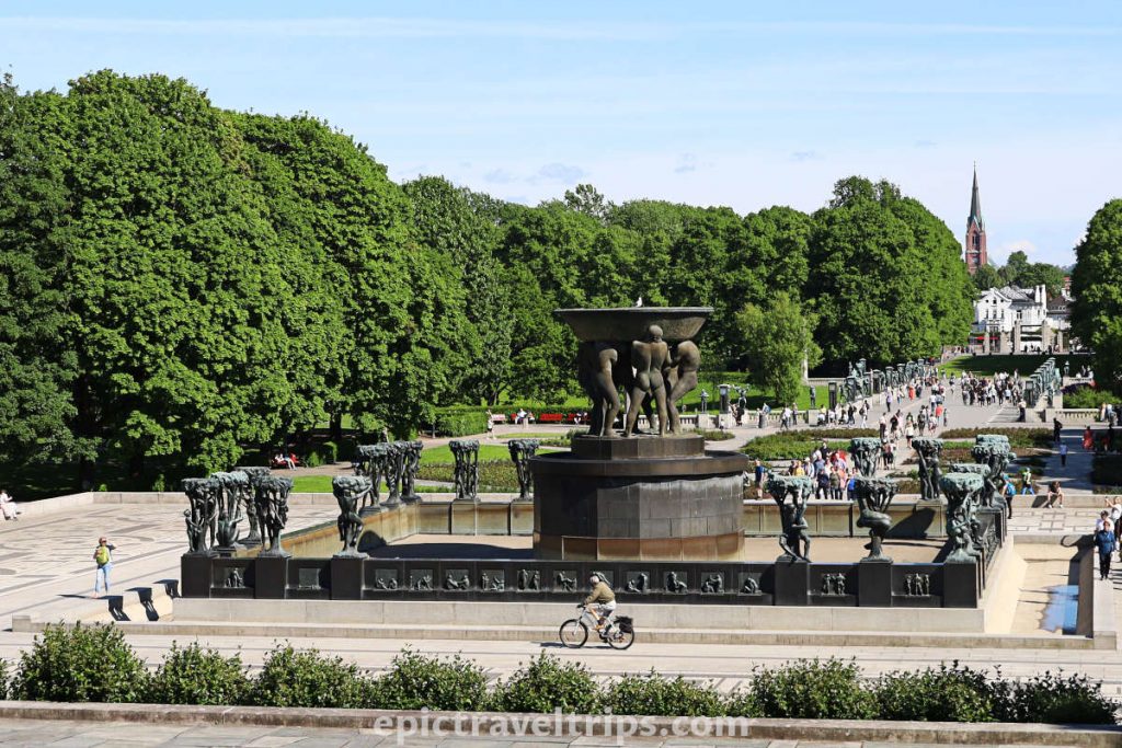
From The National Theater, you can take a subway to Majorstuen, and from there is a short walk to Vigeland and Frogner Parks. In Vigeland Park, you can see the open exhibition of famous sculptures, a Monolith Statue, a fountain, and a small lake.
Oslo Mountains
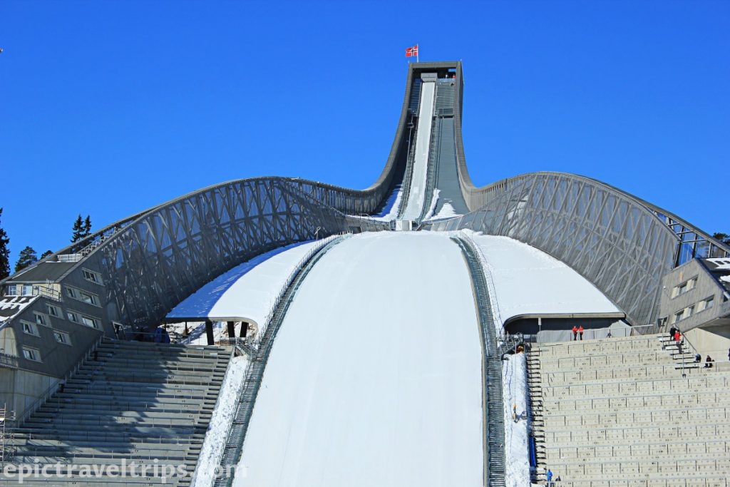
On the west Oslo mountain’s top is Holmenkollen Ski Jumps & Museum and a fantastic view over the fjord and the city. From the city center, you can take a subway all the way to the top.
This is what Ski Jump looks like during wintertime.
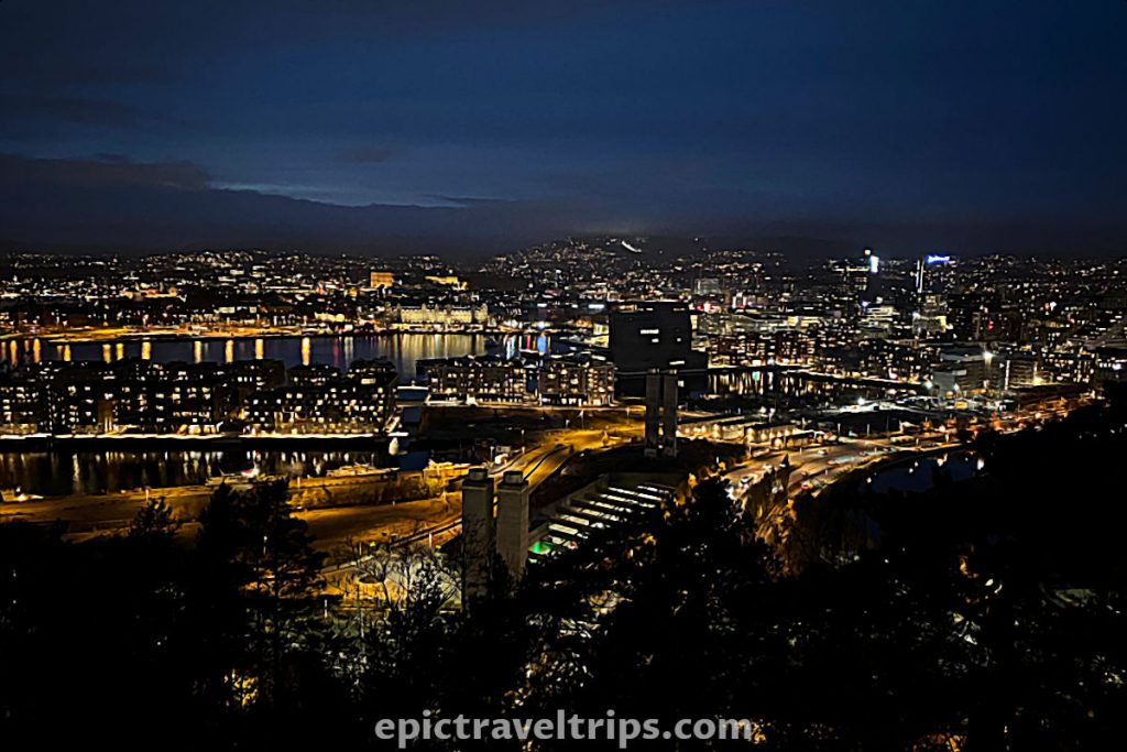
Oslo night cityscape photo from Ekeberg viewing platform.
If you click this link and make a purchase, we earn a commission at no additional cost to you.
Day 3-5: Explore Nærøyfjord & Aurlandsfjørd area
Early Jule morning, and we are, on our way, from Oslo to Lærdalsøyri. It is four and half hour’s drive and less than 300 km (around 180 miles). No worries, we will have plenty of time for stops, short sightseeing, and hiking during this day. We will get to know the Norwegian countryside and nature. It is just an introduction to what we will experience on this journey.
Day 3 – Driving Through Oslo
As you drive through Oslo, you will notice driving through many tunnels since Norwegians like to drill holes. Vertically in the sea, they search for oil. Horizontally on the land, they dig tunnels.
As soon as we exit the Opera tunnel on our left-hand side, we can see the beautiful Oslo fjord illuminated by the morning sun. In this short part of the Oslo Fjord, we notice numerous marinas loaded with boats and yachts waiting for their owners to set sail on new voyages and sea adventures.

As we approached Sandvika, we left the E18 highway and took E16 in the Bergen direction. In Sandvika, there is the biggest shopping mall in the Oslo area, so if you forgot to do the shopping, this was a chance to resupply.
Day 3 – Norwegian Countryside Driving
We left behind the buzz of the city and saw more and more nature-made beauties and fewer human constructions. As soon as we left the highway, we could expect to be in a convoy of cars heading to Bergen. So no more the highway, and welcome regular road traffic. However, we can enjoy the natural path of valleys, lakes, rivers, and streams along the road.
Day 3 – Fagernes – Our First Break
After about two and a half hours, we approached Fagernes, a small place on the lake. It was time for our first short break. We stopped at the shopping center to buy our refreshments. A pleasing way to enjoy the refreshment was by the lake. We could stretch our legs for a short walk on the shores and enjoy the first glimpse of mother nature.
Fagernes is also a conjunction to take road 51 to the well-known Besseggen hiking tour. This hike is very popular among Norwegians. It was my first hiking adventure in Norway after moving in 2008.
As we left Fagernes, the scenery changed again. We slowly climbed along the plateau surrounded by lakes, rivers, streams, and mountain cabins. Whenever we saw something appealing to our eyes, we stopped for a short break. However, as we drove to higher altitudes, Norwegian weather reminded us of where we were.
We want to emphasize the importance of weather in Norway and this is our latest crossing over mountains in late April while driving to Flåm.
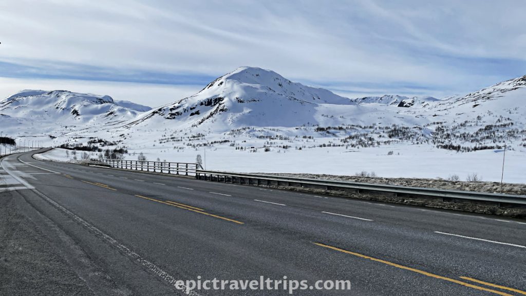
There’s a wonderful Norwegian saying – “Det finnes ikke dårlig vær, bare dårlig klær!” which translates to…
“There is no bad weather, only bad clothes!” – Norwegian saying
Remember this whenever visiting Norway, and you will not be unpleasantly surprised.
Day 3 – Borgund Stave Church
After another one and half-hour drive, it was time for another break, but this time a longer one. We exited E16 road just in front of Borgund tunnel to visit our first sightseeing point.
Borgund Stave Church is a medieval black wooden church built with motives of Viking ships (turned upside down), roof tiles reminiscent of fish scales, and dragons’ heads at the tips of the roofs. Most of these statements are just myths, but more about them is in our detailed article with the link below. It has a unique smell since old wooden churches are covered with special materials to preserve them for generations to come to enjoy them as we do now.
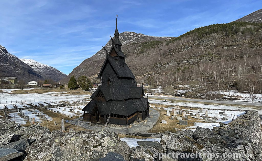
Besides the visitors center with exhibitions, ticket office, souvenir shop, and parking space, this is also starting point for hiking the Vindhellavegen. However, we decided to do something else, so please follow us.
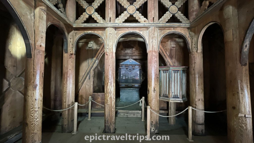
Day 3 – Vindhella Road (Vindhellavegen)
After the visit to Borgund, we drove further on the road for about 5 minutes (4 km, 2.5 miles). The road is between the stream on the left and the mountain cliffs on the right.
We stopped at the small parking space on our right-hand side. It was our starting point for a short hiking tour to Vindhellavegen.
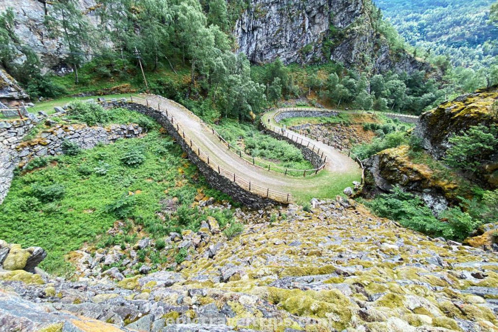
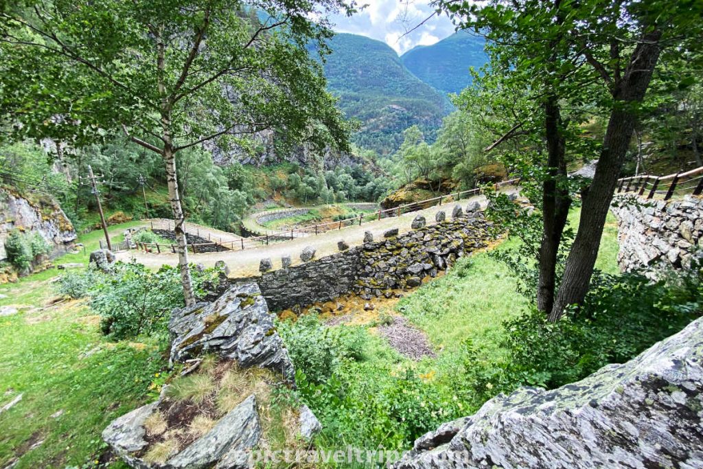
Vindhellavegen is the art of engineering blended with nature. It is 2.7km (1.68 miles) long, stretching from the parking lot on one side and to Borgund Stave Church on the other side. Its steepest part consists of four 180-degree bends supported by high stone walls blended with the surrounding terrain.
Vindhellavegen is probably, the most exciting part of the much longer trail called the King’s Road (Kongevegen). We saw many King’s Road signs on road E16 while approaching Borgund.
Climbing up at our own pace, we filled our lungs with fresh mountain air, sunbathed on sunny stretches of the path, and cooled down in the shade parts. At the top, we got our reward in the form of a fantastic view of the winding stone path below us. It was a highlight of our first day in this area.
Day 3 – Lærdalsøyri
Under the impression of the Vindhella Road visit, we drove down the local road to reenter the E16 motorway again. On the side of the road appeared something we would initially describe as a stream. Gradually, it turned into a beautiful mountain river (Lærdalselvi).
The river and the road intertwined their sides to make the rest of our journey more exciting. At one point, the river was on the right. A few kilometers later, the river was on the left side of the road. This devious game of nature and engineering continued to our final destination of the day, Lærdalsøyri.
The Charm Of Lærdalsøyri
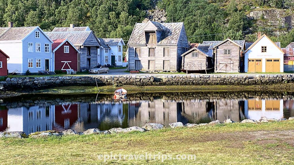
Lærdalsøyri is a small place tucked between steep knife-cut mountains. Læerdals river (Lærdalselvi) on one side of the valley slowly runs into the mirror-calm bay water. The bay is part of the much bigger fjord. Our hotel location is at the edges of the bay. It is popular among campers as overnighting place.
The sunsets are fantastic here. The setting sun hides behind the mountains on the left. Suddenly it appears and warms the bay for some time. Like a shy guy disappears behind the steep mountain edge on the right.
However, in the photo above you see that sunrises are fantastic as well.
The bay has very pronounced high and low tides, but only if you notice them. We walked along a long sandbar to get closer to the water. While I tried to take sunset photos, I didn’t even notice that the water had covered the sandbars.
The girl on the SUP paddle board effortlessly glided over the water’s surface. Half an hour ago, that section was sand and pebbles.
In our opinion, Lærdalsøyri is a fantastic location for exploring this area. It is cheaper than Flåm, less buzzy, has grocery shops, and provides good connections to all our sightseeing destinations in the next two days.
If you click this link and make a purchase, we earn a commission at no additional cost to you.
Day 4 – Laerdal Tunnel
Our second day in Aurlandsfjørd region is a visit to the famous Flåm but first, we need to find the light at the end of the tunnel.
Do you remember the part of this article about Norwegians who like to drill holes? Well, this is one of the engineering examples that prove the point.
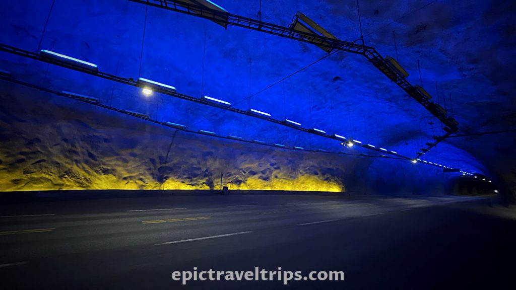
Laerdal Tunnel is a 24.5 km (around 15 miles) long tunnel. We believe it was, at one point, the longest tunnel in the world, but we are not quite sure. However, to make driving through the Laerdal tunnel less boring, in several places, caves with blue lights on the walls and yellow ones on the edges were built to give the impression of the rising sun. The blue color of the tunnel walls symbolizes the glacier.
Day 4 – Flam (Flåm)
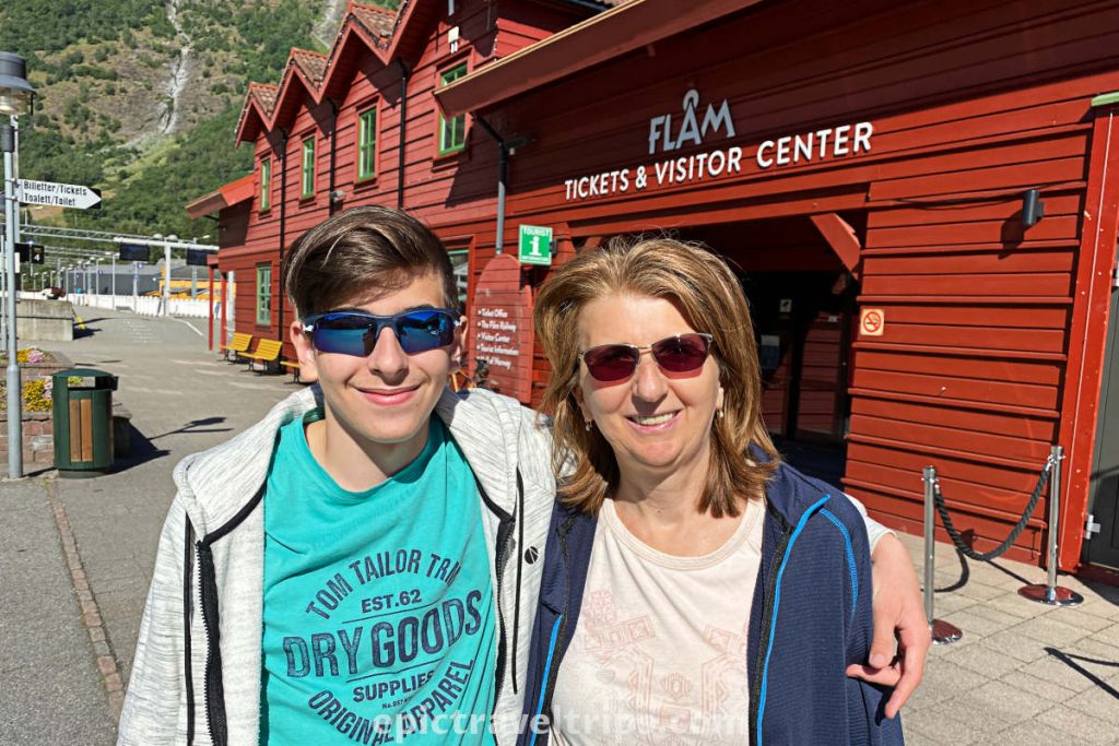
Flåm is a small place where Flåm River (Flåmselvi) meets with the end of Aurlands fjord. Wherever you look around, you can see the mountains.
Although small, Flåm is very busy due to being a tourist hub. From the fjord side, come cruise and yacht passengers. Vehicles (campers, bikers, busses, cars, etc.) come from the Oslo-Bergen motorway. The majority of them have one thing in common. They want to wander, explore, and see what this area offers.
Oh boy, Flam lives up to its reputation and has so much to offer. Sometimes it will be beyond your expectations. We will describe it in the following sections of this travel diary.
Day 4 – Flam Railway (Flåmsbana)
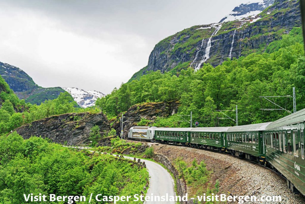
Flåmsbana is very popular among tourists. The train ride provides fantastic views over beautiful landscapes, mountains, valleys, rivers, waterfalls, etc. It is very short, only 20.2 km (12.5 mi) long, but it starts from sea level at Flåm and ends at 866 meters (2841 ft.) at Myrdal station.
Just look at this beautiful photo by © Sverre Hjørnevik. This extraordinary place will hook you to visit it.

One of the main attractions is the Kjos waterfall (Kjosfossen), where a train stops for a few minutes to take photos, see and listen to Huldra’s singing and dancing.
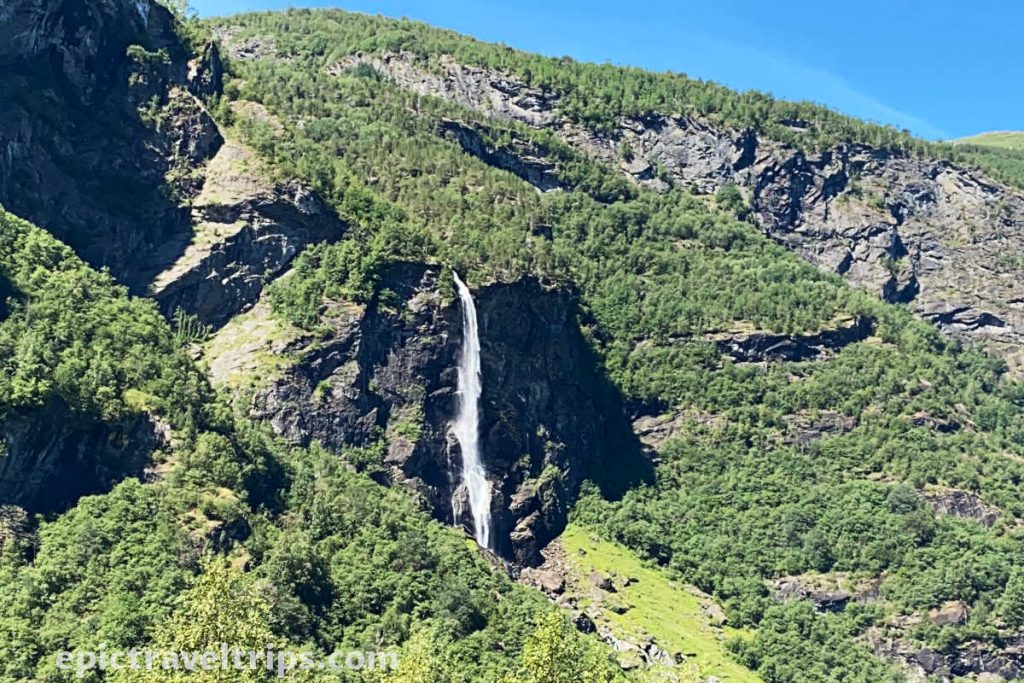
Rjoand waterfall (Rjoandefossen), the blue water of Flåm river (Flåmselvi), the valley, and surrounding mounties are eye-catching landmarks too.
This time we took return tickets. Next time we would prefer to take one-way tickets and return on the bicycles we can rent at the top.
Day 4 – Flam Railway Museum (Flåmsbana Museet)
Flåm Railway Museum is a “Wikipedia” for Flam Railway history. It is in the old railway station building next to the tracks.
Inside are many photos, artifacts, and even old trains out of service. They document the history, workers’ life, engineering challenges in solving high altitude difference problems, technology development, etc.
You can visit it to warm up before experiencing the real thing.

Day 4 – Aurlandsfjord Fjordsafari
Maybe trains are not your thing, and you want more adrenalin kick (no worries), then the Aurlandsfjord Fjordsafari is one of the options. The starting point is to throw a stone away from the railway station.
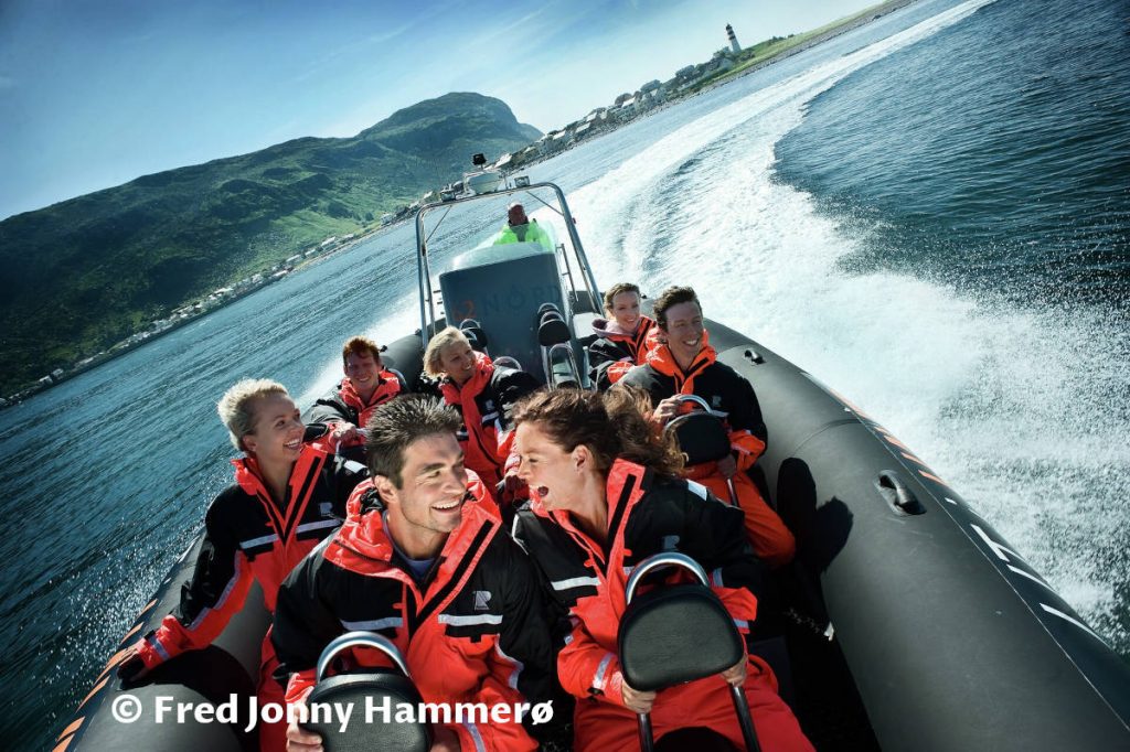
Jump into a safari suit, put on goggles and a cap, or let your hair flutter in the wind. Now you are ready. The waves ride waits for you on the fast-open RIB boats.
Thanks to the photo from © Fred Jonny Hammerø / Møre og Romsdal fylke, we can see how big a ride thrill for the passengers is.
It will be a lasting memory for sure.
Day 4 – Fjord Cruise Nærøyfjord (Optional)
Slowly glide the waters of beautiful Aurlands & Nærøy Fjords in hybrid or electrical cruise ships from Flåm to Gudvangen. Take the bus ride on the way back to round up the trip.
The ships have large windows and walkways in the shape of the final parts of the winding trails of the Flåm railway, so you can find a spot to enjoy the view.
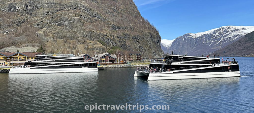
As you can see in the photo below, from Myrdal train station down to the valley is a zig-zag path and inspiration for the cruise ship design lines.
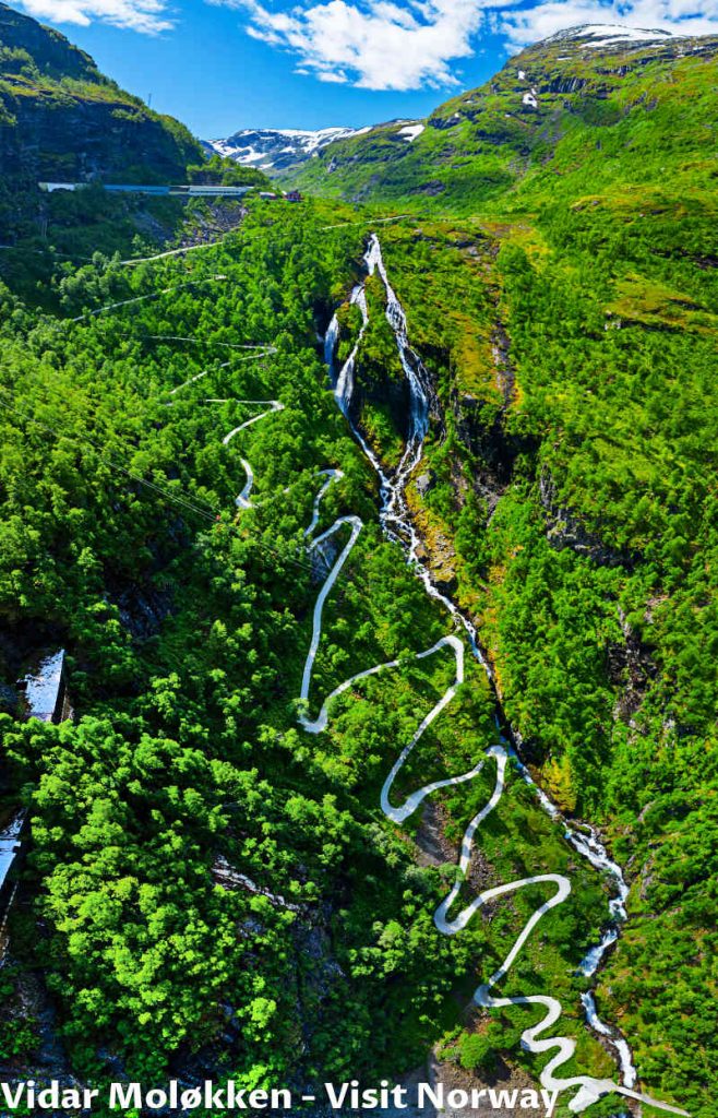
Other attractive spots in Norway have similar zig-zag patterns used as architectural design ideas. We will return to that when visiting Trollstigen mountain road and Ørnesvingen viewpoint near Geiranger.
Day 4 – Enjoy Flåm River – Flåmselvi
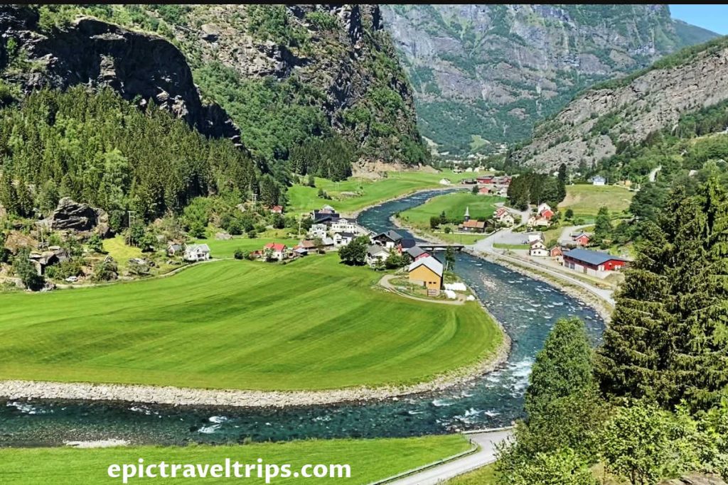
We pulled out the chairs and table from our car. Quickly we transformed the grass patch into our mini-picnic area. It was a nice break before continuing with our escapades.
We enjoyed the calm, emerald green, and sky blue mixture of colors with the refreshing air of the sunny day near the Flåm River (Flåmselvi).
If you click this link and make a purchase, we earn a commission at no additional cost to you.

If you dare, you will jump into freezing water for ultimate refreshment, or maybe not.
Day 4 – Stegastein Viewpoint
It is time to pack and come back to base at Lærdalsøyri. However, we are not taking the same route since we pick Lærdalsøyri for a reason. It provides alternative roads to reach it, which is one of the reasons.
Road to Stegastein’s viewpoint is just one of them, but what a detour. We drove up the narrow, curvy road. So extra caution was not a bad idea.
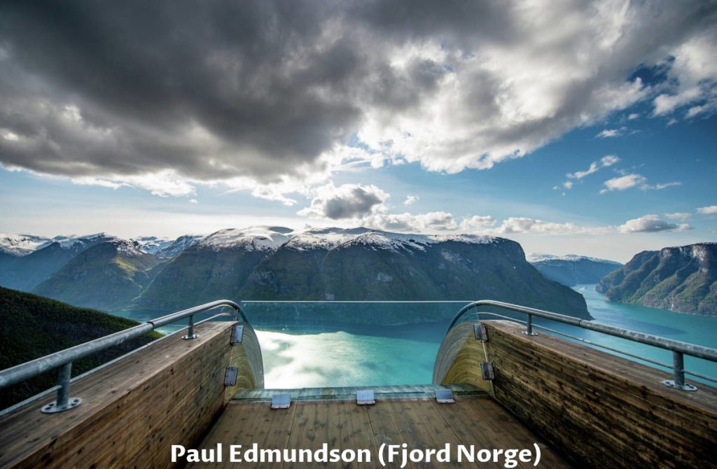
Stegastain viewpoint provides a panoramic and magnificent view over Aurlands Fjord on the platform constructed in a challenging way.

As you can see in this beautiful photo from © Sverre Hjørnevik, wooden, metal, and glass materials were used to make this platform blend into the natural surroundings, but it vibrates a bit when someone walks on it. Nothing scary, but there is an additional thrill to the anticipation of watching over the glassy wall into the beautiful landscape.
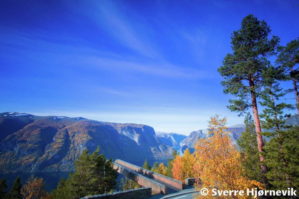
The platform is 650m (2 130 ft) above sea level, and we think it is a marvelous achievement.
I’m getting more and more afraid of heights as I get older, but my wife and son think it’s funny to watch me shiver and get scared as I approach the edge. I will do anything to cheer up my loved ones. So if you see an XXL-size version of Roberto Benigni (or Louis de Funès if you prefer) doing goofy things, it might be me.
Day 4 – Aurlandsfjellet Scenic Route (The Snow Road)
Since we were at Stegastein’s viewpoint anyway, it would be very boring to drive the same road and the same tunnel back to Lærdalsøyri. Instead, we decided to continue our adventure. Why don’t we go back to “base” over the mountains? We just did that. We drove over mountainous terrain on the so-called “Snow Road” or the Aurlands Mountain Road (Aurlandsfjellet).
We expected this fantastic photo from Fjord Norge/Visit Norway to be the same image we will experience, but…
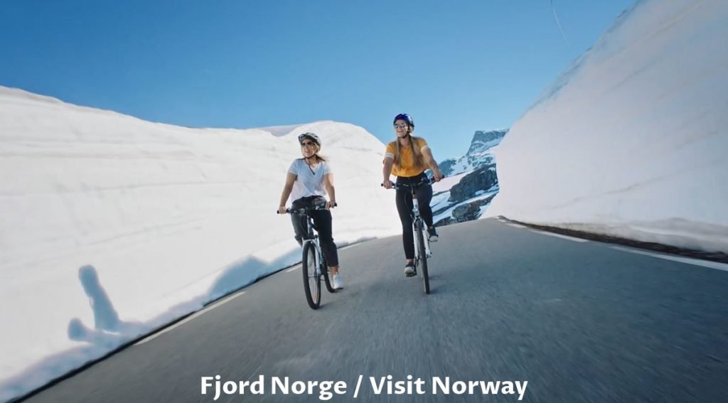
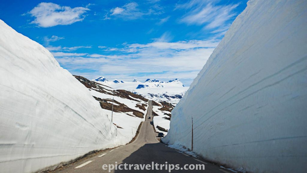
Aurlandsfjellet Scenic Route (the snow road) is only open during the summer months. When this road season is open, the snow is usually very high, so cars drive between snow walls on the side of the road. We were not so lucky in July, and most of the snow melted. Only short sections were still with pockets of snow.
The road is 47 km (29 miles) long and goes just over 1 300 m (4 265 feet) above sea level at some points. It is probably one of the best locations if someone wants to get a sense of winter during the summer.
However, if you want to ski during summer in Norway, Stryn Summer Ski Resort is the best location. We passed by it a week later on this epic trip.
Day 5 – Norwegian Glacier Museum (Jostedalsbreen)
Again has proved that Lærdalsøyri is an excellent location for exploring this region. It is just 64 km (40 miles) from The Norwegian Glacier Museum in Fjærland. However, this time we drove to the north. However, this time we drove to the north, and this was our first ferry crossing (of many) on this epic road trip.
The museum holds an exhibition about the Jostedal glacier (Jostedalsbreen) and the national park. It is the largest glacier on the European Continent, with an area of 474 square km (183 sq. miles). It is possible to see the panoramic movie about the Jostedal glacier on the big screen.
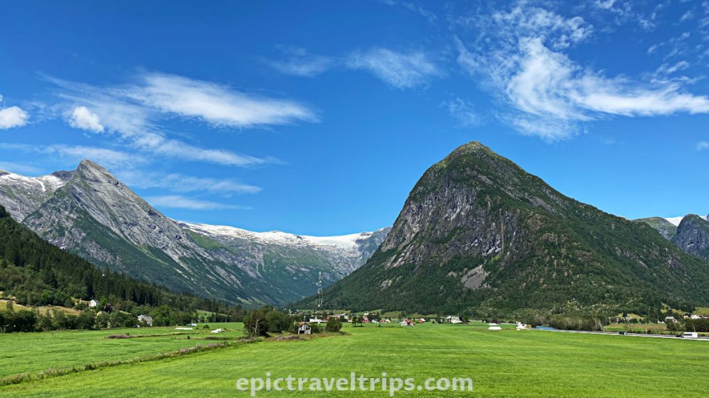
The surrounding nature is beautiful, and you can imagine what this walk on the glacier looks like.
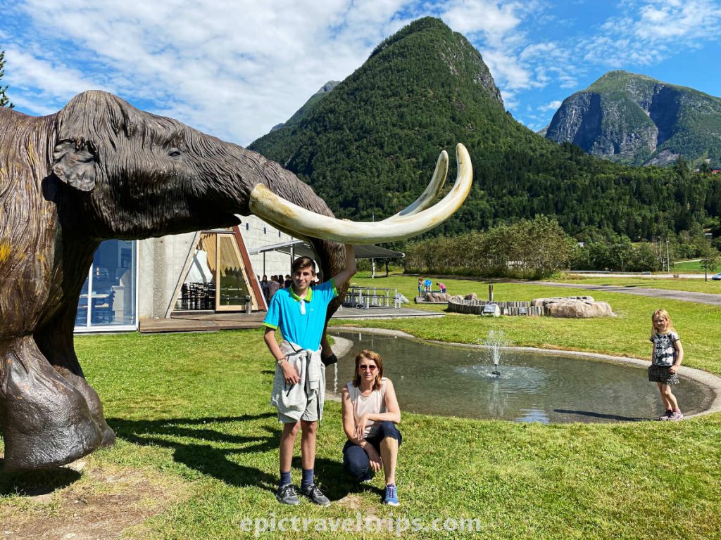
Maybe the Glacier Museum building’s architecture is not attractive enough to make you stop by. Mammoths in front of the museum are, maybe, a better magnet for visitors. If the kids accompany you, the joy is at the apex. Our teenage son was “so so” excited.
Day 5 – Mundal (Fjærland) – The Norwegian Book Town
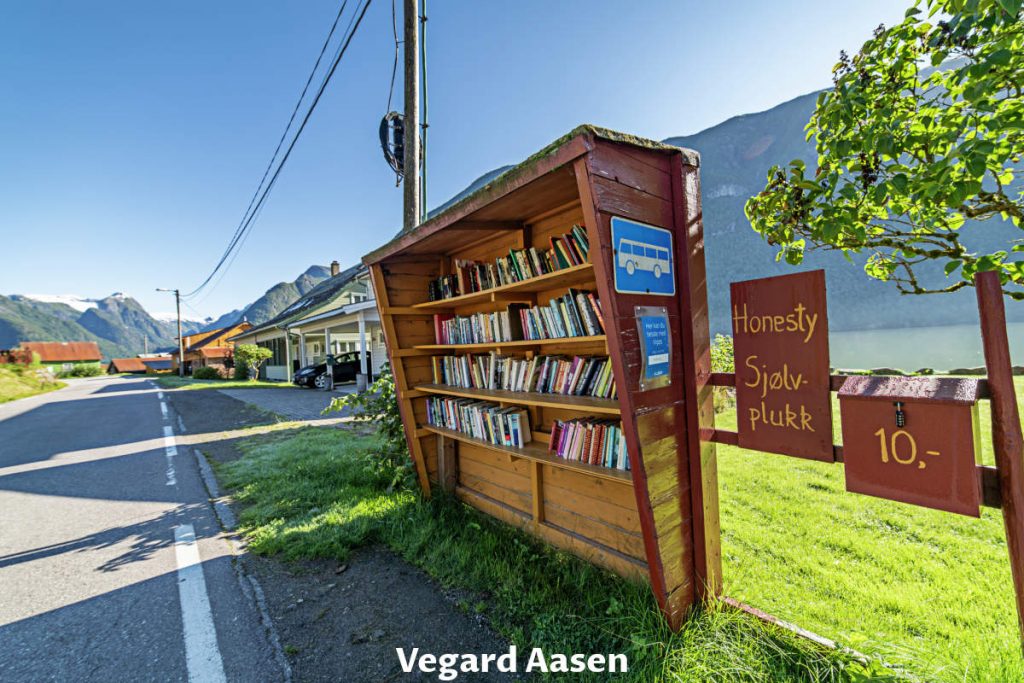
Just a 4-minute drive and 3 km (1.8 miles) further down the road from the Norwegian Glacier Museum is the small village of Mundal. It is also known as The Norwegian Book Town (Bokbyen i Fjærland). Here you can find several picturesque second-hand book shops.
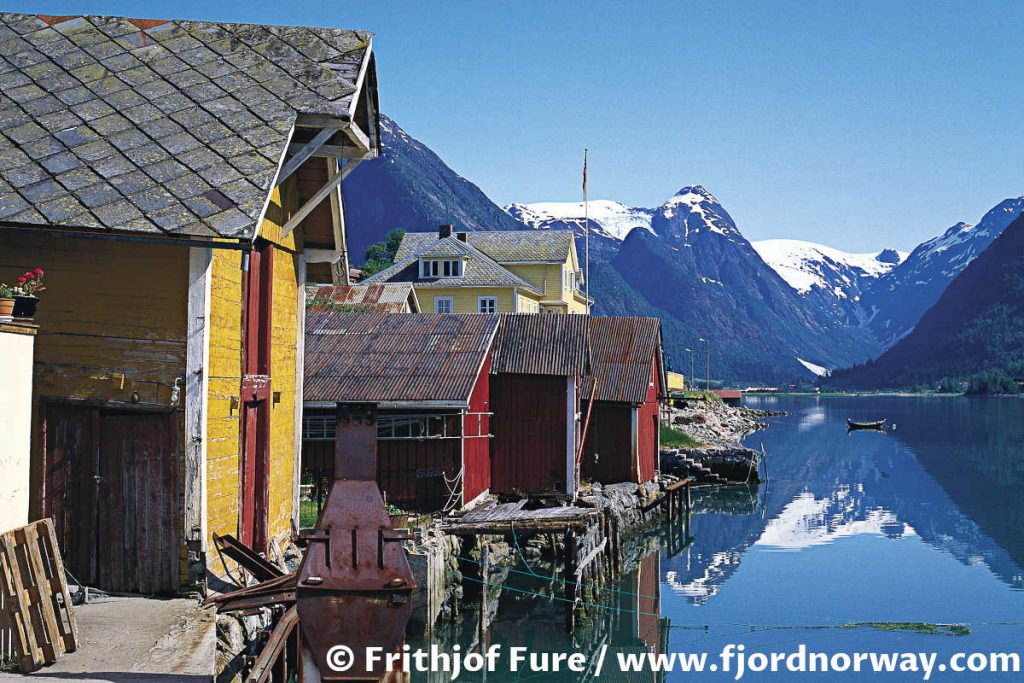
Alternatively, you can enjoy kayaking on the calm waters of the Fjærland fjord, which is another arm of the bigger Sognefjord. We have already mentioned the Aurlandfjord arm at Flåm and Nærøyfjord arm at Gudvangen village. Both are the arms of Sognefjord. Sognefjord is the largest and deepest fjord in Norway, nicknamed The King of the Fjords.
Day 6: On The Road To Bergen
We were on our way to Bergen, but to make the trip exciting, we decided to make a few stops along the way. The escapades on today’s list were: short photo sessions, enjoying nature full of waterfalls, gorges, winding roads, and many more.
It is a 3-hour drive from Lærdalsøyri to Bergen and is only about 200 km (125 miles) away.
Day 6 – Kjel Falls – Waterfall (Kjelfossen)
As soon as we passed Flåm, we entered only the 5 km (3.1 mi) long Flenja tunnel. Next, we drove through the much longer 12 km (7.45 mi) Gudvanga tunnel. Finally, on the tunnel’s exit is Gudvangan village on the right-hand side.
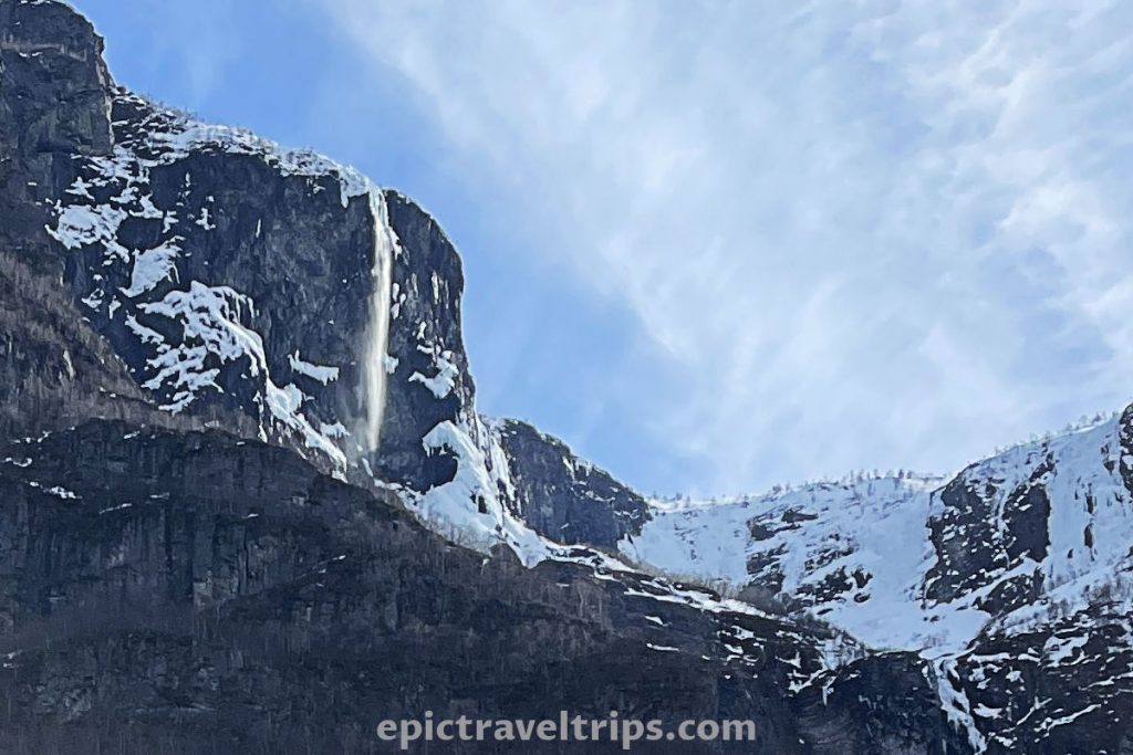
On the left-hand side of the tunnel is the world’s 18th tallest Kjel waterfall (Kjelfossen), with a total fall height of around 705 meters (2 313 ft). There are six drops in the falls and the tallest single drop of 198 meters (650 ft).
Day 6 – Gudvangen Village – Viking Vallley
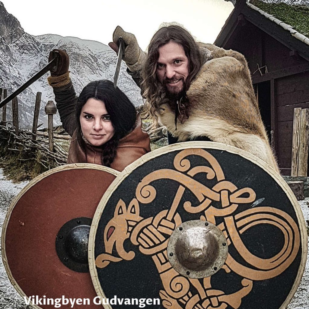
Gudvanga village is at the end of Nærøy fjord, and many tourists come on cruise tours here. Besides the waterfall drops, the beautiful Nærøydalselvi River runs into the fjord.
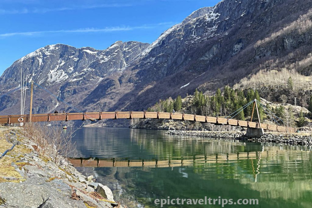
In addition, it provides a taste of Viking life in the Viking Valley that will bring you back to the Viking age.
Day 6 – Nærøyfjord
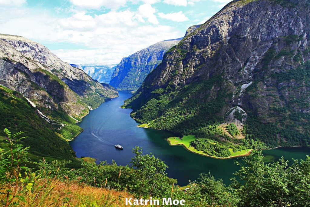
Nærøyfjord ends up at Gudvangen village. From Gudvangen village is possible to take Fjord Cruise Nærøyfjord to Flåm and experience this beautiful fjord. One option is to take a bus from Bergen to Gudvangen, switch to cruise, experience the fjord, and finish in Flåm for further exploration.
In the opposite direction, you can take the same cruise from Flåm and end up at Gudvangen. You can take the bus back (to Flåm) to round up the trip.
However, the car is the most convenient transportation in our humble opinion.
The Nærøyfjord arm (part of the Sognefjord) is 19 Km (11.8 mi) long and only 250 meters (820 ft) wide in some places.
As you can see in the photo below, the surrounding mountains are steep, allowing many waterfalls to perform their crash dance into the fjord below. The green vegetation and blue sky reflect these colors into the fjord’s watercolor. Nature worked for millions of years to make this majestically beautiful landscape.
Day 6 – Stalheimskleiva Road
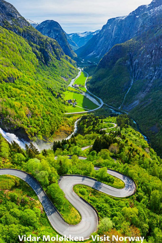
For two consecutive years, we tried to “slide down” this 13 hairpin bends only downhill driven road, but without any luck yet. It is currently closed due to maintenance work. So it is still on our wishing list for visits in the future.
To reach it, exit E16 at the Stalheim sign and drive up the narrow road to the Stalheim Hotel. The hotel was the furthest we could drive to on our first attempt to experience the road. While you “slalom” drive, please do not forget the magnificent views of the beautiful waterfalls Stalheimfossen and Sivlefossen.
Day 6 – Tvinde Waterfall (Tvindefossen)
There are so many waterfalls on the road from Flåm to Bergen, and Tvinde Waterfall (Tvindefossen) is one of them worth mentioning. The waterfall is only 13km (8 miles) from Voss on the road’s right-hand side while driving in the Voss direction from Flåm. Near the waterfall are a souvenir shop, camping, and parking space. It is very easily reachable from the road and parking.
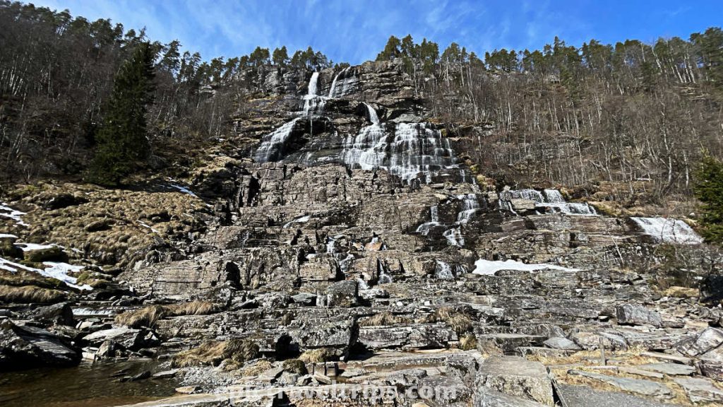
Compared to Kjel Falls – Waterfall (Kjelfossen), the Tvinde waterfall drop is only 110 meters (360 ft). However, the Tvinde waterfall is broader. The water flows down natural staircases, cascade sprinkling around stair by stair.
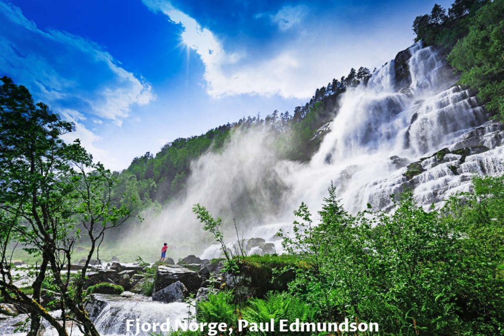
We were lucky to visit this place several times. However, during the summer months (July especially), the waterfall is as beautiful as in the photo above.
On our first visit, it was raining. So weather conditions can be challenging to enjoy this beauty to the full extent.
As you can see in the photo below, it is a lot less impressive in spring. The rocks are predominant, and the colors are too gray since there is less water and the vegetation is not green.
Day 6 – Voss
Voss is considered the adventure capital of Norway and offers both adrenaline and adventurous activities but relaxing ones in the surrounding natural landscapes.
Voss offers many activities such as skydiving, tandem paragliding, the wind tunnel, rafting, kayaking, riverboarding, SUP paddle boarding, fishing tours, biking, hiking, gondola rides, etc.
For more relaxing-oriented visitors are swimming pools, spa centers, or golf courses.
Winter is no less exciting, with many slopes to ski, snowboard, or snowshoeing.
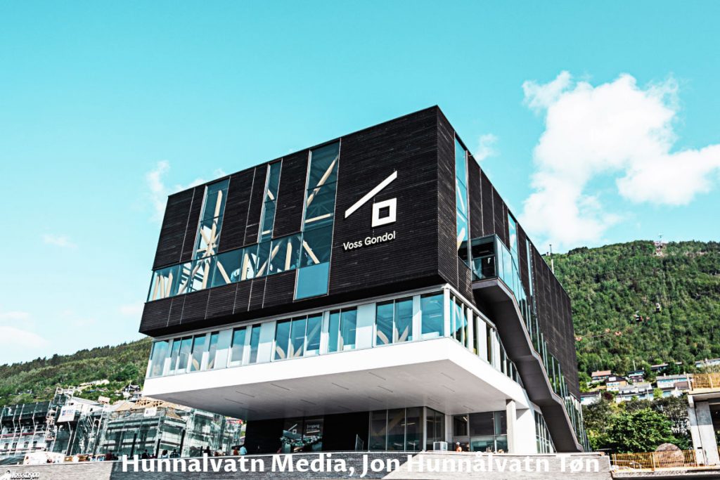
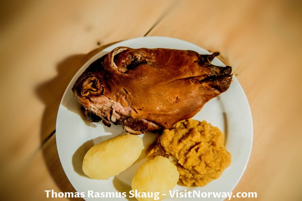
If you are a food adventurer, you can taste “sheep’s head” (Smalahovetnunet). It is the dish back to the Viking age. The sheep’s eye is a special treat and honor for the guest from the host.
After resupplying at the Voss Amfi shopping center, we continued our road trip to Bergen. We have a one-and-half-hour drive and another 106 km (63 mi) to Bergen.
If you click this link and make a purchase, we earn a commission at no additional cost to you.
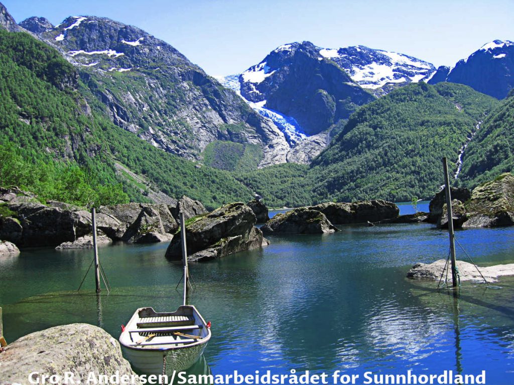
The previous year, we came to Voss from the south after visiting Pulpit Rock (Preikestolen), Bondhusvatne Lake, and Bondhusbreen Glacier.
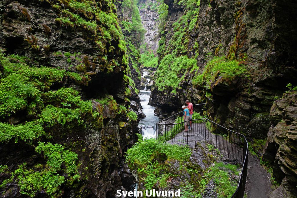
Day 6 – Bordalsgjelet Gorge
We wanted to visit Bordalsgjelet Gorge on the outskirts of Voss. Unfortunately, the weather beat us this time. So we are putting this one on our wishlist again for the next visit.
Day 6 – Bergen
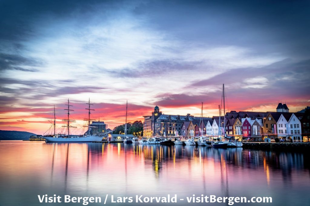
Finally, we arrived at Bergen, the second biggest city in Norway.
I (Dejan) have been to Bergen five or six times. Every single time rained. We hope for sunny days this time. However, we prepared our rainjackets just in case.
We hope that you all remember a very important rule in Norway.
“There is no bad weather, only bad clothes!” – Norwegian saying
Day 7: Bergen
We spent the whole day wandering around the city. Here is a short version of what we saw.
Day 7 – Bryggen in Bergen
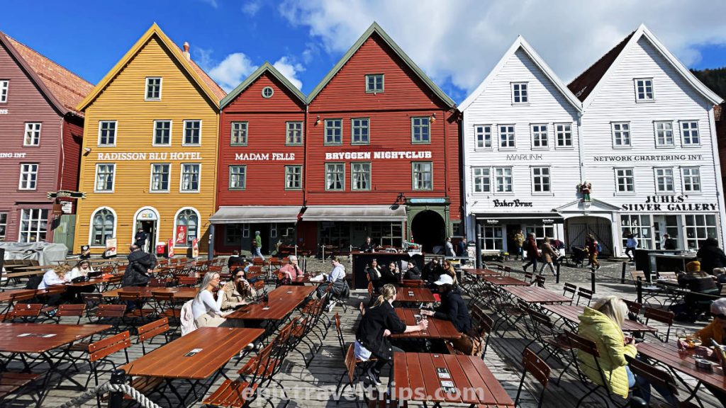
Bryggen in Bergen is in the heart of Bergen Center and is one of the most visited attractions in Norway and on UNESCO’s list of world heritage. It contains an array of wooden houses in different colors (white, red, and yellow shades). It was a trading center and housing in the period of the Hanseatic League.
Day 7 – Inside Bryggen
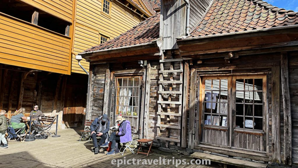
There are many souvenir shops, galleries, artist studios, pubs, and cafes between the small passages. The wooden houses, seen from the front, tuck all of them.
Day 7 – Mount Floyen & Funicular (Fløibanen)
Fløibanen Funicular facilitates the journey from Bergen center up to Fløyen viewpoint at 320 meters (1050 ft.) above sea level. The journey takes 5-8 minutes.
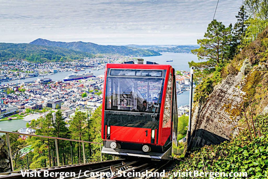
The view from the top is magnificent providing that it is not raining which occurs often in Bergen.
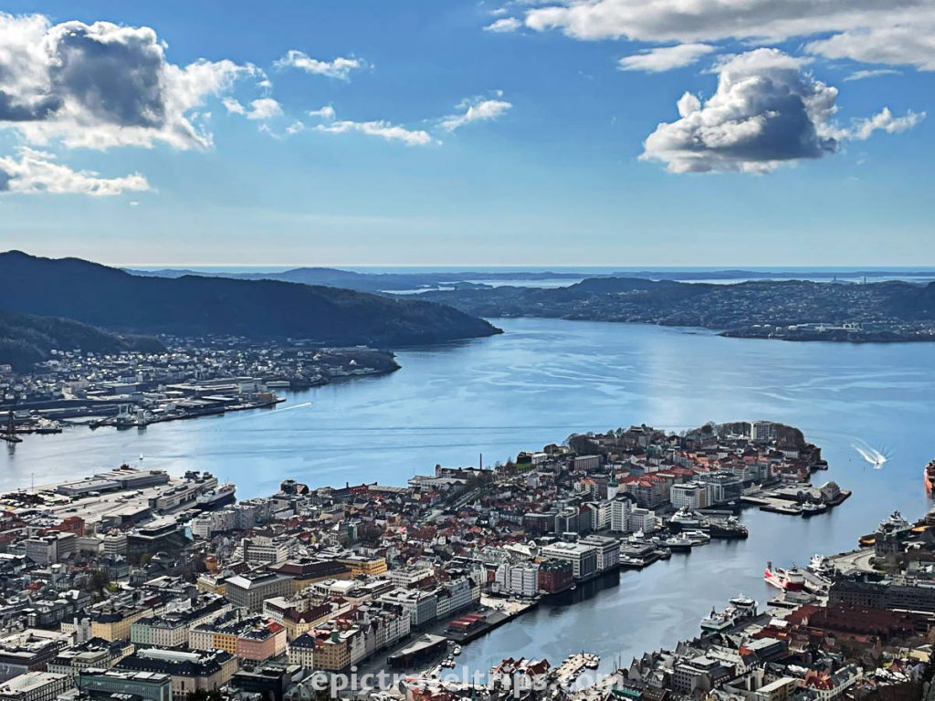
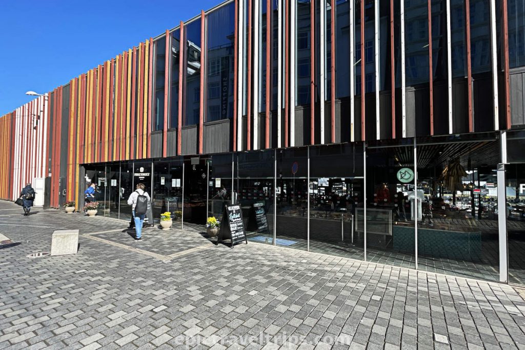
Day 7 – Bergen Fish Market (Fisketorget i Bergen)
In the Bergen city center is Bergen Fish Market (Fisketorget i Bergen). You can buy fresh fish, seafood, caviar, and much other good stuff there.
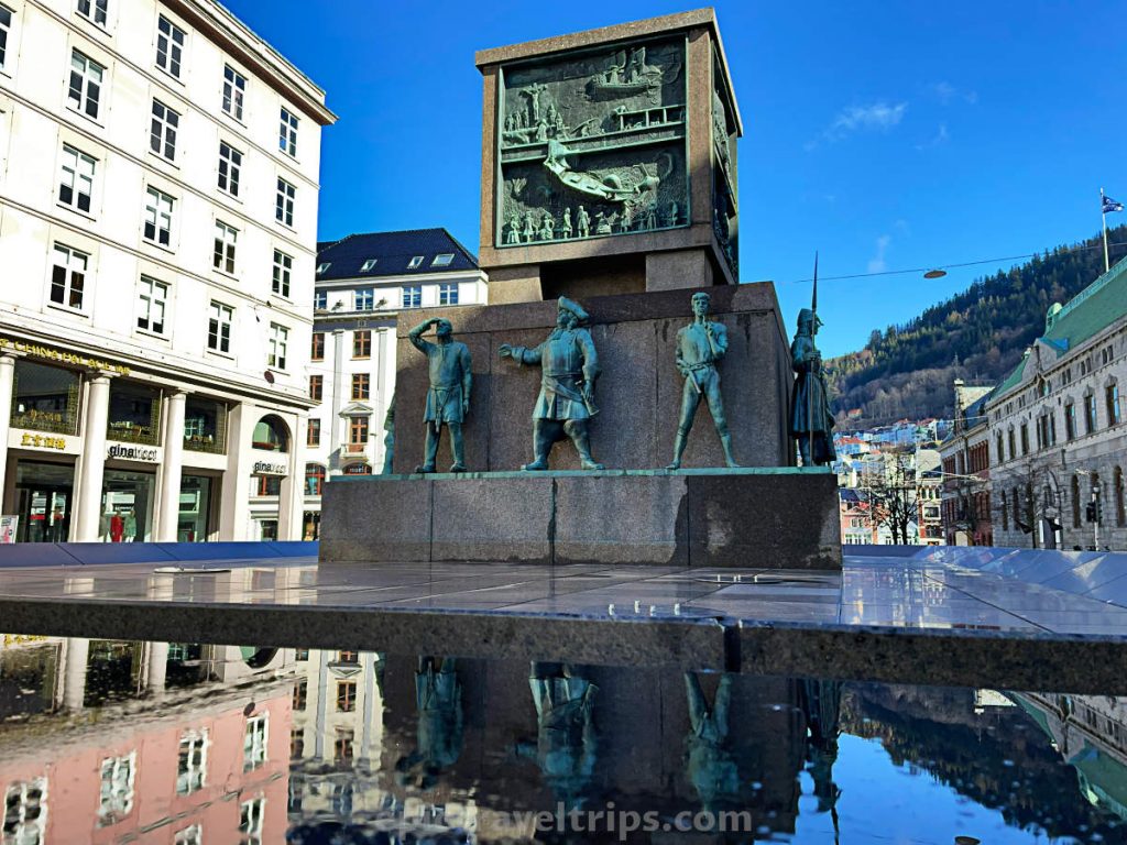
Day 7 – Sailor’s Monument (Sjøfartsmonumentet)
Sailor’s Monument consists of twelve male figures from different periods of history. The monument is in the pedestrian area not far away from Fish Market and Tourist Information.
If you click this link and make a purchase, we earn a commission at no additional cost to you.
Day 7 – Rosenkrantz Tower
Erik Rosenkrantz, the governor of Bergen, financed the building of the Rosenkrantz Tower in the year 1560. The tower had both military (fortification) and residence purposes.
It is not far away from the Bergen Bryggen and it is a part of Bergenhus Fortress.

Day 7 – Bergenhus Fortress
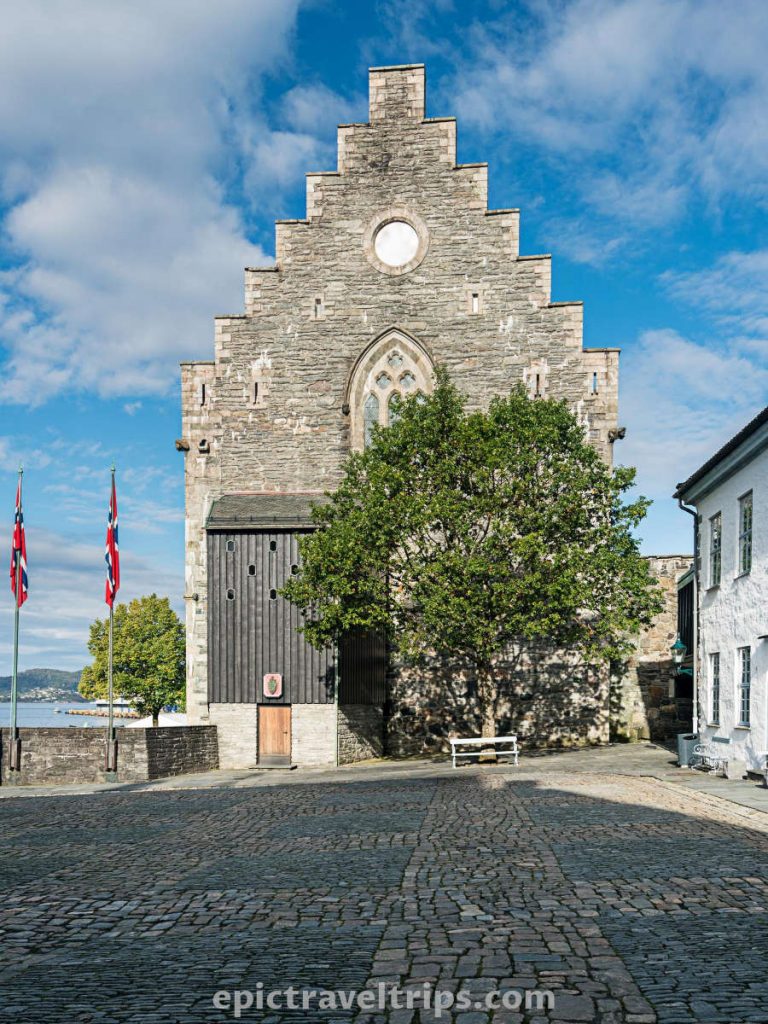
Besides Rosenkrantz Tower, there are many other interesting buildings, monuments, and spots within Bergen Fortress. Just to name a few: the Commandant’s and Captain’s residences, Håkon’s Hall, King’s Håkon VII statue, Koengen concert venue, etc.
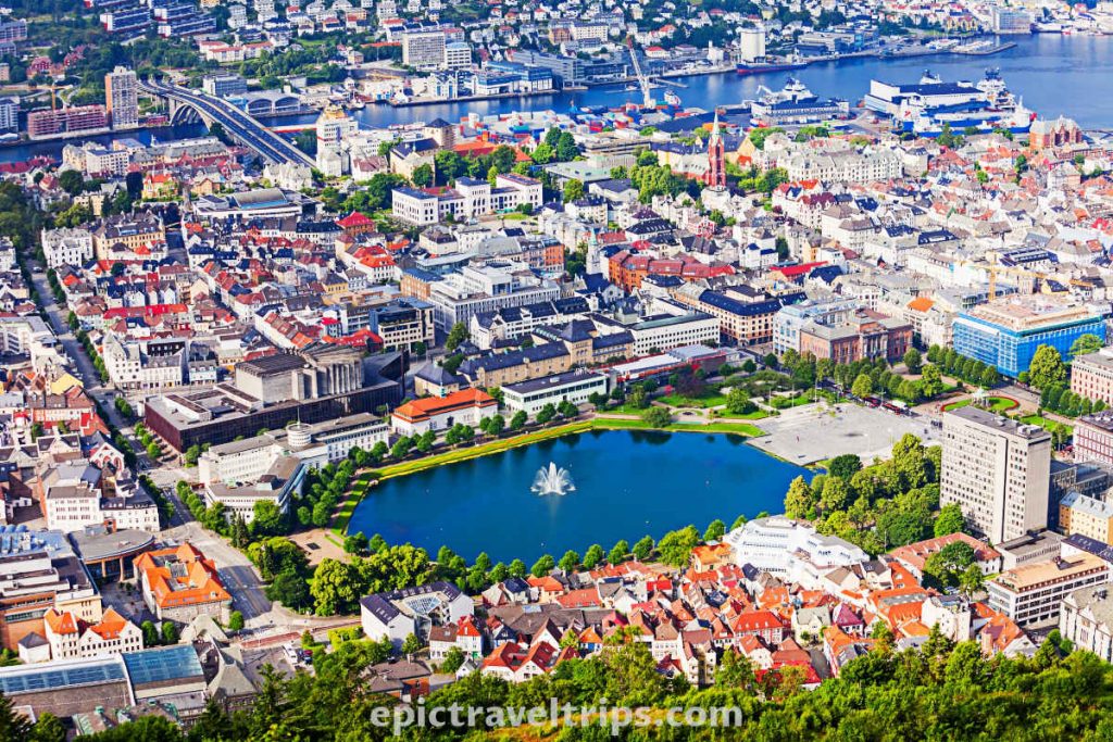
Day 7 – Lake Lille Lungegårdsvannet
A small lake with springs in the middle at the city’s center.
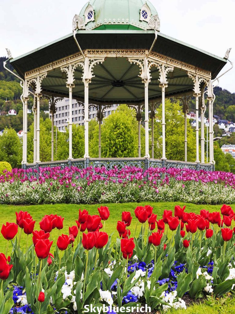
Day 7 – Byparken Gazebo
Byparken is a beautiful gazebo near the lake surrounded by flowers in the park.
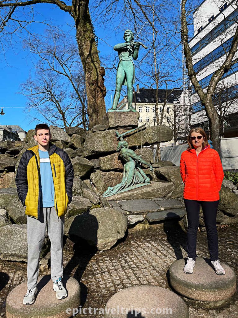
Day 7 – Ole Bull Fountain
Ole Bull Fountain is not far away from the Byparken. During the summer it is a nice place for cooling down on hot days. On our last visit to Bergen during Spring the fountain was empty.
Ole Bull was a Norwegian virtuoso violinist and composer from the 19th century, born in Bergen.
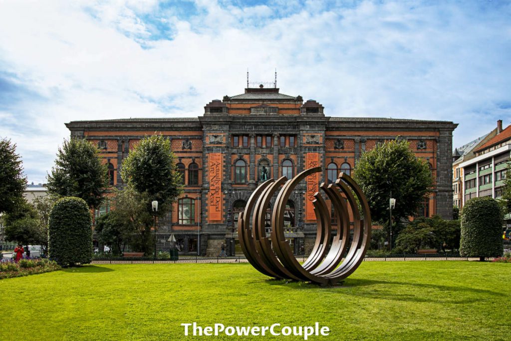
Day 7 – KODE Museums – The Museum of Decorative Art (Permanenten)
On the edges of the lake, Lille Lungegårdsvannet is the alley of KODE museums. The building that caught our attention is the Museum of Decorative Art (Permanenten) built in the Neo-renaissance style.
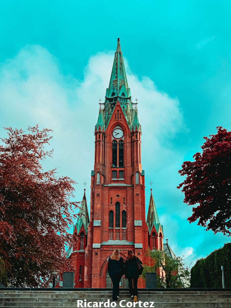
Day 7- Saint John’s Church (Johanneskirken)
It is a beautiful Catholic cathedral built of red bricks with an alluring light blue patina on the roof.
If you click this link and make a purchase, we earn a commission at no additional cost to you.
Day 7 – Timber Houses On Cobblestone Lanes
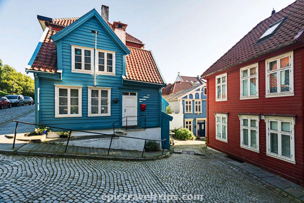
We were on our way to Bergen’s Aquarium. As an extra treat, we decided to zig-zag the small narrow cobblestone lanes on the peninsula and discovered beautiful architecture.
Timber houses in different colors tightly packed in narrow lanes are the main attractions. The house that got most of our attention is the blue one on Strangehagen 14 Street. The worth mentioning is the house on Strangebakken 16, as well.
Day 7 (Optional) – Bergen Aquarium
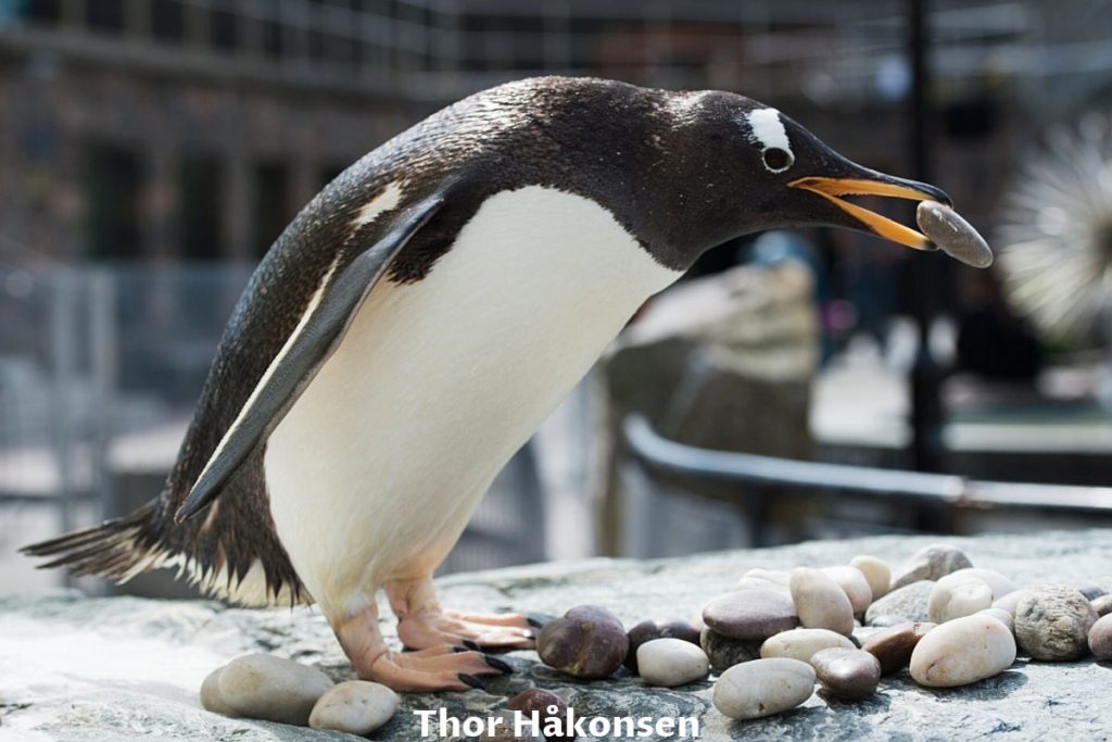
Bergen Aquarium is not far away (only a 20-minute walk) from Bergen Fish Market at the peninsula’s cape. The Aquarium focuses on Norwegian marine fauna. We could see many different fish species, sharks, penguins, otters, sea lions, and many more.
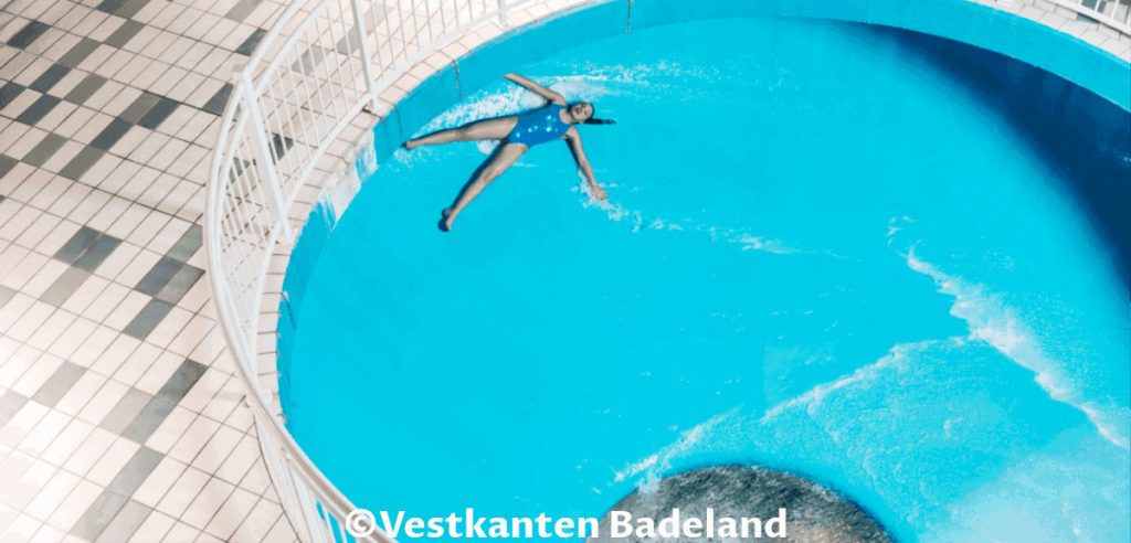
Day 7 (Optional) – Vestkanten Experiences & Water Park (Vestkanten Opplevelser & Badeland)
During our summer road trip, we did not have enough time for this attraction. However, on our last visit to Bergen, we had time to visit Water Park and we had a really good time. It is fantastic entertainment, relaxation, and amusement with many swimming pools and water slides. Our son (teenager) loved the super bowl and bob slides.
Smaller kids can enjoy many children’s pools, sing, and dance with the water park dolphin mascot Duffe.
Day 8: On The Road To Stryn & Innvik
We drove the roads from Bergen to our destinations, Stryn & Innvik. It was a long six-hour drive, but we decided to make a few stops on the way and had an exciting day. The easiest way to reach Stryn from Bergen is by driving on road E39. Well, as you might notice, we like detours. We wanted to visit the Gaularfjellet viewpoint, so we took E16 and then national road 13.
The mountain pass on national road 13 between Vinje and Vik can be unpredictable, to say the least, due to the weather conditions. Although we drove in mid of July, it rained and was cloudy. The road is high up in the mountains. We passed the road at a high altitude surrounded by clouds.
Day 8 – Hopperstad Stave Church
Just 15 minutes ago, we were 1 000 meters (3280 ft) above sea level and felt like Alice in Wonderland due to clouds and rain. The Storehaugtunnelen tunnel exit is a viewpoint high on the mountains. From there is downhill to a small village and fjord bay. Suddenly, we were almost at sea level approaching Vikøyri, the home of Hopperstad Stave Church.
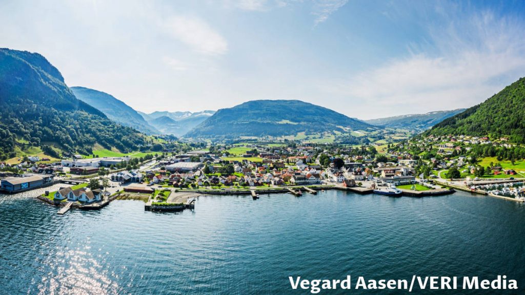
The original stave church is from the Middle Ages, but the current church was restored in 1880. It is much smaller than the Borgund but not less impressive and has similar design motives.
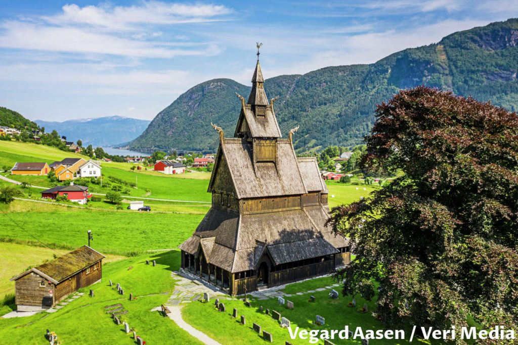
Day 8 – Balestrand
Two short ferryboat hops from Vangsnes were enough to be on the northern side of Sogn Fjord (Sognefjord). It is the longest and the deepest of all the fjords, stretching 204km (126 miles) inland from the Atlantic Ocean north of Bergen. Somewhere in the middle of this vast fjord is located the charming village of Balestrand.
If you click this link and make a purchase, we earn a commission at no additional cost to you.
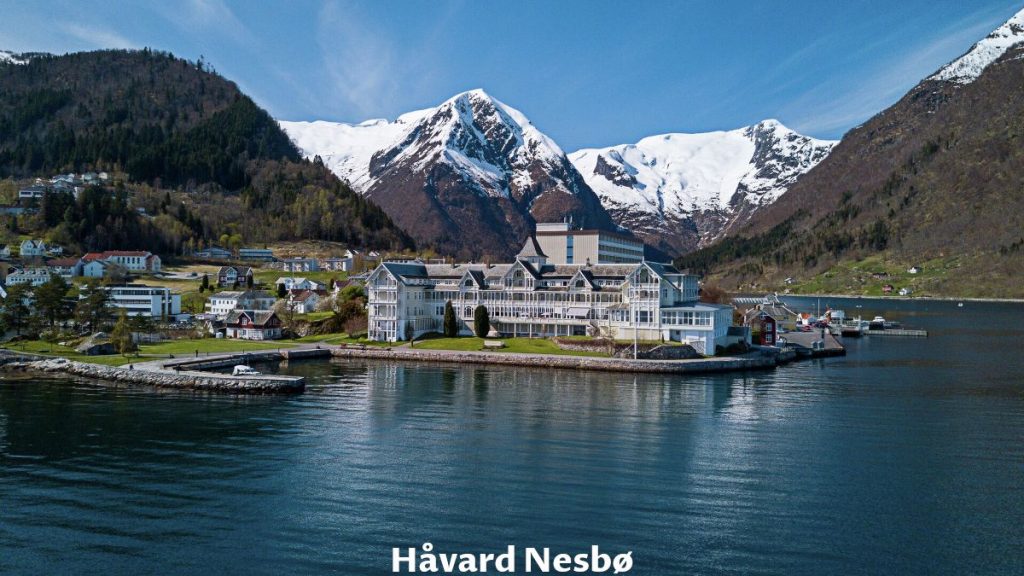
Day 8 – St. Olaf’s Church – The Anglican Church
Besides the beautiful nature surrounding Balestrand village, this church is one of the main attractions. The style reminds of the Norwegian stave churches, but it doesn’t have a long history back to the Middle Ages. It is a “young” church building from the year 1897.
Day 8 – Gaularfjellet Viewpoint
We were back in the mountains again. Just 40 minutes drive and 37 km (23 miles) from Balestrand, we reached the Gaular Mountain (Gaularfjellet) Viewpoint.
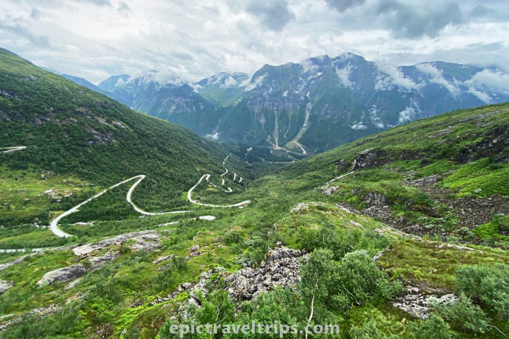
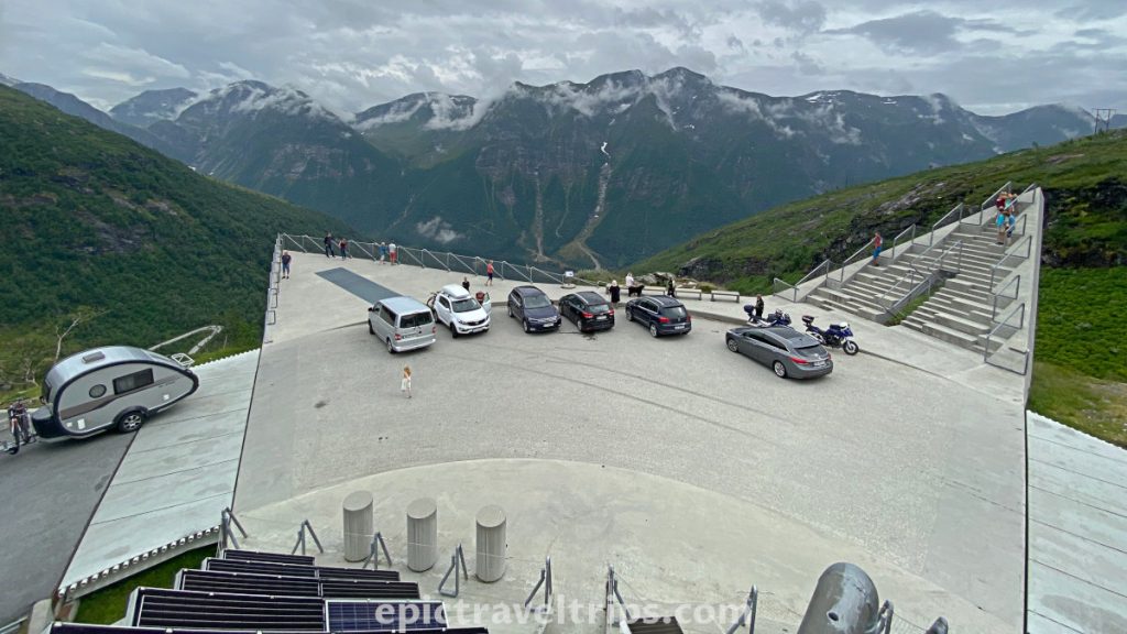
Gaularfjellet Viewpoint is 700 meters (2300 ft) above sea level. It is a modern concrete engineering achievement. The view over the surrounding mountains and winding road below us is magnificent at such a height.
The concrete platform reminds me of the spaceship with the nose pointing to the mountains and two wings at the back. On one wing are solar cell panels “to boost the spaceship engine”. On the other wing is a staircase for a better view of the area and “seats for spaceship passengers”.
Day 8 – Nystølvatnet Lake – Wooden Houses
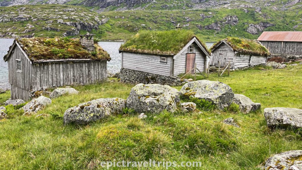
3 km (1.86 miles) further up the road near the shores of Lake Nystølvatnet are some charming wooden houses with grass roofs. We took a short break for another photo session on the fly.
Day 8 – Likholefossen
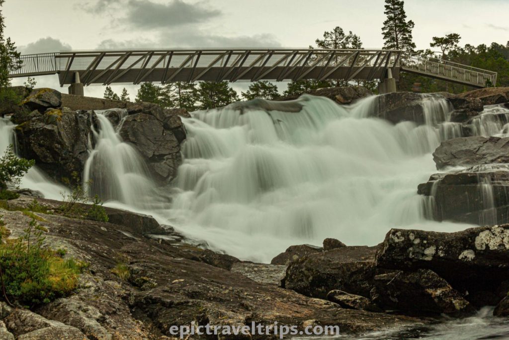
Likhole Waterfall (Likholefossen) is 15 minutes drive and just 15.5 km (9.63 miles) from Gaularfjellet Viewpoint, on the left-hand side of the road.
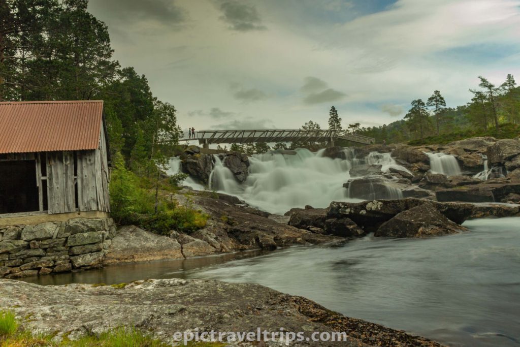
We had a short walk over the narrow metal bridge and into nature. Cold mountain air refreshed our lungs.
Recharged, we were ready to practice the long exposure and silky waterfall photo lesson.
Day 8 – Haukedalsvatnet
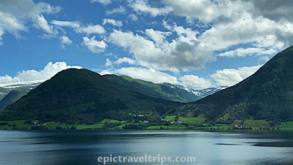
Haukedal Lake (Haukedalsvatnet) is another hidden gem of this area but very well known to the trout fisherman. We have marked this location for our future exploration of this region.
See you soon, Haukedalsvatnet. We are looking forward to coming back to this charming lake.
Day 8 – Skei
I have had a former colleague who worked from the home office in Skei instead of Bergen. Now, when we have passed this area just for a glimpse of time, I understand why he did not want to leave this nature-rewarded area.
Day 8 – Stardal River (Stradalselva)
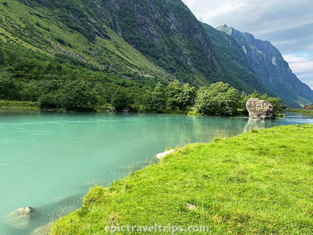
We have just passed Skei and followed the Stardal River (Stradalselva). I couldn’t drive any longer without stopping and enjoying this place.
We found the perfect spot. It was in the valley carved by this river centuries ago. Mountains on both sides of the river, the grass perfectly green, and the river emerald green and turquoise blue.

At the same spot, two families with campervans established their picnic location. Music from their mobile app mingled with the murmur of a flowing river. Breeze air sound was interrupted by the drone noise in the distance.
It was almost the perfect spot for camping and true nature enjoyment. However, we had to leave and move on to our final destination for the day. Goodbye Skei. For now. We are coming back for sure.
If you click this link and make a purchase, we earn a commission at no additional cost to you.
Day 8 – Stryn Panoramic Road ( Stryn Panoramavegen)
The initial intention was to drive over the mountains and come straight to Innvik. Innvik was our final location for the day and the location of our hotel. However, we detoured again and extended the day a little longer. We drove via Sandane to the Innvik Fjord and took the ferry between Anda and Lote.
As soon as we drove out from the ferry, we turned right on the local road fv698.
It is better known as Stryn panorama road (Stryn Panoramavegen). It is a 44-minute drive on the 44 km (27.3 miles) to Stryn. Panorama Road is on the northern side of Innvik Fjord. We could see our hotel on the other side in Innvik, but before that, we need to reach Stryn.
The day was long, and it took a toll. In addition, a few detours due to road construction slowed us down. So we didn’t embrace what the panorama road has to offer. Maybe we will give it a better chance next time.
Day 8 – Innvik
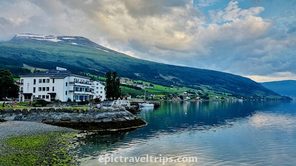
Finally, we arrived at our hotel and base for the next three days of our escapades. Innvik is a small village in the fjord with the same name Innvik fjord (Innvikfjorden). We chose the hotel in Innvik since it was cheaper compared to Stryn and Loan. At the same time, all the sightseeing locations were not far away from Innvik.
If you click this link and make a purchase, we earn a commission at no additional cost to you.
Day 9-11: Innvik Fjord & Stryn
Oppstryn, Loan, and Olden valleys are the treasures of the most attractive natural beauties in the Innvik Fjord area. Each valley is a story on its own, and we will explore them in the next few days. We will try our best to describe every landmark as accurately as possible. So follow us along on this colorful trip into nature.
Day 9 – Briksdal Glacier (Briksdalsbreen)
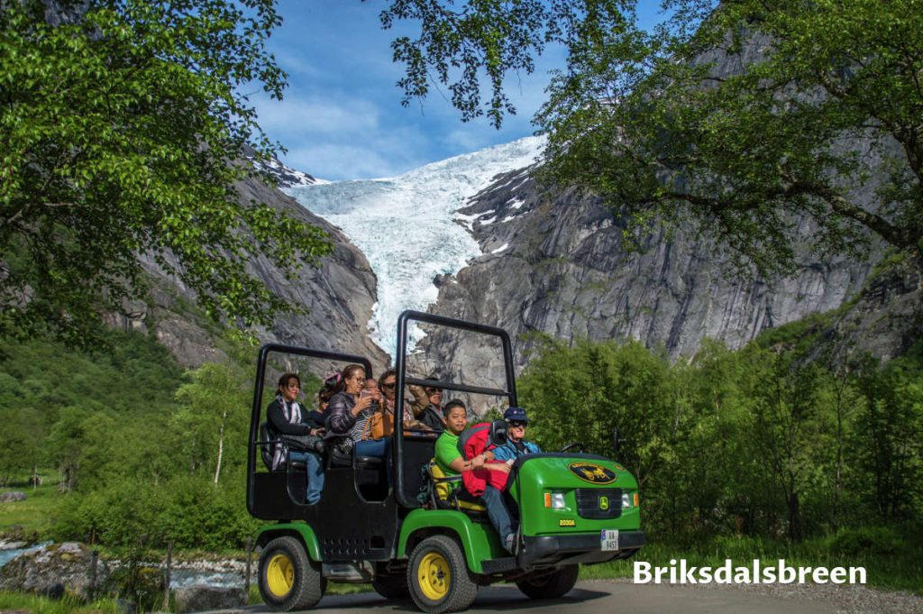
The trip to Briksdal Glacier (Briksdalsbreen) was a beautiful half-day excursion. Briksdal Glacier (Briksdalsbreen) is a picturesque place with many natural treasures, from the surrounding mountains, wild rivers, and powerful waterfalls to the main prize glacier itself.
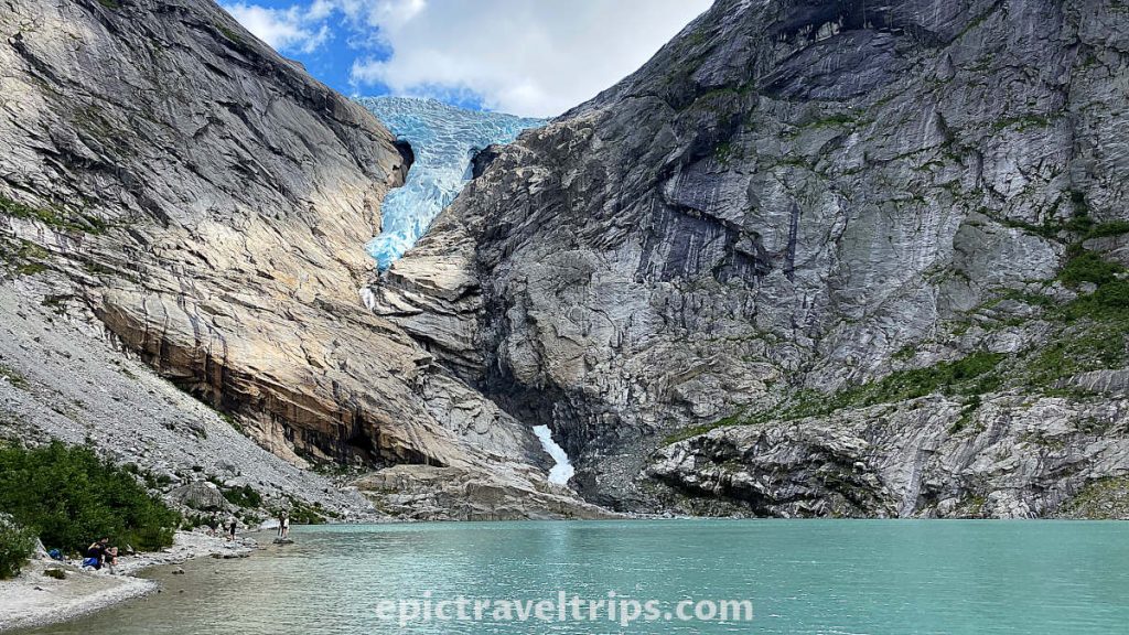
Briksdal Glacier is a small part of Jostedal Glacier (Jostedalsbreen). When we visited the Norwegian Glacier Museum, we mentioned that we would meet again at Jostedal Glacier from the other side of the mountain. Now we are at that spot.
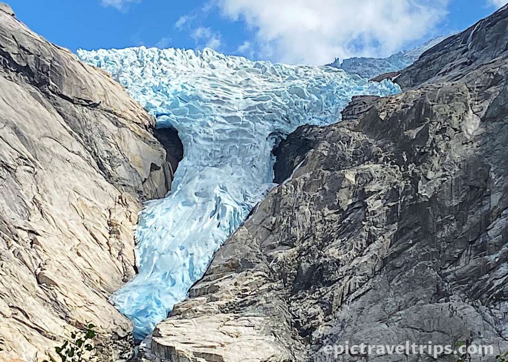
We’ve written a longer article about hiking Briksdal Glacier, where we go into detail and try to answer all your questions. Here we will show you some pictures. This way, you will get a glimpse of this incredible gem of nature.
Day 9 – Oldevatnet Lake
We were gathering our thoughts on our return from the Briksdal glacier hike. As soon as we thought that was the highlight of our day, Norwegian nature had other plans and a few additional surprises on its sleeves.
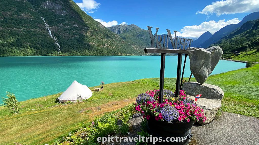
Oldevatnet Lake is another emerald-green lake in this region. It is the perfect spot for short relaxation, meditation, and just soaking in the beauty of this nature.
You cannot miss it when driving to the glacier from Stryn or Innvik. We stopped by the Olden Gytri camping to take this fabulous and colorful photo.
Day 9 – Floen Lake
Floen Lake is a lot smaller compared to Oldevatnet Lake. However, it is almost as beautiful as Oldevatnet Lake. It is just 2.5 km (1.55 miles) from the Olden when turning in the direction of Briksdal Glacier (Briksdalsbreen). If you return from the Briksdals Glacier hike, Floen Lake is around 20 km (12.4 miles) just after Oldevatnet Lake.
Day 9 – Loen River & Lake (Loenelva & Loenvatnet)
We had plenty of time to discover the next valley with a river, lake, and small farmhouses at Loen.
Loen river and lake (Loenelva & Loenvatnet) are part of the Loendal Valley. The valley is around 23 km (14.3 mi) from Innvik and just 11 km (6.8 mi) from Stryn. The road follows the river first and later the lake. However, the road is narrow in some sections.

Photo from © Sergey Bogomyako
Our main objectives were Breng wooden farmhouses that we would describe next.
Day 9 – Breng – Wooden Farm Houses (Breng Seter)
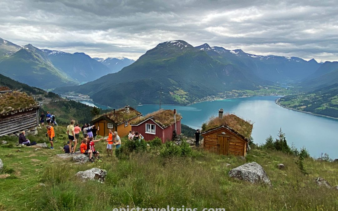
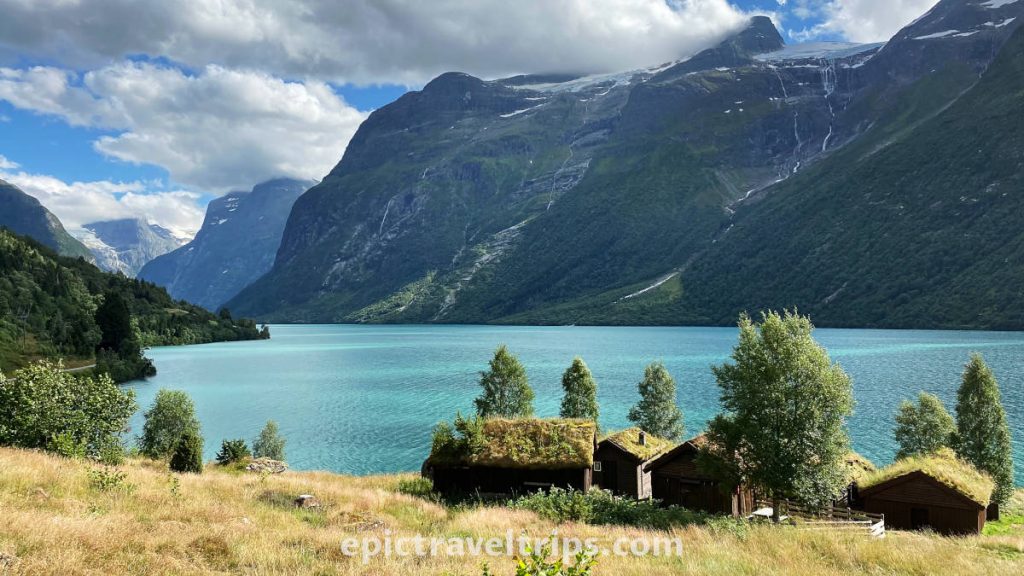
We had already seen the wooden farmhouses next to Nystølvatnet Lake when we drove to Stryn and Innvik from Bergen. Breng wooden farmhouses’ design is very similar, notice again the grass isolation layer on the roofs.
Breng is very popular for photographers, while campers stop by to bathe, kayak, paddle board, and more in the lake.
It was the correct transition to wrap up the day with the farmhouses visits and an introduction to start tomorrow’s adventure of hiking similar summer farms but high in the mountains.
Day 10 – Raksætra – Summer Pasture Farm
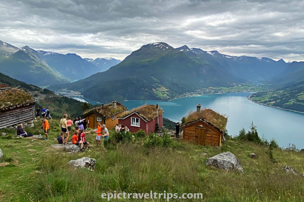
Today we continue discovering summer farms in fantastic natural surroundings. We drove up into the mountain to hike Raksætra and Oppheimssætra farms.
A mind-blowing view from Raksætra is worth the effort of hiking this summer pasture farm. We have seen it. It is your turn now.
Day 10 – Oppheimssætra – Summer Pasture Farm
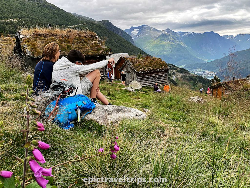
Oppheimssætra is a little bit further up from Raksætra. Oppheimssætra is a little bit further up from Raksætra. We stumbled upon it by wandering in the forest on our return down but no regrets, on the contrary.
Day 10 – Loen Skylift (Cable Car)
Taking the Loen cable car (Loen Skylift) is an easy and fast way to be in one of the best locations to have a panoramic view over the Innvik fjord, Briksdalen, and Lodal valleys. However, remember this is Norway, so attractions tickets are not very cheap.
Maybe, Raksætra and Oppheimssætra hikes are not your cups of tea. Maybe, you prefer a more relaxing, fast, and easy-to-climb approach. The cable car is a highly recommended option to approach these locations.
Photo from Loen Skylift shows the magnificent view from the top in its glory.
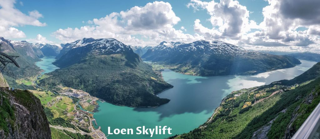
On the left-hand side, we can see Loen Lake, its valley, river, and place itself. The most dominant is Innvik Fjord which is part of the much bigger Nordfjord. The valley in the middle of the photo is Olden Valley, where Oldevatnet Lake, Floen Lake, and Briksdal Glacier are.
Taking the Loen cable car (Loen Skylift) is an easy and fast way to be in one of the best locations to have a panoramic view over the Innvik fjord, Briksdalen, and Lodal valleys. However, remember this is Norway, so attractions tickets are not very cheap.
Day 11 – Stryn
Stryn is a regional administrative center and one of the corners of Innvik Fjord, which is part of a much bigger Northern fjord (Norfjord).
Stryn is lively during summer, with many restaurants on the main street (Tonningsgata) for a nice lunch or dinner. If you want to ski or snowboard even during the summer months, Stryn Summer Ski is the first choice. Although, the resort is 45 km (28 mi) east of the Stryn center and 45 minute’s drive.
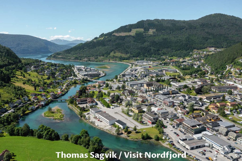
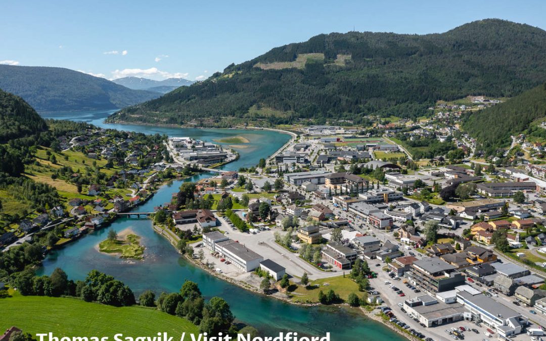
Photo from Thomas Sagvik / Visit Nordfjord shows us Stryn town, river, and a small part of the Nordfjord.
Day 11 – Hjelle
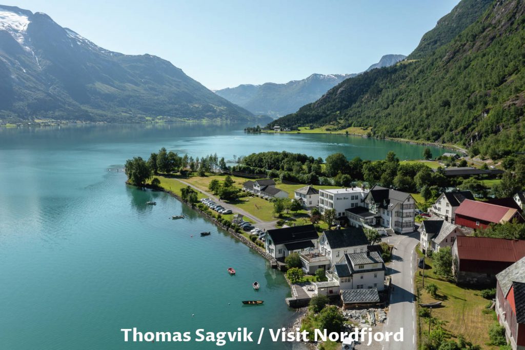
Hjelle is a charming village on the shores of Oppstryn Lake. It is 26 km (16 miles) from Stryn on the road to Geiranger, old Stryn road (Gamle Strynfjellsvegen), and one of the valley roads back to Oslo. We exited the main road before the Hjelle tunnel and followed a small road beside the lake right to the village.
Although mid-summer, snow covers the tops of the surrounding mountains. Most mountains are part of a vast plateau, Jostedals Glacier (Jostedalsbreen), and a national park.
The day of our visit was cloudy and windy, so we could imagine how beautiful this scenery on sunny days was.
Thomas Sagvik / Visit Nordfjord was lucky enough to get this fantastic drone photo on a sunny and bright day when the lake water was very calm.
We stopped by another glacier museum and national park center (Justedalsbreen Nasjonalparksenter) on the lake shores on our way to Hjelle.
If you click this link and make a purchase, we earn a commission at no additional cost to you.
Day 11 – Old Stryn Road (Gamle Strynfjellsvegen)
36th kilometer (22nd mi) from Stryn is the junction to the old Stryn road (Gamle Strynfjellsvegen). It is part of the road engineering history through this rough terrain over the mountains and is now a tourist attraction mostly.
The day was cloudy, and we anticipated that the fog and clouds had covered most of the road. We decided to skip it this time and put it on our wish list for some future visits and hopefully better weather conditions.
Preferably, we would continue our journey to beautiful Geiranger.
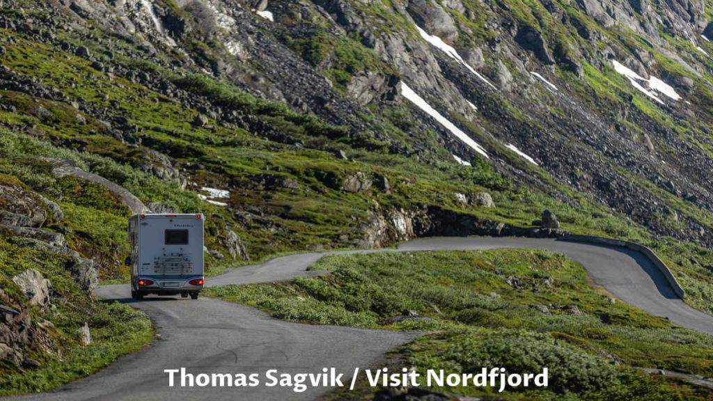
Photo from Thomas Sagvik / Visit Nordfjord shows us a glim of this piece of history.
Day 12-15: Geiranger Fjord
We were on our way to Geiranger from our Innvik hotel, and it was a short road trip of about 110 km (68 miles).
Although short, it was, by no means, less attractive since it provided opportunities for many sightseeing spots. We have already mentioned a few, such as Justedal Glacier Museum and national park center (Justedalsbreen Nasjonalparksenter), Hjelle Village, and Old Stryn Road (Gamle Strynfjellsvegen).
In addition, there are many more sightseeing spots to visit. We are excited to see them soon. To tease your imagination, we start describing just two of them Dalsnibba Viewpoint and Flydal Gorge (Flydalsjuvet).
This is a short version of a visit to Geiranger and written as a journey diary. For a more detailed description with more photos and to answer more of your questions about this region, please read Geiranger & Geiranger Fjord, Best Things To Do (Epic Trip Guide).
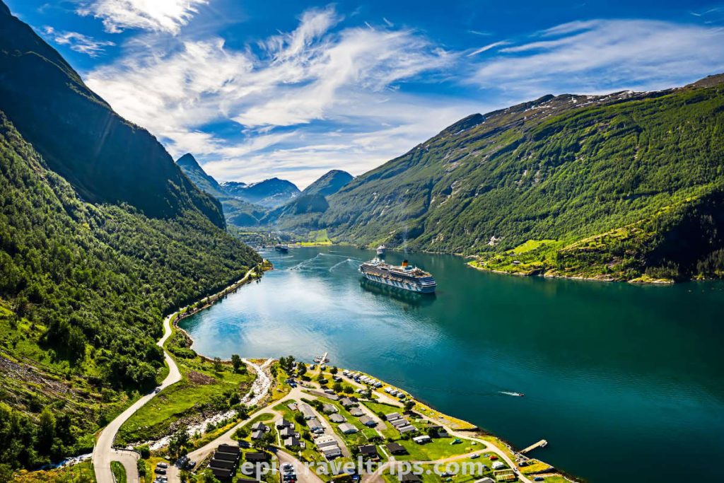
If you approach Geiranger from Stryn or Oslo (via Otta), the first visiting location is Dalsnibba Viewpoint. We were coming from Stryn, and the day was cloudy, so we decided to wait for a sunny day since we would be in Geiranger for three days. Weather lords granted our wishes a few days later…
Day 12 – Flydalsjuvet
We drove the winding road in the valley to our next point of interest. We felt like we were on a natural roller coaster combined with the engineering marvels of driving on a winding road.
When you see postcard photos of the fjord, cruise ships, and village, the photographer was, most likely, standing at the Flydalsjuvet viewpoint.
It is just 4 kilometers (2.5 miles) from Geiringer.
It consists of two plateaus. The top is more massive, with a concrete platform secured with a metal railing. The bottom plateau is more tucked in nature but has a unique installation popularly called Queen’s Seat (Fjordsetet). Yes, you guessed correctly, the Norwegian Queen Sonja unveiled it in 2003.
Passages connect both plateaus, and the sightseeing area has parking, tourist info, and toilet facilities.
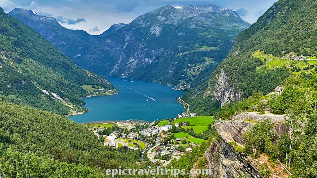
Day 12 – Geiranger Village
Geiranger is a small village, but it is an iconic symbol for fjords. Ask someone to portray or describe the fjords. The description will most likely resemble a photo of Geiranger Fjord and its village.
We had a fantastic cabin overlooking the Geiranger village. We had a dilemma about whether it was better to be there during the day or the night with the lights in the distance.
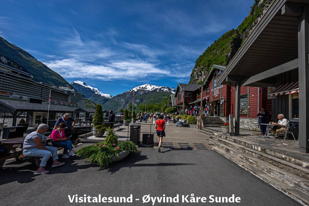
Day 13 – Geiranger Fjordsafari
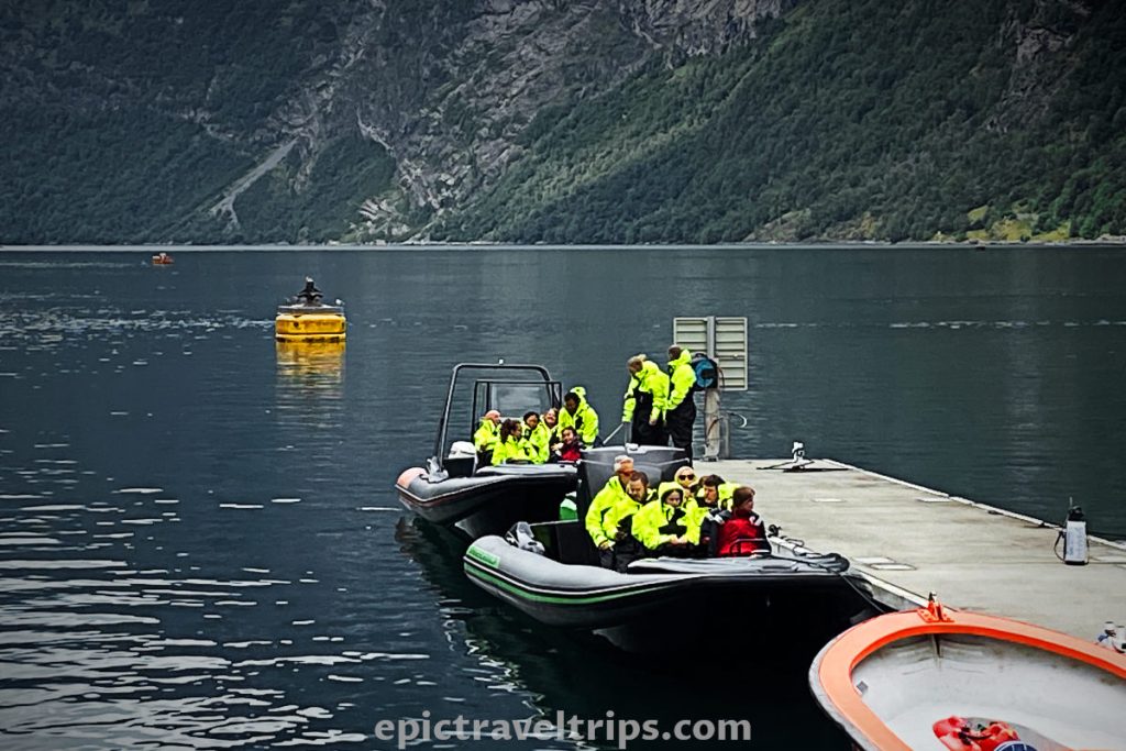
Geiranger Fjordsafari is an adventurous and adrenaline tourist attraction. It is a fun & fast ride on the open RIB boats through Geiranger Fjord and the best way to see the Seven Sisters Waterfalls. We loved the ride and described it in our more detailed article Geiranger & Geiranger Fjord, Best Things To Do (Epic Trip Guide).
Day 13 – Seven Sisters Waterfalls
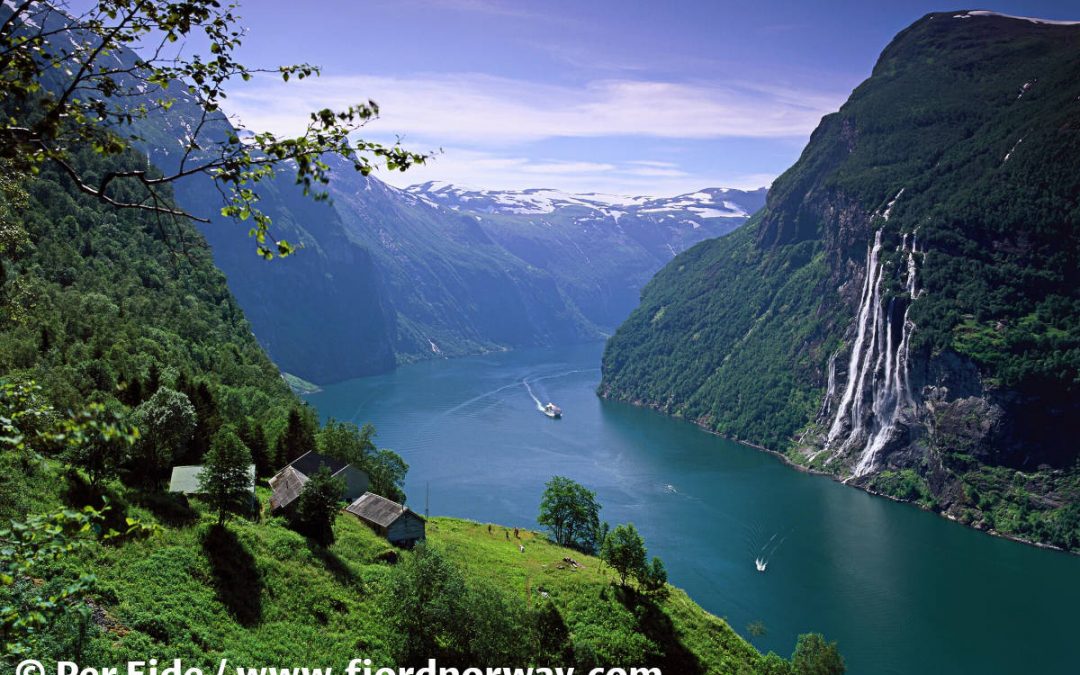
These waterfalls are the main attraction in the Geiranger Fjord. The waterfalls begin as a single drop and spread out into seven. Seven Sisters waterfalls mix with the fjord seawater at the bottom.
However, it is important to emphasize the fact that the power of the waterfall largely depends on the amount of accumulated water. Therefore, do not be surprised that only two or three sisters are visible due to the lack of water. I would call it a shy version of the waterfalls.
If you click this link and make a purchase, we earn a commission at no additional cost to you.

Day 14 – Dalsnibba Viewpoint (Geiranger Skywalk)
Finally, nice sunshine day (almost clear) in Geiranger and the surrounding mountains. We can clearly see the Dalsnibba peak from our fjord cabin, so we should visit the viewpoint.
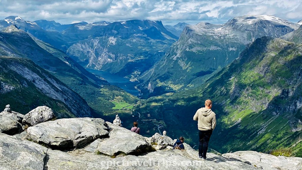
Do you sometimes wish to be a bird and see everything through the eagles’ eyes? Welcome to 1500 meters (4 920 ft.) top of the mountain called Dalsnibba Viewpoint, which provides just that. We had a spectacular view of the winding road following the valley that led us into the surrounded by mountains, Geiranger village, and fjord.
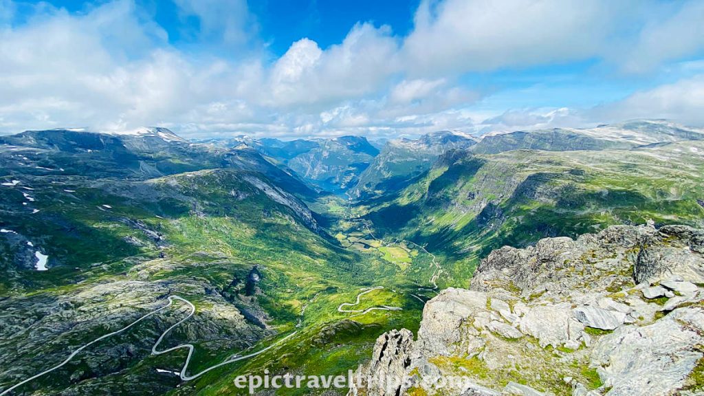
The paid road up is new and modern even the busses can reach the top with ease, although I must admit the climb is steep. After all, we were on the way to visit “the eagles’ home”.
If you click this link and make a purchase, we earn a commission at no additional cost to you.
Day 15 – Ørnesvingen Viewpoint
The drive is a thrilling eleven turns ride to the top from Geiranger. At the top of Ørnesvingen Viewpoint is a magnificent view over the fjord. On the left-hand side is a Geiranger village. On the right-hand side are the Geiranger Fjord and Seven Sisters Waterfalls.
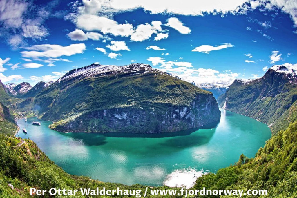
Day 15 – Storfossen Waterfall
From the center of Geiranger is an easy walk to the Storfossen waterfall, following the metal steps next to the stream. Further on is our next attraction.

Day 15 – Norwegian Fjord Centre – Geiranger
It is further up from Storfossen Waterfall and has a nice park for an outdoor picnic or break. Norwegian Fjord Center provides many exhibitions that showcase the exciting and unique fjord landscape.
Day 16: Trollstigen – The Mountain Road To Geiranger
Please, allow us to be a little bit fantasy-inspired. Trollstigen is eleven sharp turns for “rafting on the wheels”. So please, “raft” with us.
Trollstigen is only 87 km (54 miles) one way from Geiranger, so Geiranger is a fantastic location hub for daily excursions.
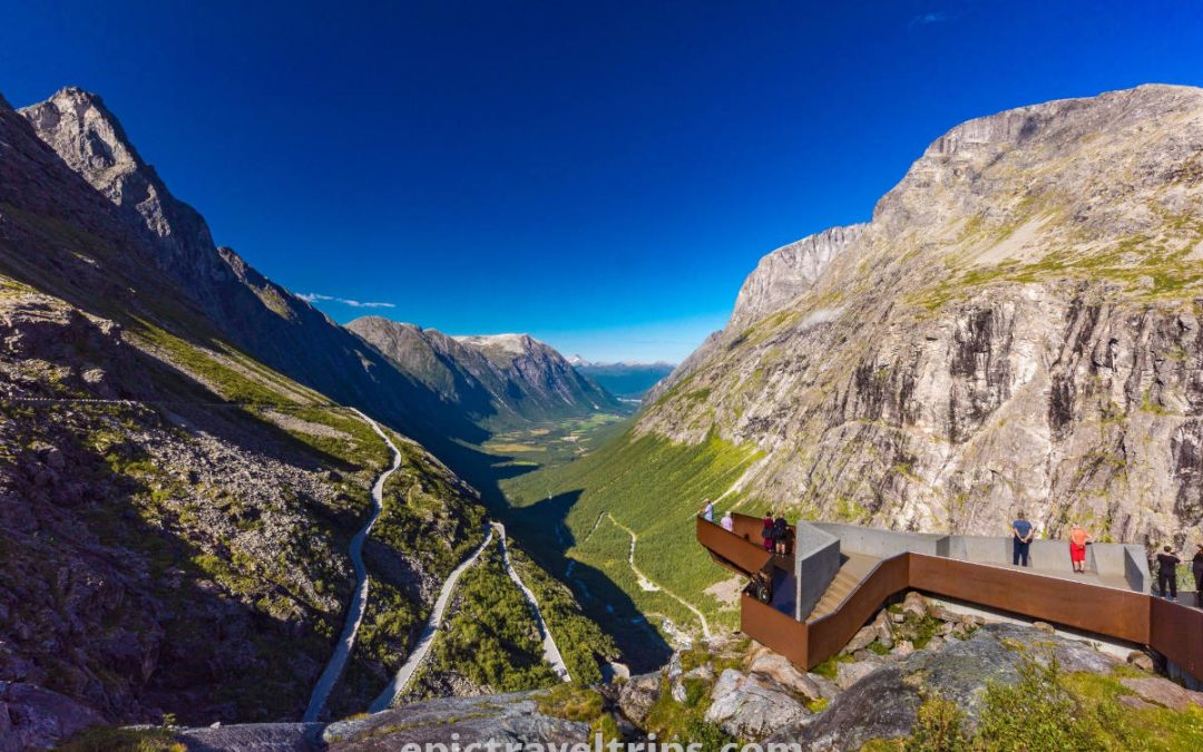
There are two highlights of Trollstigen (the panoramic view and driving the mountain road itself).
Day 16 – Trollsstigen Panoramic View
From the parking space are nicely built pathways to the viewpoints that present the panoramic view of the road, valley, and surrounding mountains at its best.
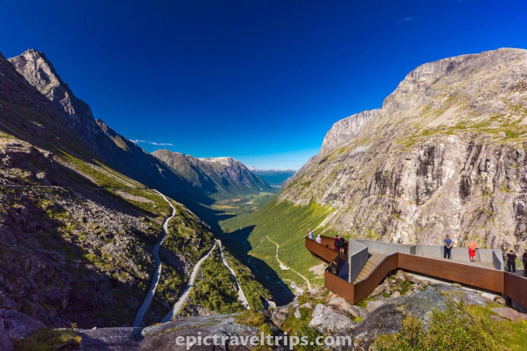
Day 16 – Trollstigen Mountain Road
The second highlight was even more attractive, and that is driving this road. The road is about 5 km (3.1 mi) long and has an elevation difference of about 850 meters (2,789 ft). In some sections, the slope is 10%.
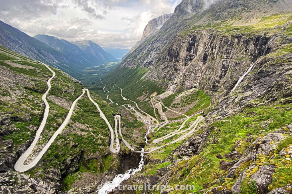
Trollstigen provides a magnificent view of this natural paradise. It is open only during the summer months Mid-May until October. So do not miss your chance to drive this winding mountain road and be thrilled with it for a lifetime.

Day 16 – Trollveggen
After visiting Trollstigen, we drove down the valley in Åndalsnes direction. We gathered our thoughts and wanted to call the day filled with joy and excitement. However, Norwegian nature has more to offer. At the crossroad, instead of turning left to Åndalsnes, we decided to turn right and drove in Dombås direction.
Trollveggen (in free translation, Troll’s Wall) is another pearl on the Norwegian necklace of natural beauties. Blue sky (mixed with clouds) edged with mountain peaks shaped like sharp teeth carved the horizon.
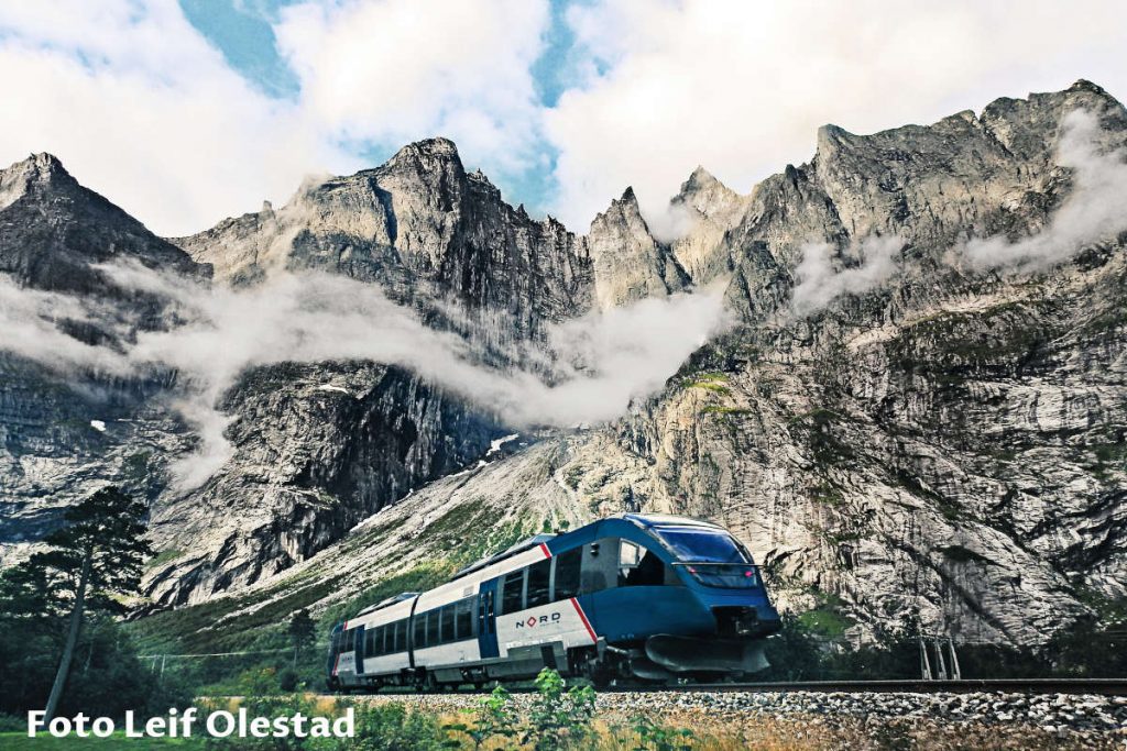
Mountain rocks blend with green conifers and birch trees vegetation melting into the emerald green but cold waters of the Rauma River at the bottom.
If you click this link and make a purchase, we earn a commission at no additional cost to you.

Day 16 – Gudbrandsjuvet – Gudbrans Ravine
We stopped at Gudbrans Ravine (Gudbrandsjuvet) on our way back from Trollstigen to Geiranger. We had an opportunity to look at how the peaceful mountain river Valldøla suddenly becomes wild and carves its course through this ravine.
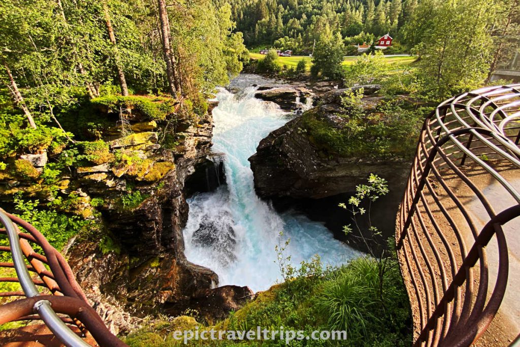
Day 17 & 18: Ålesund
We changed our location once again. This time we were on our way from Geiranger to Ålesund. It was another short trip of only 110 km (68 miles) and two hours drive on local roads (including a ferry crossing).
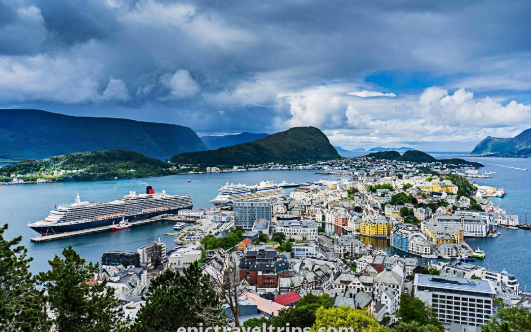
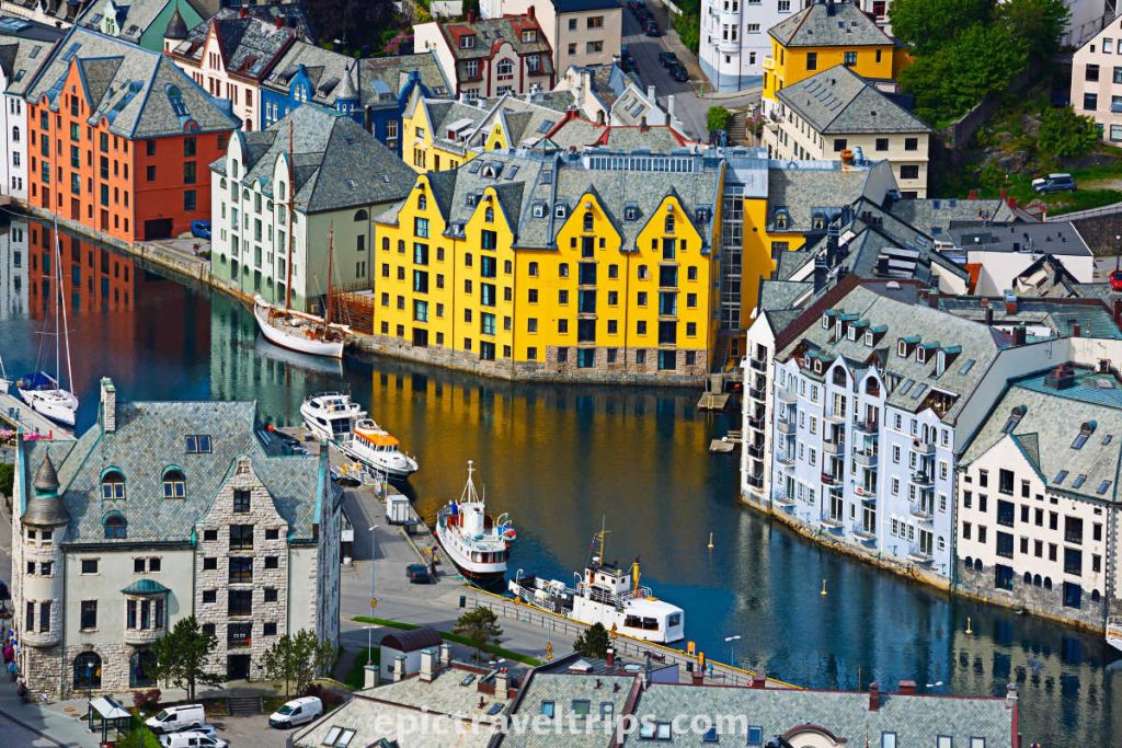
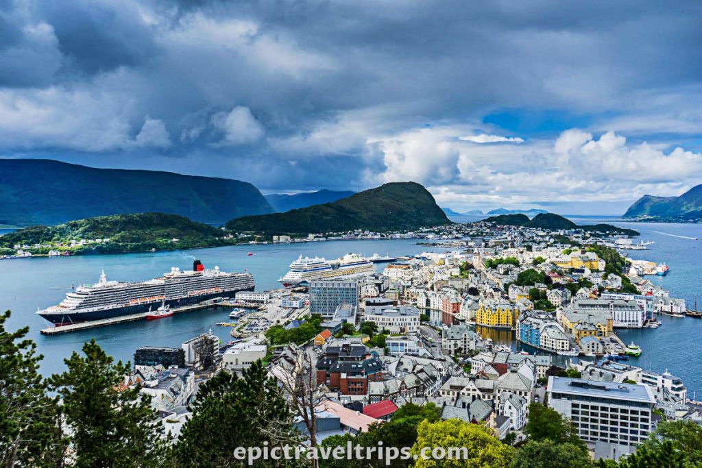
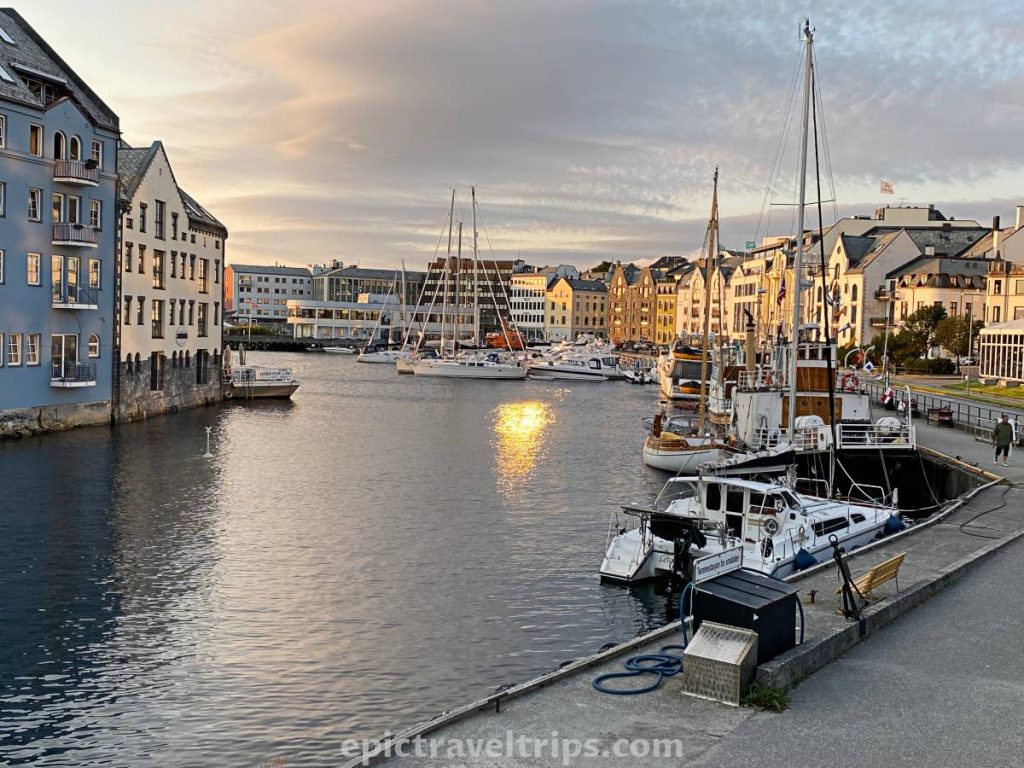
Ålesund is an interestingly shaped city on many peninsulas. It is very lively and full of tourists buzzing during working hours. However, Ålesund settles down and becomes a calm and sleepy place later in the afternoon and evening. The majority of people are in restaurants, pubs, and cafe shops. The luxury ones enjoy drinking wine or champagne on their expensive yachts in the harbor.
The city’s architecture in the style of Art Nouveau (Jugendstil) is a consequence of the great fire in 1904. Therefore we cannot see wooden houses in the city center as we saw in Bergen.
While walking Ålesund central streets, we noticed buildings decorated with towers, turrets, and artistic ornaments.
Day 17 – Ålesund Swimming Pool
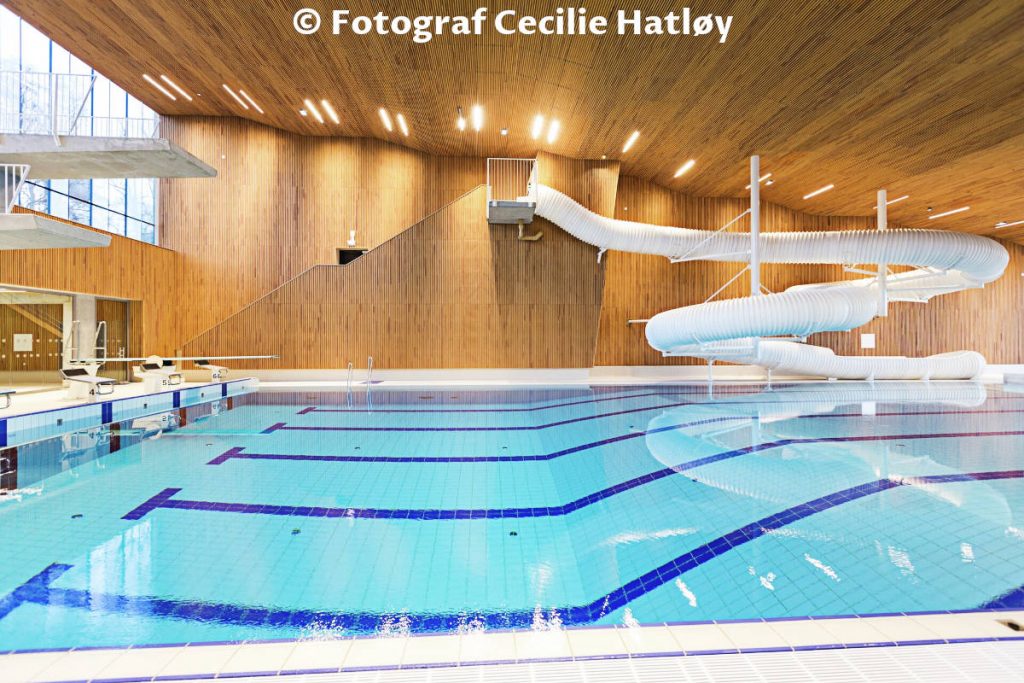
When we arrived at Ålesund Center, we noticed on the other side of our parking place a newly built swimming pool at Park Street (Parkgata).
Since the Atlantic Ocean is cold even during summer, we decided to find refreshments in the swimming pool. What a treat in many of the indoor pools inside the complex.
As in many modern spa facilities, even the showers have illumination, audio, and water splash features.
Day 17 – Ålesund Viewpoint (Aksla)
Ålesund is well-known for its panoramic view over the city and beautiful sunsets over the ocean.
We decided to drive to the Aksla instead to walk up the famous 418 steps. However, parking space is limited, and the road is narrow. So everyone who decides to drive there must be aware of these limitations.
Day 17 – Atlantic Sea Park (Atlanterhavsparken Aquarium)
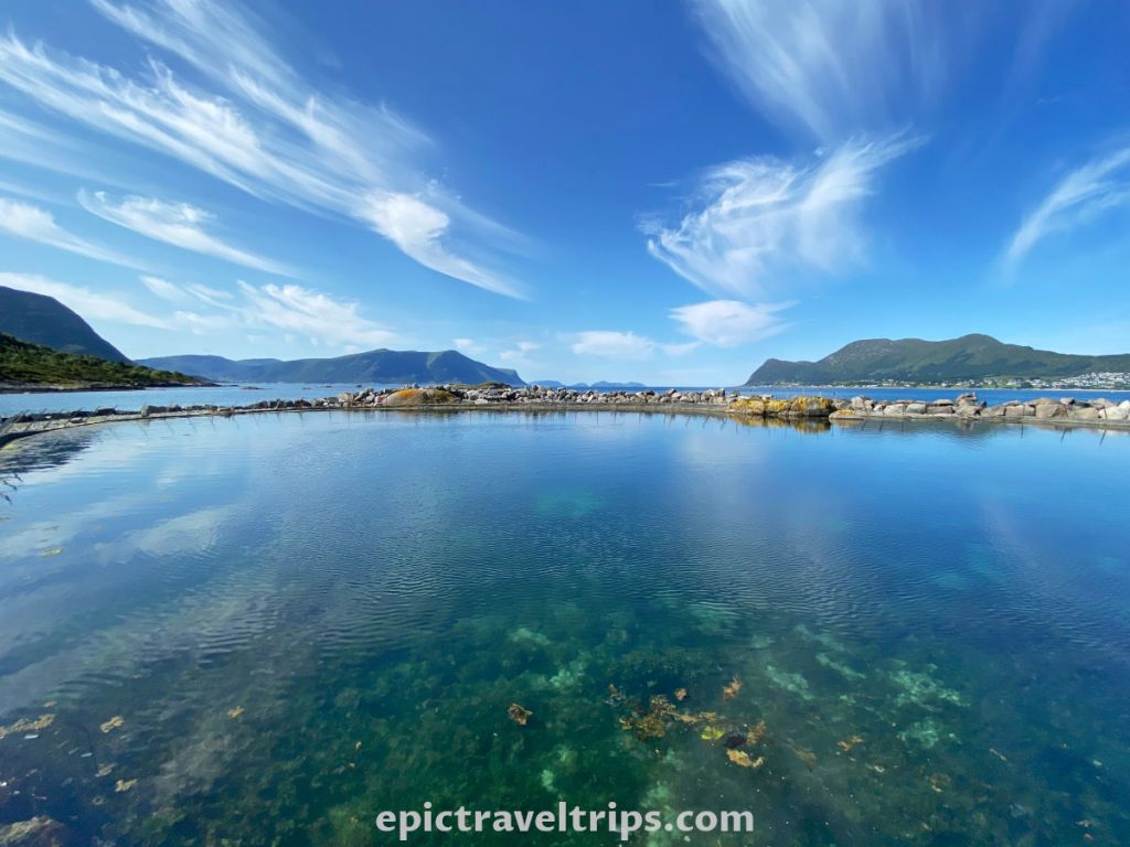
We decided to enjoy the ocean life (flora and fauna) on the edge of the Atlantic. Therefore we visited Atlantic Sea Park (Aquarium) in Ålesund.
Penguins and seals playing in the water were the most attractive among sea fish species, lobsters, starfishes, and king crabs.

Seals have a fantastic pool on the edge of the sea.
Day 18 – Alnes Lighthouse (Alnes Fyr)
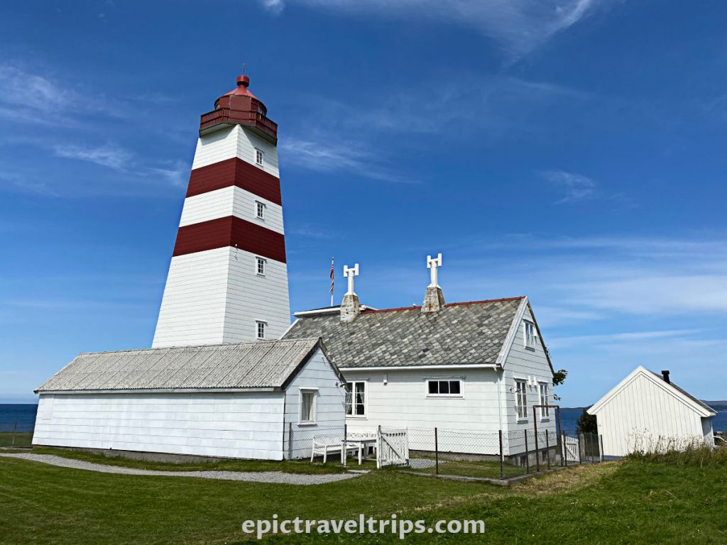
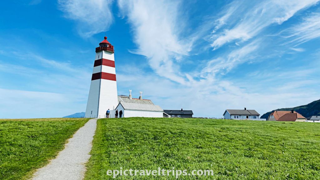
Alnes Lighthouse (Alnes Fyr) is on Godøya island. It is 25 minutes driving and 22 km (13.7 miles) from the Ålesund city center.
We followed the airport signs and reached our destination in several hops over two islands, three tunnels, and one bridge.
The drive is unique since the tunnels go deep below the sea bed.
The lighthouse is in the middle of the green grass meadow, following the gravel pathway. We visited a nearby cafe with a nice view of the ocean and a place for refreshment after the lighthouse visit.
If you click this link and make a purchase, we earn a commission at no additional cost to you.
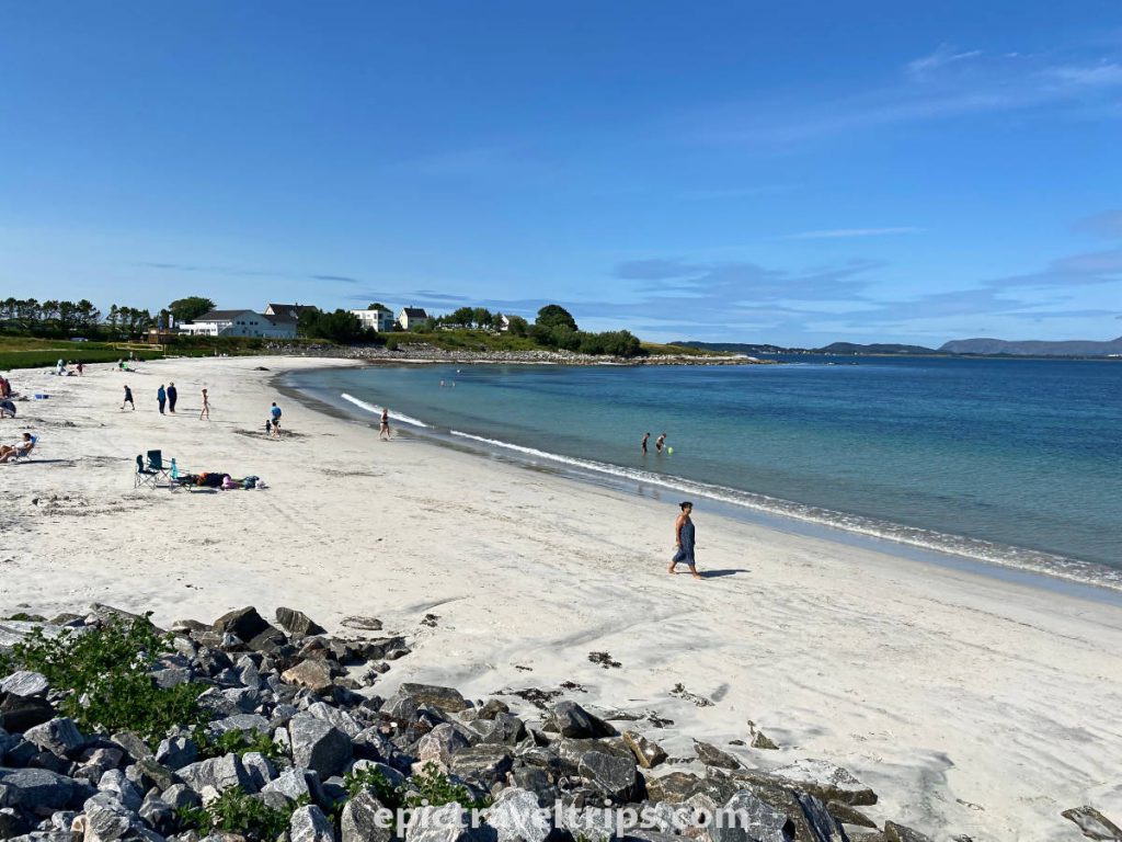
Day 18 – Gjerde Beach (Gjerdesanden)
While we drove to Alnes Lighthouse, we noticed beaches on the side when crossing the Giske bridge (Giskebrua). Some kids were swimming and playing in the water while many people sunbathed. This picture was like a magnet for us to come back. So we decided to stop by and check the beaches on the way back.
The beach, sand, and the ocean, through the car window, look pleasing and warm. However, reality proves a different picture. The water was cold, and the wind blew, and we did not like it. To sunbathe on the beach covered with blankets was not our thing. So we stayed shorter than we initially wanted due to these factors.
Instead, we had more time for another evening stroll in Ålesund Center to wrap up this visit.
Day 19: The Atlantic Ocean Road (Atlanterhavsveien/Atlanterhavsvegen)
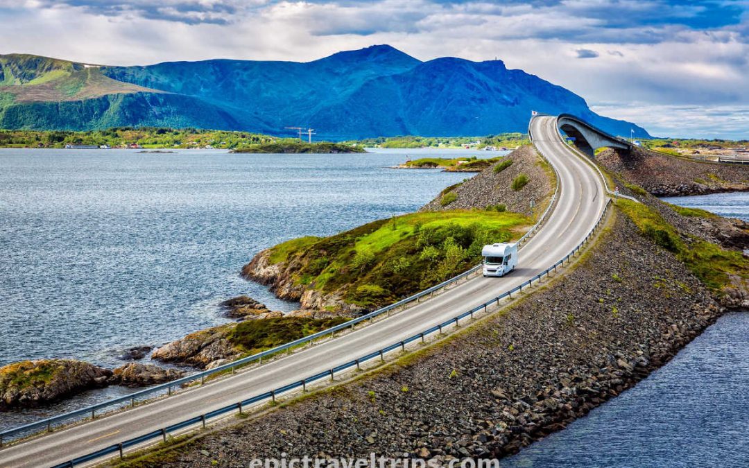
Our road trip in Norway is almost coming to an end, and we are about to visit the northernmost point of our journey. Again this is just a summary and for more photos and a longer story answering more of your questions please read our detailed article The Atlantic Ocean Road.
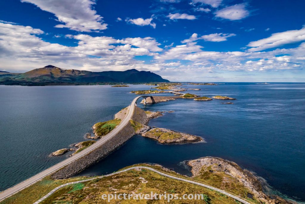
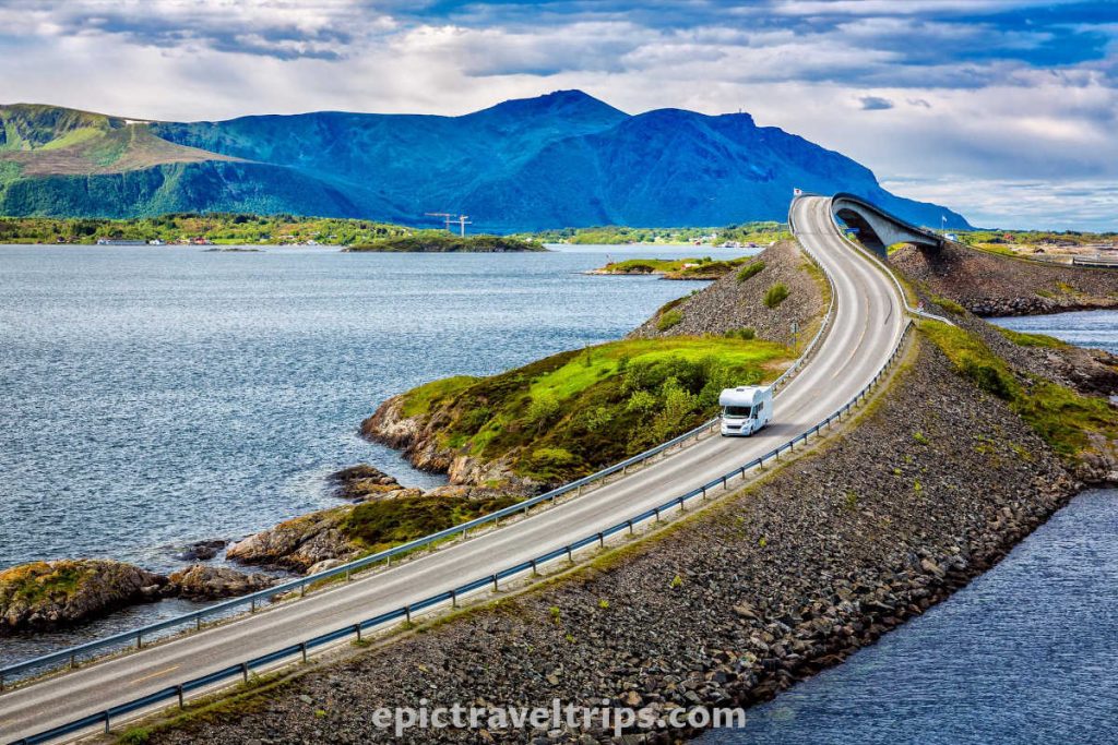
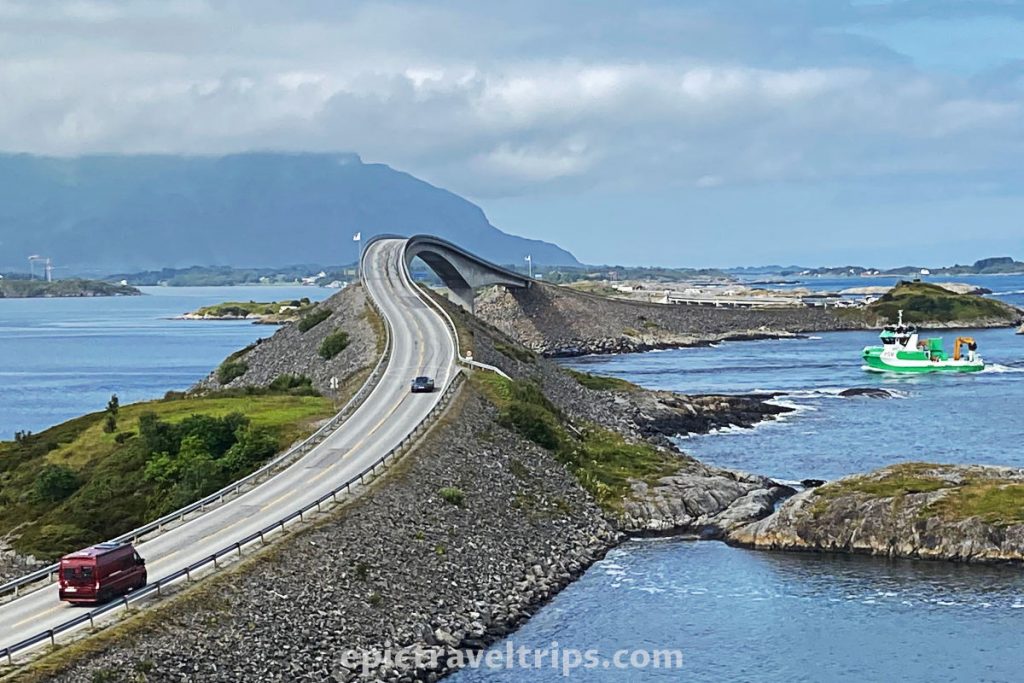
Atlantic Ocean Road is a unique experience of blending nature and engineering cleverness. So we did not want to miss it. Several viaducts and bridges connect the mainland via several small islands. Due to the maritime transport requirements, some bridges and roads have unusual and attractive shapes. These eye-appealing shapes are the magnet for many to visit this unique place.
The Atlantic Road – Practical Info
The Atlantic Ocean Road (Atlanterhavsveien/Atlanterhavsvegen) is around 125 km (77.7 miles) far from Ålesund, and it takes two and half hours to reach it, including the ferry between Vestnes and Molde.
If you click this link and make a purchase, we earn a commission at no additional cost to you.
As we drove through Molde, my son called his best classmate. What a coincidence his best friend was on the way to Molde airport flying back to Oslo after visiting his grandparents in Molde.
But back to the road, Atlantic Ocean Road is around 8 km (5 miles) long (at least the most popular section). Seven bridges hopping over the islands connect the mainland.
The Best Spots
There are many spots to stop by, take photos, walk around, etc. The most interesting are Eldhusøya (Lyngholmen parking), a view over the Storseisund Bridge (Storseisundbrua), and Myrbærholm Bridge.
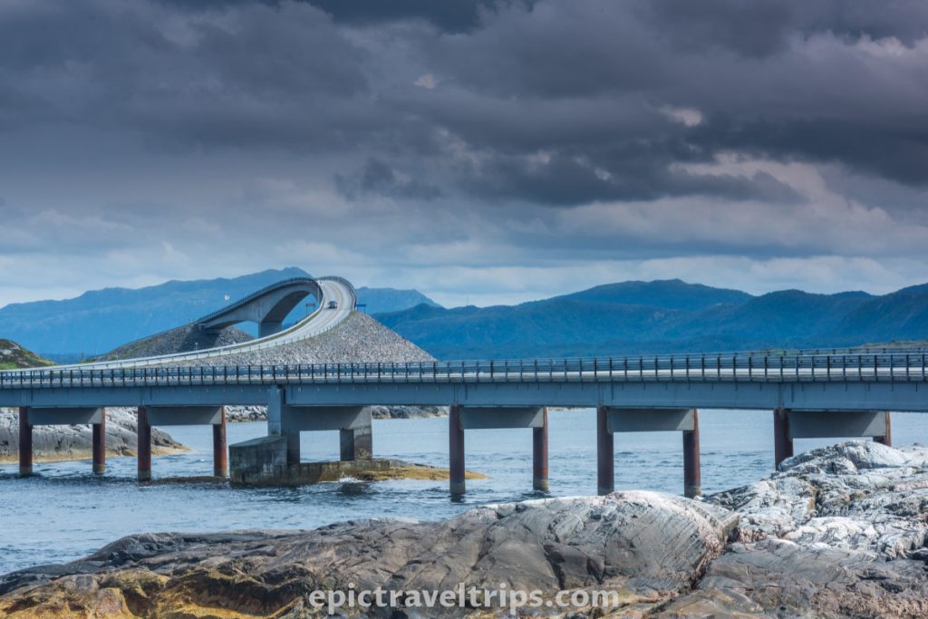
We drove it both ways since it was a short drive and we wanted to enjoy it as much as we could.
Day 19 – Kristiansund
We drove to Kristiansund for resupply in a big shopping center. However, we were not lucky to have a sunny day in Kristiansun as Per Kvalvik did in the photo below. The rest of the day we spent in Kvernesfjorden where we found our accommodation.
If you click this link and make a purchase, we earn a commission at no additional cost to you.

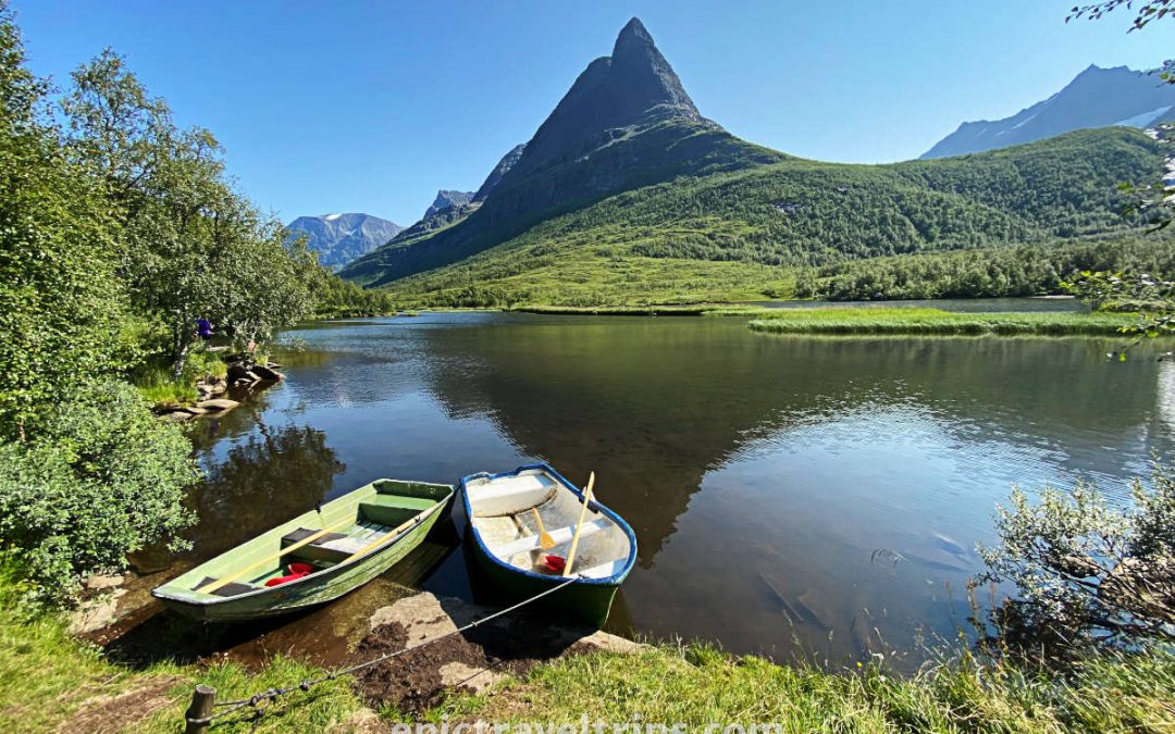
Day 20: Renndølsetra at Innerdalen – Farmhouses
Hiking Renndølsetra is more than just a walk to a summer pasture farm. Every nature lover should visit this fantastic landscape.
Beautiful mountains surround the environment. Streams and waterfalls flow from the mountain slopes, carve dense green forests and finally meet the beautiful lake as their final destination.
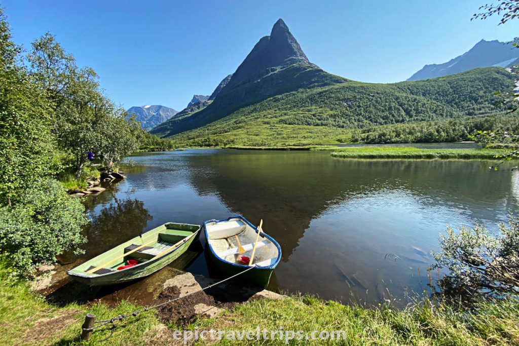
The hike is 3.5 km (2.18 miles) long, and it has 196 meters (645 ft.) climb on the way to Renndølsetra and only 53 meters (174 ft.) climb on the way back. The day was nice and sunny. We had plenty of time, so we enjoyed the hike at our own pace. We are more than eager to return and stay longer in this region soon. So, we can further explore many hiking options, kayaking, landscape photography, etc.
If you click this link and make a purchase, we earn a commission at no additional cost to you.
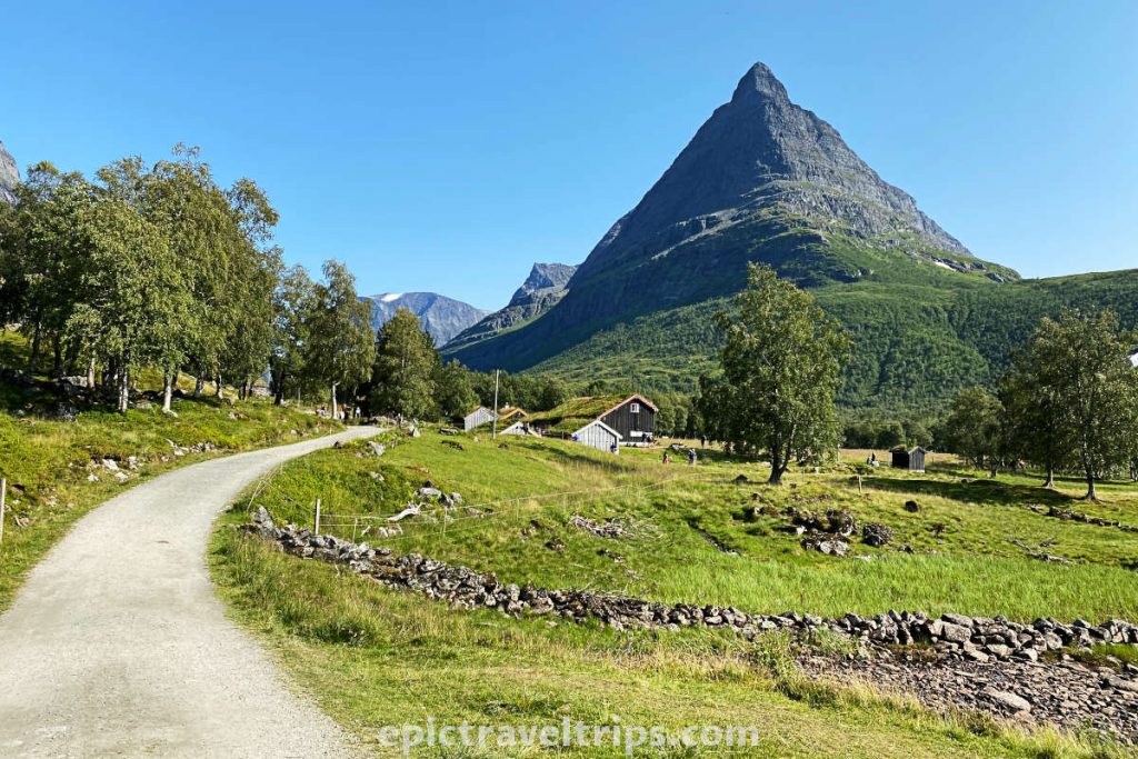
Renndølsetra were farmhouses used for livestock farming in the past predominantly. Nowadays, it has additional functions. It is used as a cafeteria and serves drinks, waffles, and simple meals. It sells fresh milk and some dairy products (yogurt, creams, butter, etc.). Waffles with jam are a popular treat.

Day 21: On The Way Back To Oslo
We love the feeling of coming home. It’s nice seeing new places, meeting great people, and adventure new things, but sleeping in your bed and being at home in your own space is a cozy feeling that we like a lot. From our base, we can plan new trips soon, hopefully.
However, the Norwegian weather saved the “best” for the last day. It was foggy and rainy all day. We didn’t miss much because we had already visited some of the places on our other trips. Anyway, we only live a few hours away so we might come back another time soon.
Additionally, we have researched the area for our future travels and would like to share it with you.
Rafting Sjoa River
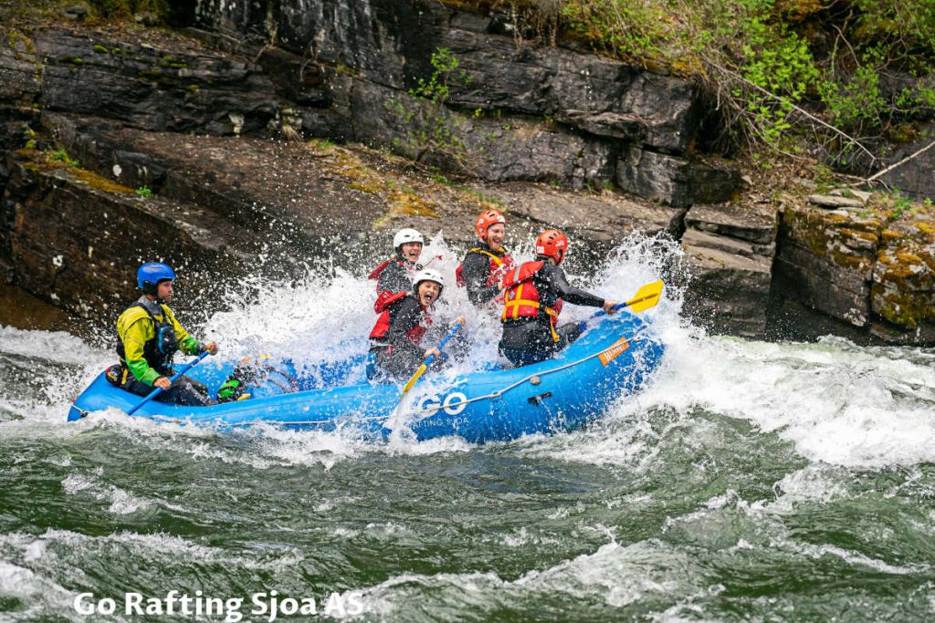
We found a few photos of rafting on the river Sjoa that are cool, in our opinion. There are many more activities offered on this wild river and around it. Just to name a few: kayaking, riverboarding, SUP paddle boarding, canyoning, ducking, fishing, bungee jumping (kind of), high rope parks, archery, axe throwing, blowgun, and more.
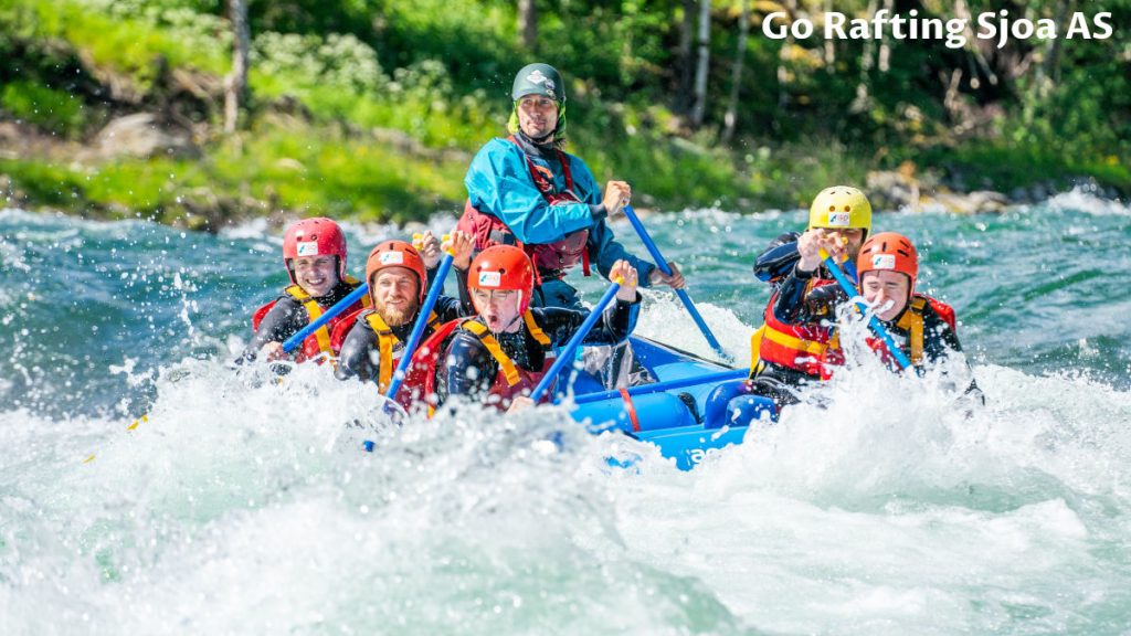
Interestingly enough, the Sjoa River is the outlet from Gjende Lake in Gjendesheim and Jotunheim National Park. Gjendesheim is the region of the famous Besseggen trail, which was, by the way, my first hike when I arrived in Norway. The river flows northward at the beginning but turns eastward, and at Heidal village, it takes final course southeast until it flows into the Gudbrandsdalslågen River at the Sjoa village.
Sjoa is three and half-hour drive and some 280km (174 mi) from Oslo. So we look forward to returning and experiencing this area ourselves in the near future.
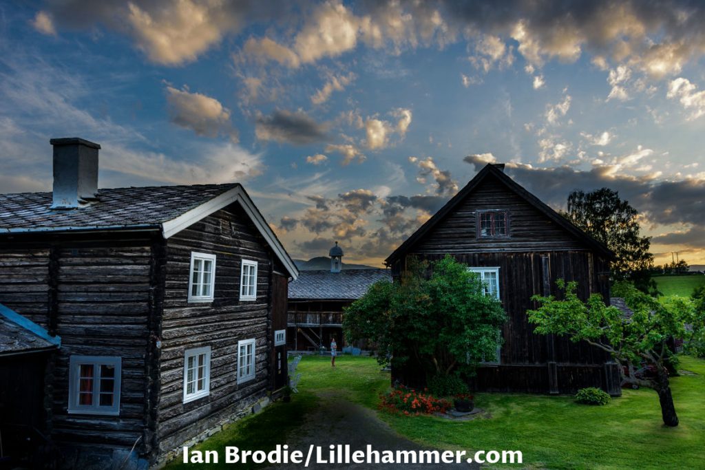
Sygard Grytting
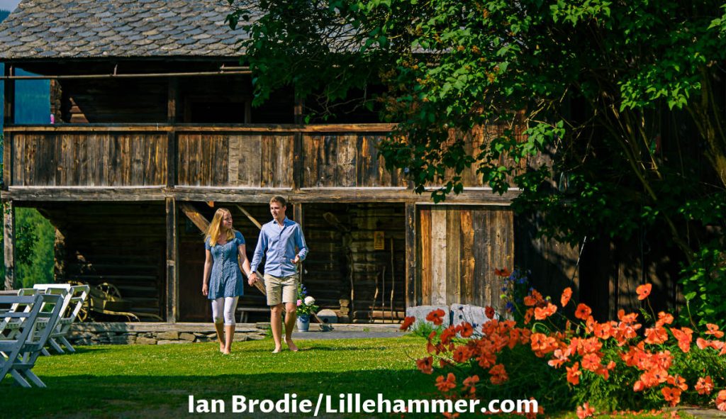
Stygard Grytting is an old farm still in operation but also offers accommodation facilities with a long history. It looks very promising for future visits as a stay option. The grassy courtyard in the center surrounded by timber houses looks very nice in the photos.
If you click this link and make a purchase, we earn a commission at no additional cost to you.
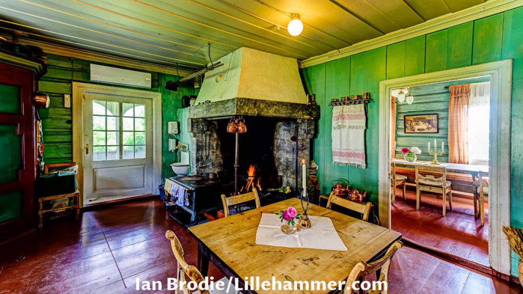
However, the interior is even more attractive, charming, romantic, and intriguing.
The view of the Gudbrandsdalen Valley should also be attractive.
“What?! 1.21 gigawatts of historical power!?!” – “Wait a minute, Doc. Are you telling me you built a time machine…out of a Sygard Grytting farm?”
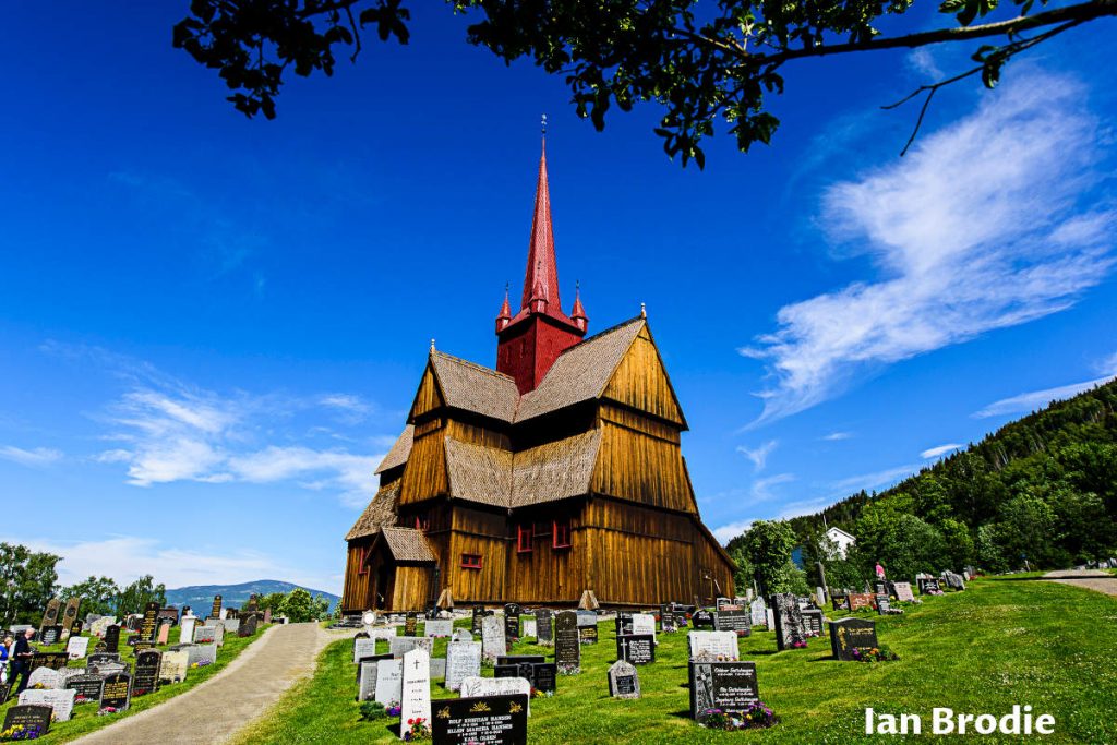
Ringebu Stavkirke
We visited several wooden churches on this trip and several on our other trips. The weather prevented us from visiting this one this time, but we will stop by on our next trip. We will look at this photo of Ringbu Church until we visit the real one.
Kvitfjell
Kvitfjell is the most renowned for ski sports during the winter season. However, during the summer season hiking and biking are the most popular activities.
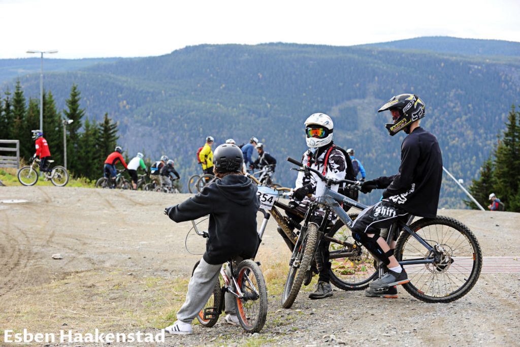
Hafjell
We visited Hafjell on daily trips from Oslo to Lillehammer on several occasions. During summer, Hafjell is very popular among mountain bike riders for its thrilling trails. Kids love it due to the two attractions described below. Teenagers find interesting something else described shortly after.

During winter, it is a ski resort and paradise for alpine, cross-country, snowboarding, and snow lovers in general. It has many slopes of different skill levels, kids and family areas, terrain parks, cross-country skiing tracks, night skiing sessions possibility, and more.
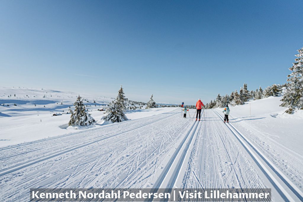
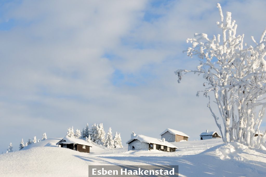
If you are a landscape photographer, you can snap mesmerizing winter idyllic photos with frozen wooden houses, trees, and untouched snow on a sunny day.
Lilleputthammer – Family Park
The grownups’ world is oversized for children. Why don’t we make a mini city where children will feel big? That’s the idea of Lilleputthammer Family Park.
The children feel at home surrounded by the facilities in a one-to-four ratio.

Hunderfossen Adventure Park
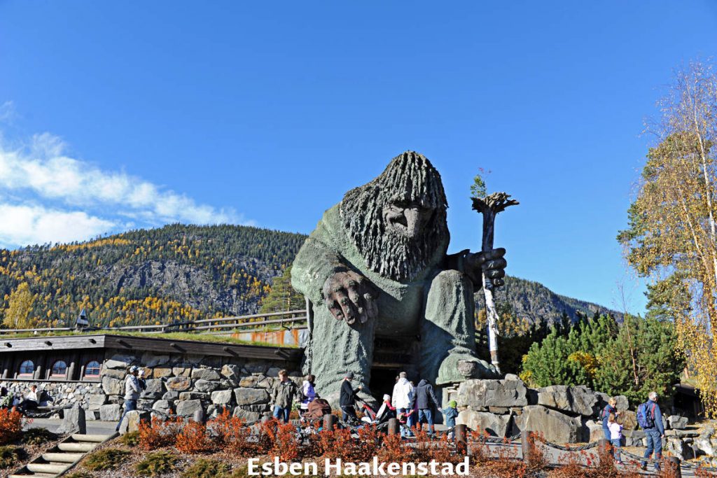
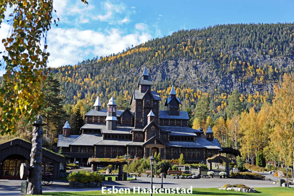
Five minutes drive from the above park and on the other side of the Gudbrandsdalslågen river is Hunderfossen Adventure Park. Two things strike you as you enter the park. The first is the big green Troll that guards entrances to the second one, and that is the Fairytale Castle.
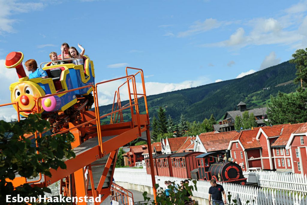
There are rides for kids of different ages and sizes. Some are even for the parents so the whole family can enjoy the park.
Wheel Bobsleigh
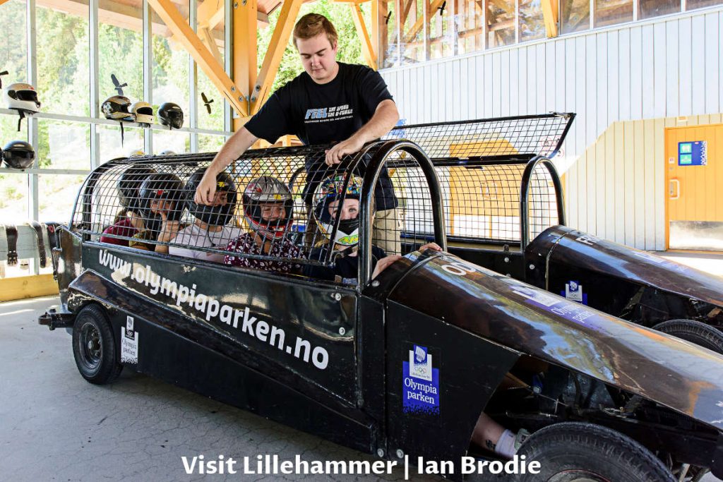
Just one minute’s drive down the road from the adventure park is the next attraction for teenagers and families too. Bob track built for Lillehammer 1994 Winter Olympic Games got a new adventure use as Wheel Bobsleigh (or Wheelbob as some call it) during summer.
Minimum two and maximum of three passengers with professional driver provided rush downhill at the 100 km/h (62 mph) speed.
“If my calculations are correct, when this baby hits 88 miles per hour, you’re gonna see some serious s***.” – Doc
Lillehammer
Many know that Lillehammer was the host of the 1994 Winter Olympic Games, but many don’t know what Lillehammer means…
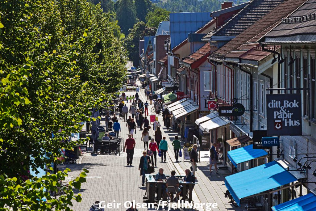
The pedestrian street with wooden houses in the center is the most charming, popular, and lively in Lillehammer.
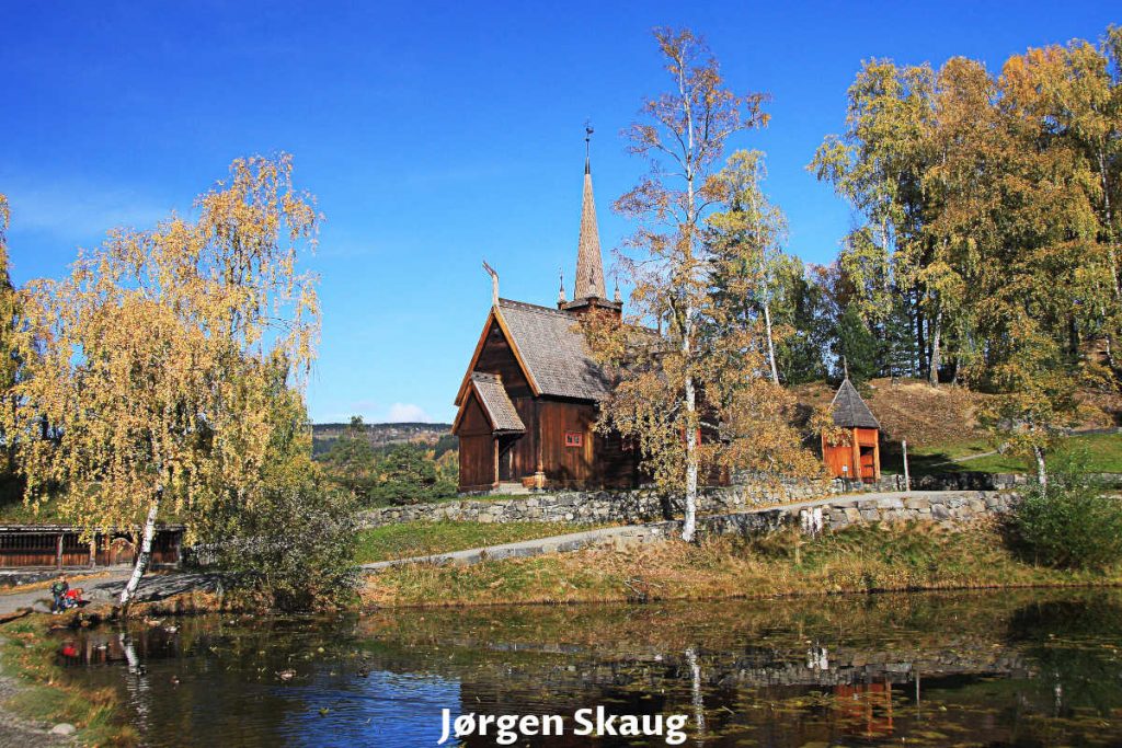
Garmo stavkirke
Yet another stave church in Norway, speaking of which, Garmo church was demolished in 1880, and the materials were sold at auction. Later building materials were redeemed, collected, and transferred to Lillehammer for reconstruction.
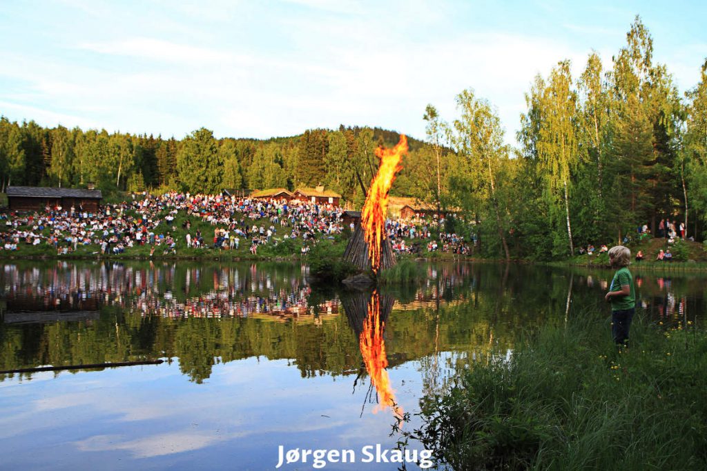
23rd of June – Saint John’s Eve (Sankthansaften) in Lillehammer
We have already mentioned that Saint John’s Eve (Sankthansaften) celebration is usual in Norway. Lillehammer is no exception, and celebrate it with a bonfire.
Lysgårdsbakkene hoppanlegg – Ski Jump
On the slopes above Lillehammer is ski jumps visible even from the highway.
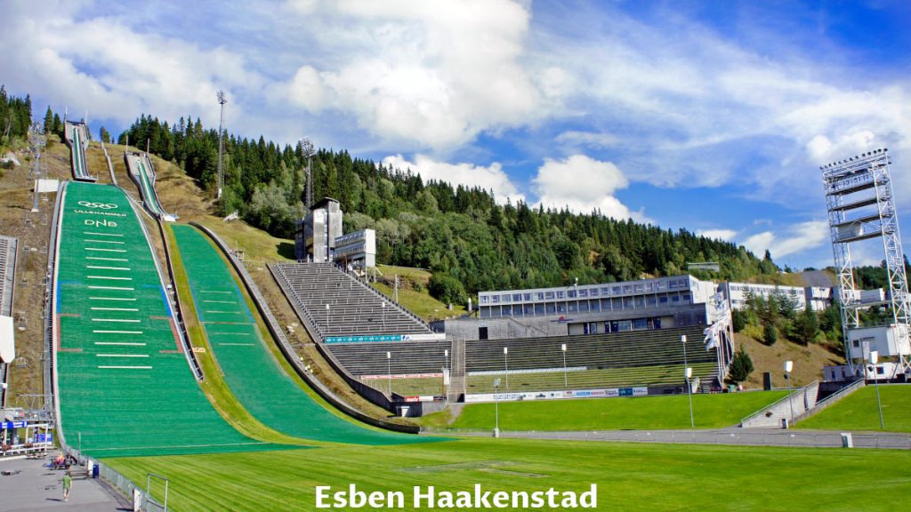
Even the moon is sometimes tempted to jump off the ski jump hill.

Telemarkstunet
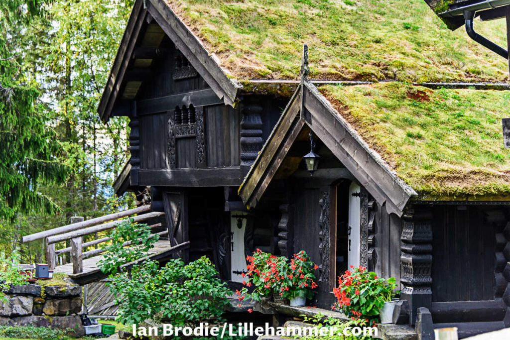
Telemarkstunet wooden cabins are above the ski jumps. They are charming places to eat and drink while out on the town.
If you click this link and make a purchase, we earn a commission at no additional cost to you.

The grass on the roofs, the colorful gardens, and the attractive carved wooden pieces on the exterior are the cover of the book.
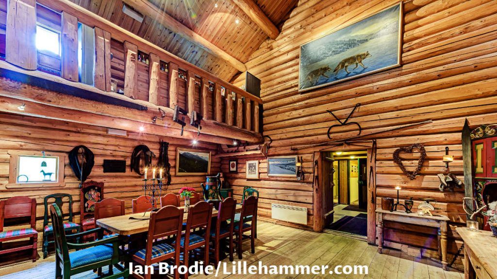
The book’s content is each room’s beautifully decorated artifacts, colorful cabinets, and charming fire pit room.

Birkebeinerrennet (The Birkebeiner race)
I have many former colleagues who trained for months, if not years, before signing up for the Birkebeiner ski race. It’s a big deal for Norwegians. You may be wondering why there is so much fuss about it. Well, let me tell you a short story.
This race commemorates a ski trip made by Birkebeiner loyalists (Torstein Skevla and Skjervald Skrukka) to save the infant heir of the Norwegian throne, Håkon Håkonsson, in winter 1206. So the most important rule for all participants is to carry a backpack weighing at least 3.5 kg (7.7 pounds) since that is the estimated weight of a one-year-old baby king.
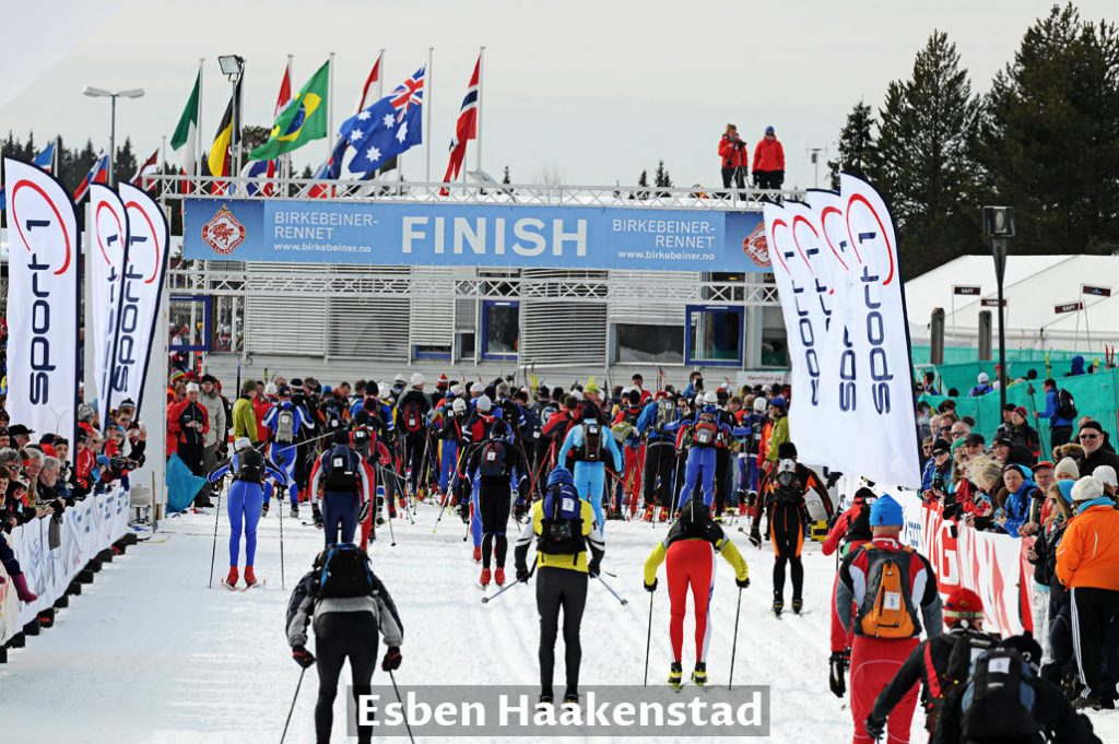
The race starts at Rena and finishes at Lillehammer, a distance of 54 km (34 mi). The number of participants is limited to 16 000. Each participant must register and pay a fee to race. The current race track record for men is 2:19:28, and for women is 2:41:46.
The skiing race was not enough of a challenge, so Norwegians have a summer version of the race and not one but two. Bicycling race is Birkebeinerrittet, and the cross-country running race is Birkebeinerløpet.
Lillehammer Mikrobryggeri – Brewery
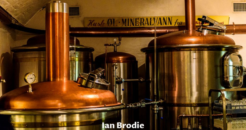
We are looking forward to visiting this unique eating and drinking place in Lillehammer. As we can see from the photos the site looks very promising.
In addition, we might tour the brewery and that would be cool.
Skibladner Paddle Steamer Boat
When the weather is nice (important in Norway), and we are triggered by Mark Twain’s “Life on the Mississippi”, we will plan an adventurous lake trip.
Between late June and mid-August operates on Lake Mjøsa the world’s oldest paddle steamer Skibladner. We plan to take the northern route from Hammar via Gjøvik to Lillehammer, stay short in the Lillehammer center, and return to Hammar by a late train.
I hope that my Olive Oyl will scream at least once “Help! Popeye!” and I will be her knight and save the day.

Aulestad – Bjørnstjerne Bjørnson’s House
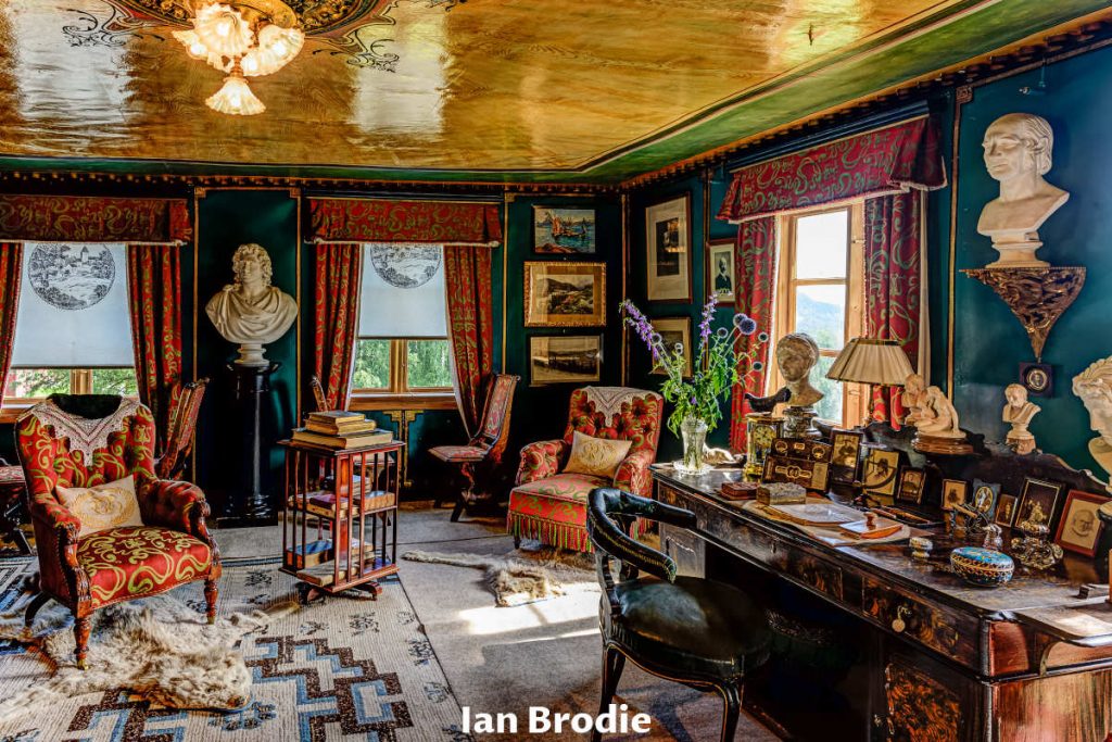
Norway has three laureates of the Nobel Prize for literature, and Bjørnstjerne Bjørnson is one of them. He lived in Aulestad village, 25 minutes drive north of Lillehammer. He wasn’t just a writer but involved in public life and cultural debates. He wrote the Norwegian national anthem “Ja, vi elsker dette landet” (“Yes, we love this country”).
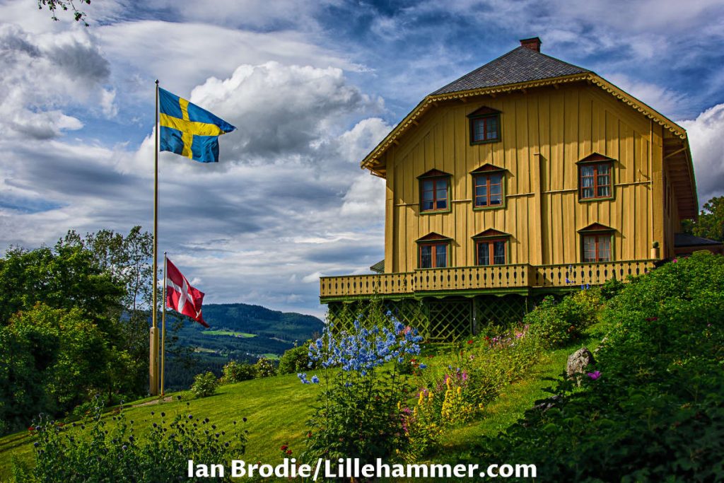
We found some amazing photos of Bjørn’s house, both exterior and interior, with eye-striking vintage artifacts. We can’t wait to visit this picturesque, historic site of such important Norwegian heritage.


Hell’s Potholes (Helvete Naturpark – Jettegrytene i Espedalen)
Hell’s Potholes are 25 minute’s drive down the road from Aulestad village. As far as we see in the photos, a wooden path leads to the entrance to the potholes, and at the end, there are wooden ladders that lead to the bottom. We are aware that down there can be wet, muddy, and slippery, so it is wise to have nonslippery footwear.
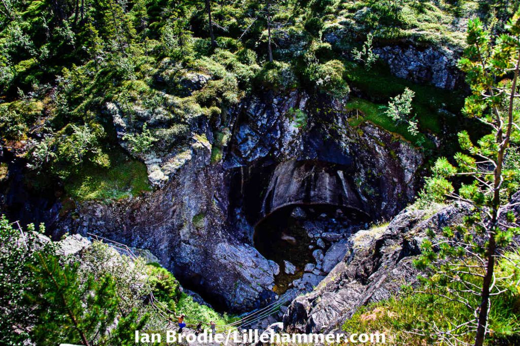
As creepy as the pothole’s name is, we want to cheer it up as written in Asterix’s comic “Vis comica” (Have a sense of humor).
We could bring all the ingredients to prepare the magical potion of Gauls in this cauldron and become Asterix and Obelix with superhuman powers.
Wait! Where will we find strawberries?!

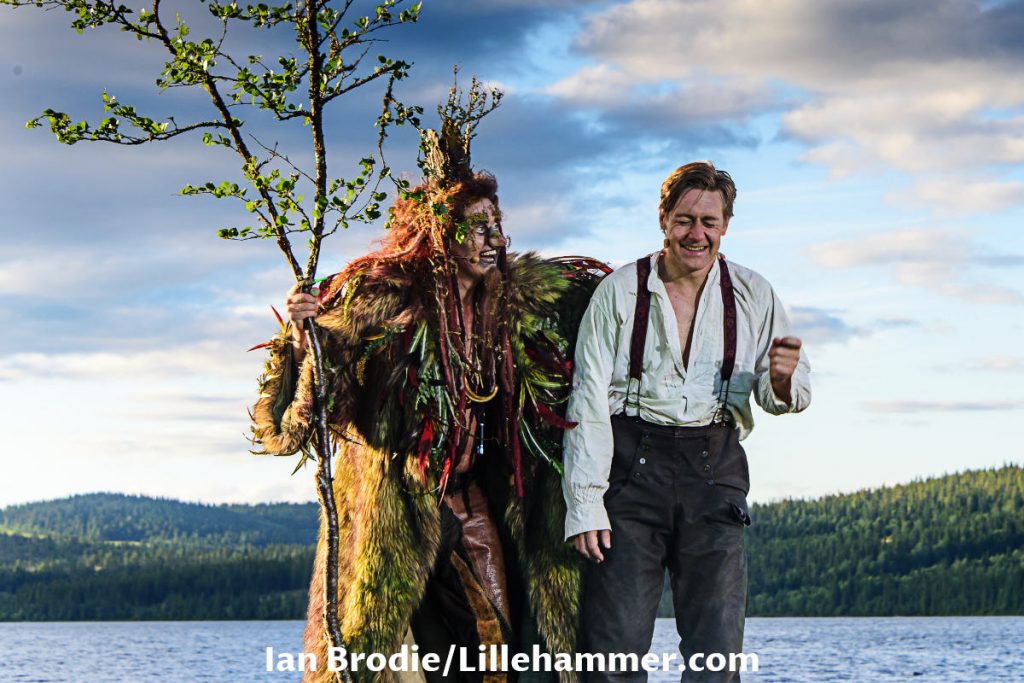
Peer Gynt Annual Festival on Gålå Lake
The main attraction is the open-air play on the stage near Lake Gålå. Peer Gynt wrote Henrik Ibsen, one of the most famous Norwegian playwriters, and is considered “the father of realism”. The play is accompanied by Edvard Greig’s music and within the ambiance of Norwegian nature as we mentioned near lake Gålå. The festival is held the first week in August.
For the international audience, it is possible to rent an audio guide, attend introduction in German or English prior to plays and read booklets.
Lillehammer & Gudbrandsdalen Valley Region – All Seasons Landscapes
Norway’s landscapes are fantastic, so Gudbrandsdalen Valley and the Lillehammer region are no exception.

While researching the area, we found astonishing photos from all seasons. It is an opportunity to snap some amazing landscape photographs in the future. It is a blessing that we live just a couple of hours, so we can return whenever we expect the right weather and the season.
If you click this link and make a purchase, we earn a commission at no additional cost to you.
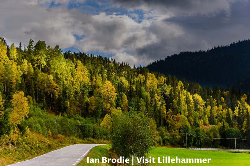
We hope you will like the photos as much as we like looking for them with expectation and excitement to see them in person in near future. Enjoy!
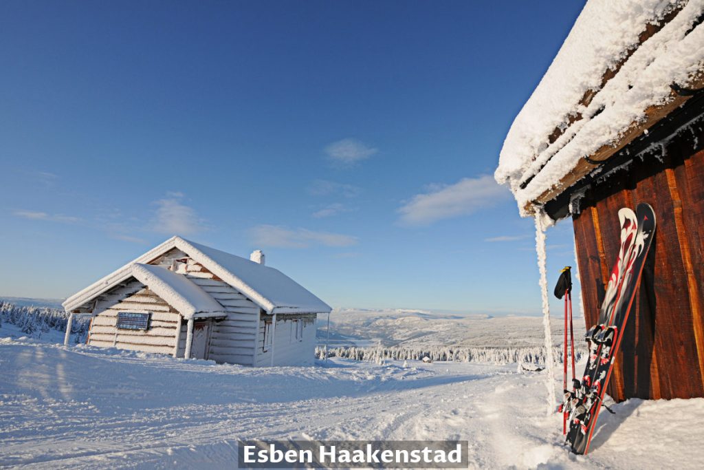
How To Get Around In Norway
Norway has a good network of airports, railways, buses, boats, ferries, roads, etc. It is up to each individual to make a transportation type choice. We have collected the list of websites and info about your potential travel to/from and within Norway.
By Car: Most of the roads on this trip are not highways but regular one-lane (two-way) motorways. You can expect the usual multiple lanes highways around major cities (Oslo, Bergen, Stavanger, etc.).
Some mountain roads are steep and narrow, and those demand cautious driving, traffic anticipation, etc. We tried to give you driving tips for such roads and hope they will be helpful. Driving in snow conditions in Norway is a completely different animal and we will probably write a separate article in near future.

We live in Norway, so we use the AutoPass gadget in our car to pay for road tolls with discounts. If you are coming to Norway with a foreign vehicle, please check the AutoPASS website about registration for road tolls. We believe the toll camera will take a photo of your car’s license plate, and you will get an invoice to pay the toll (not the fine).
During our trip, we used many ferries to cross the water barriers. We use the same AutoPASS gadget with a separate prepaid ferry account to pay for ferries. If you are coming with a foreign vehicle, please get more info at the AutoPASS Ferry website.
Intercity Transport
By Airplane: If you decide to travel inside Norway by plane, check the Avinor website for the usual info (departure, arrivals, transportation, baggage, etc.).
SAS and Norwegian operate both domestic and international flights in the big airports. Widerøe operates domestic flights at smaller airports.
By Train: In our more detailed articles (links throughout this journey diary post), we have described whether a place is on a railway network (or not). If you decide to travel inside Norway by train, please check VY (former NSB) website for all information.

By Bus: Please, check the VY Bus website for all information about bus transport within Norway.
Some cities in Norway have their own bus network and company. In our more detailed articles (links throughout this journey diary post), we marked the links to these companies websites.
By Ferry: We have already mentioned that we had to cross several ferries during our trip. It is wise to check ferry payment methods if you come with a foreign vehicle by checking the AutoPASS Ferry website.
By Cruise: Hurtigruten is a popular option to travel alongside the Norwegian coastline. Please check the Hurtigruten website for more information about tour options.
Public Transport In The City
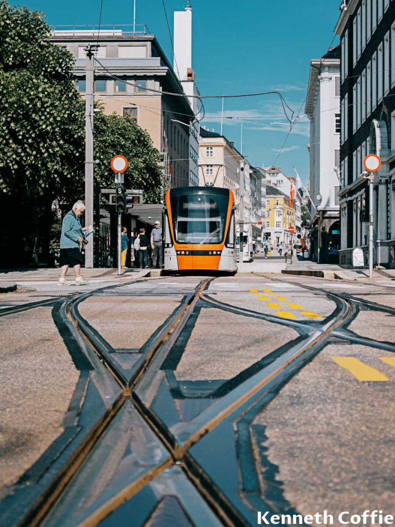
Most of the cities, towns, and places in Norway are pedestrian-friendly. So you can see a lot just on foot. Other options are rented bicycles or electric scooters.
Oslo has a public transportation network including metro (T-bane), buses, trams, boats, ferries, etc. Ruter Tourist Information (next to the Tiger statue) in front of Oslo Railway station, sells all sorts of tickets. You can use Ruter mobile App as well.
Bergen has a network of buses, light rails (trams), boats, ferries, etc. Bergen Tourist Information is next to Fisketorget in downtown Bergen and sells all sorts of tickets. You can use the Skyss Ticket app (Skyss Billet) or purchase tickets at kiosks, shops, and onboard (sometimes).
Ålesund has a network of buses.
Where to stay in Norway?
For this trip, we have booked various accommodation capacities such as hotels, motels, camping cabins, apartments, etc. We will briefly mention each of them, and you decide for yourself if they are interesting to you or if you want to look at another offer.
Oslo
We have been living in Oslo for over ten years. So we did not need to look for accommodation in Oslo. Please, do not worry since Oslo has a variety of accommodations from hostels as budget options to luxury hotels.
If you click this link and make a purchase, we earn a commission at no additional cost to you.
Flåm – Lærdalsøyri – Lærdal Ferie- og Fritidspark
Lærdal Ferie- og Fritidspark is a small budget hotel in Lærdalsøyri on the shores of Sognefjord. It is near camping and has amazing sunsets. We bought food in the nearby grocery shops and prepared it in the hotel’s common kitchen facilities.
It was a cheaper option than booking accommodation in Flåm. The hotel location was great for exploring this area in all directions.
If you click these links and make a purchase, we earn a commission at no additional cost to you.

Bergen – Bratland Camping
I (Dejan) visited Bergen on numerous business trips and always booked hotels in the city center or nearby to the event venue.
However, on our private trips, we came by car. Bergen is not the best or the cheapest option for finding accommodations with a parking spot in the city center.
Therefore we decided to find accommodation outside the city and Bratland Camping was a good choice. It has charming wooden cabins with a view of the lake. Tent, caravan, and motorhome tourists are the most often visitors here.
Please be aware that the local road nearby the camp is the shortest connection between the road E39 (coming from or going to the south: Haugesund & Stavanger) and road E16 (coming from or going to the east: Voss, Flåm, Oslo). So you can expect some traffic noise there, but use earplugs, and you are all set.
We saved for our accommodation expenses, drove 20 minutes to the city center, and parked in the centrally located garage (By Garasjen).
If you click this link and make a purchase, we earn a commission at no additional cost to you.

Stryn – Innvik – Innvik Fjordhotell
Innvik Fjordhotell has a fantastic location on the shores of the fjord. The breakfast was tasteful and diverse. However, this hotel is not on the budget side of the price spectrum, although it was a cheaper option compared to the Loan and Stryn offers.
If you click this link and make a purchase, we earn a commission at no additional cost to you.

Gerianger – Fjorden Campinghytter
Fjorden Campinghytter (Fjord cabins) near Geiranger was the best accommodation on our road trip. It has a fantastic view over Geiranger village, fjord, Ørnesvingen viewpoint, etc. Price was higher, but we saved on our meals since we used the kitchen in the cabin.
We have tried our fishing luck as well.
If you click this link and make a purchase, we earn a commission at no additional cost to you.
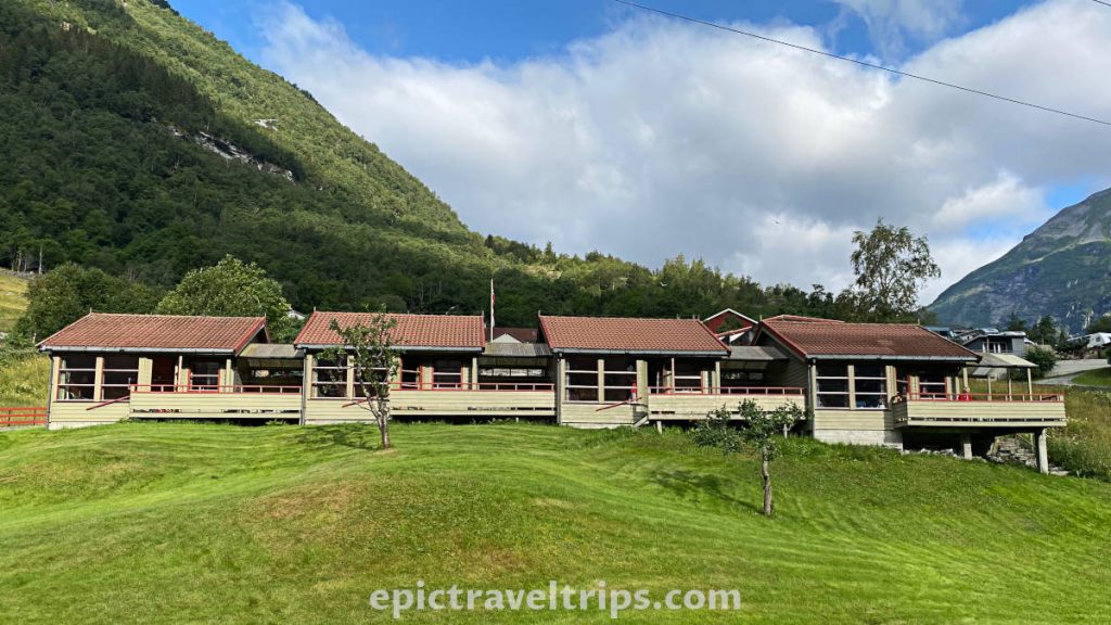
Ålesund – Norhostel Apartment
Norhostel Apartment is specious and with kitchen facilities. I believe it is even bigger than our apartment in Oslo. The price was great, the location excellent, the only downside was no parking. However, we have managed to find paid parking space close by.
The walk to the town center was a breeze and a great way to stretch our legs.
If you click this link and make a purchase, we earn a commission at no additional cost to you.
The Atlantic Ocean Road – Kvernesfjorden Apartments
We have found Kvernesfjorden Apartments on the “fly” without pre-booking. Our hosts were a fantastic Lithuanian couple. The apartment is on the slope with a fantastic view over the fjord, a spacious bathroom, excellent kitchen, and we love it.
If you click this link and make a purchase, we earn a commission at no additional cost to you.
Lillehammer & Gudbrandsdalen Valley
There was no need for us to book accommodation near Lillehammer since we live in Oslo which is just two hours drive. So we do not have any accommodation to recommend from personal experience. However, we are sure that you will find suitable accommodation for your needs and budget.
If you click these links and make a purchase, we earn a commission at no additional cost to you.
Best Time to Travel in Norway
Norway is an all-year-round visiting location. However, the best season to visit depends on your wants and needs. We will focus on the summer season.
We took this road trip in July since July is the common summer vacation month in Norway. You can count July as the summer high season month, and overcrowded in some places. However, we recommend planning a similar trip in the summer months of June, July, and August.
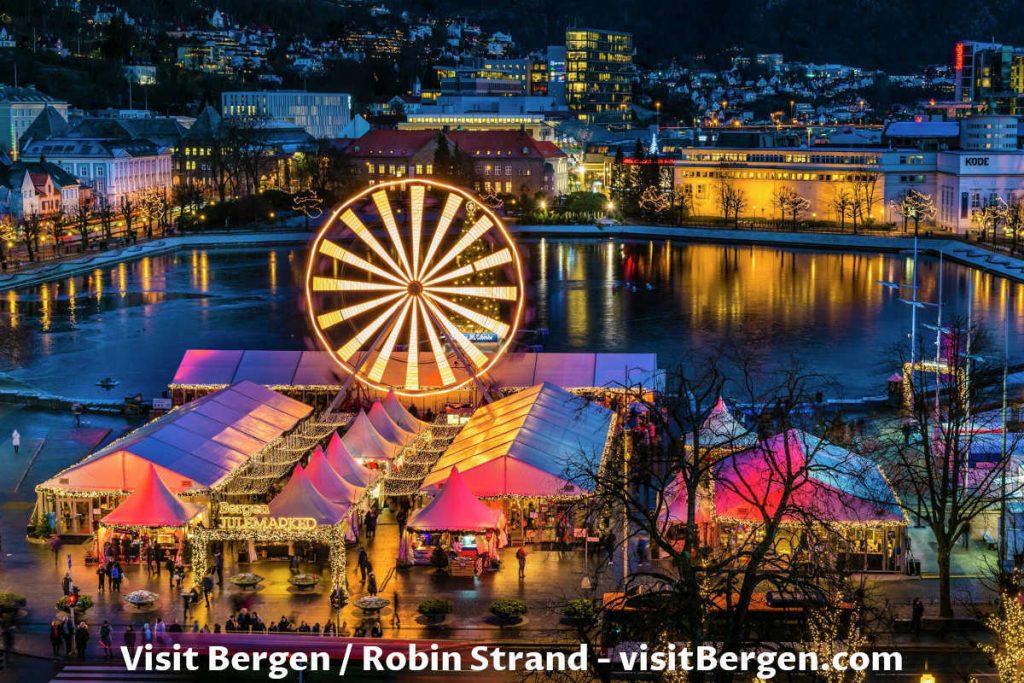
November to the middle of February is a “dark” season when the days are very short. However, at Christmas time is colorful (Christmas markets) to visit big cities in Norway.
Easter week in spring is travel busy in Norway. However, the weather can be unpredictable in those months (March, April, beginning of May).
Many places can have certain dates when festivals occur or some special occasions and events. Those days can be very lively and especially interesting to visit.
We recommend two events that might be especially interesting for some of you and worth visiting since they are really special in Norway.
17th of May – Constitution Day (Syttende Mai)
The 17th of May is a national holiday in Norway (Constitution Day). It is a day when Norwegians celebrate in national garments and wave the Norwegian flags.
The celebration is popular among children who march in bands. The music orchestras play the music in the parade. Marching children and/or music orchestra represents a school or local community.

23-24th of June – St. John the Baptist (Sankthans)
St. John the Baptist (Sankthans) is the 24th of June and the longest summer day in Norway.
On the 24th of June are grilling in the parks if the weather is nice.
On the 23rd of June in the evening celebrate with a bonfire in some places, for example, Ålesund, Oslo, Bergen, Lillehammer, etc.

Costs of Traveling in Norway
We have set a budget estimate that might be helpful while planning your own trip to Norway. In addition, we have a few tips for you that might save your wallet or cards from going in the red.
USD ($) – Budget
- Hotel: $50 - $150 per night
- Hostel: $20 - $50 per night
- Price per meal: $9.6-$25
- Dish: (Pizza) $16.5
- Activities: $15 - $160 per day
- Transport: $6-10.8 per day
- Gas: $2 per litre
- Camper: $130 - $295 per day
- Coffee: $3.6 cup
- Wine: $7.5 per glass
- Beer: $9 0.5L
EUR (€) – Budget
- Hotel: € 60 - € 145 per night
- Hostel: € 20 - € 48 per night
- Price per meal: € 9 - € 23.7
- Dish: (Pizza) € 15.6
- Activities: € 14-5 - € 150 per day
- Transport: € 6-10.23 per day
- Gas: € 1.94 per litre
- Camper: € 120 - € 275 per day
- Coffee: € 3.4 cup
- Wine: € 7.3 per glass
- Beer: € 8.75 0.5L
GBP (£) – Budget
- Hotel: £51 - £123 per night
- Hostel: £23 - £40 per night
- Price per meal: £7.7-£20
- Dish: (Pizza) £13.15
- Activities: £12.3 - £128 per day
- Transport: £5-8-6 per day
- Gas: £1.64 per litre
- Camper: £105 - £235 per day
- Coffee: £2.8 cup
- Wine: £6.15 per glass
- Beer: £7.4 0.5L
Tips: How To Lower Travel Costs In Norway
Here are some helpful tips for you:
Accommodation: Camping is probably the cheapest option. We tried to find accommodation outside the most popular tourist locations and drive to them on our visits. Finally, another option is to have accommodation with kitchen facilities as we did and make your own meals so you can avoid spending too much at restaurants.
Meals: Grocery shops (Joker, Bunnpris, Meny, Spar) have salad bars, barbeque, and hot food sections which are a lot cheaper meal options compared with restaurants.
Drinks: Tap water in Norway is drinkable, of excellent quality, and free compared with highly-priced soft drinks, beer, or wine. Bring a bottle, refill it whenever you find the chance, and save lots of money for other activities.
Snacks: We always have small packages of raisins that are very cheap. They are a good choice for quick energy boosts as needed.
That’s all folks. We wish you an epic trip!


