
- What is?
- Drive Experience
- How much is the road toll?
- Where is located?
- How To Reach?
- Is the drive demanding?
- How Long Does It Take?
- Where To Park?
- When Is The Best Time To Visit?
- What Is Nearby?
- Our Impressions
What is Atlantic Ocean Road (Atlanterhavsveien)?
Atlantic Ocean Road or in Norwegian (Atlanterhavsvegen/Atlanterhavsveien) rates as Norwegian Scenic Route or National Tourist Route like the Trollstigen mountain road to Geiranger, Jæren Veg, and many others.
Engineers constructed the road keeping in mind that it should enable road and maritime traffic. Overall it is attractive to many tourists as well. Several viaducts and bridges connect several small islands, making a unique combination of nature offer and engineering cleverness.
Due to the maritime transport requirements, some bridges and roads have unusual and attractive shapes.
Atlantic Ocean Road (Atlanterhavsveien) Drive
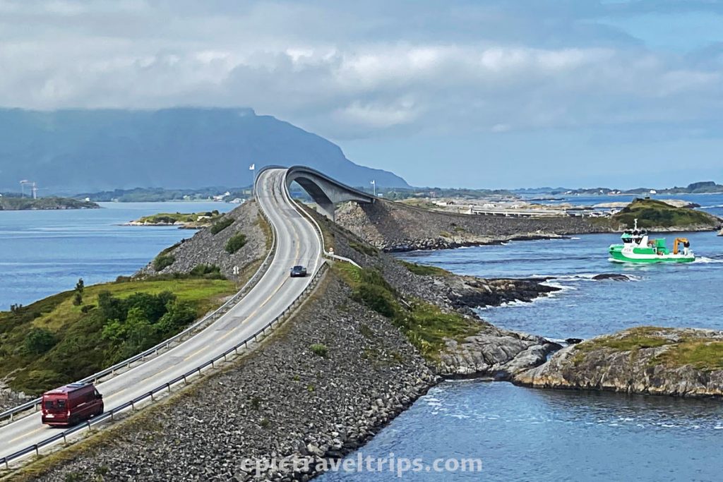
We will describe the most tourists attractive part of the road between Kårvåg and Hågå, which is 8.3 km (5.16 mi) long. Eight bridges connect the mainland over several islands.
Geitøya & Håholmen
It is a first stop coming from the north side and direction of Kristiansund. The main attraction, the Storseisund Bridge (Storseisundbrua), is far away from here. So you need a good zoom lens to take the photos from here. Parking spaces are on both sides of the road, but the right-hand side is better.
However, there is a souvenir shop behind the parking lot. Due to the rock, it is not visible from the road. It is a place where one can take a boat to the fishing village and hotel on Håholmen island.
Eldhusøya
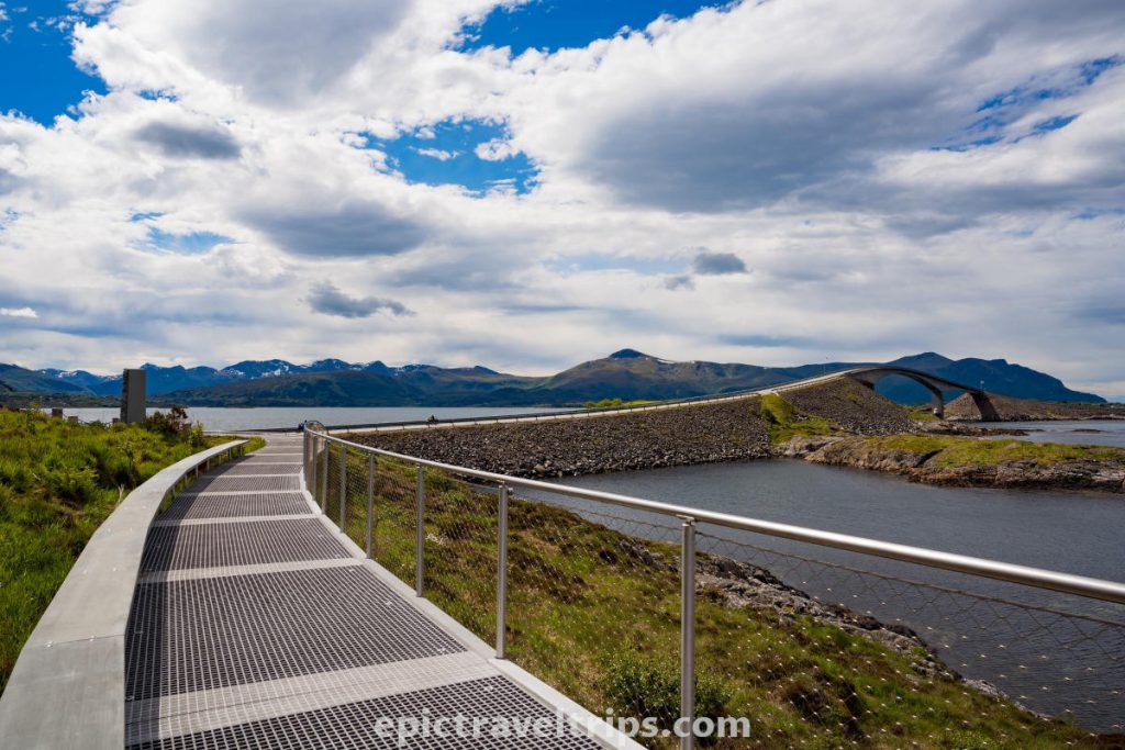
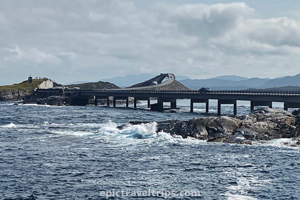
It is probably the best spot to take photos of the main attraction, the Storseisund Bridge (Storseisundbrua). The parking is on the right-hand side, coming from the north side (from Kristiansund’s direction). From parking, you can take around the island short walking tour on the modern built metal pathway. We just walked up the small hill to take the best photos of the bridge.
At the parking, there is a café and toilets. The café is carved into the island’s side and resembles the long sea fish with scales shining on the sun.
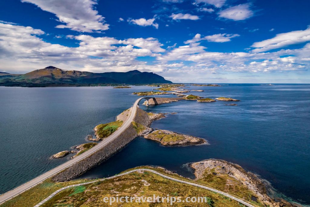
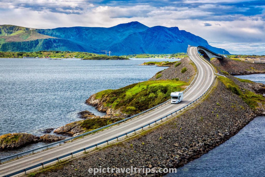
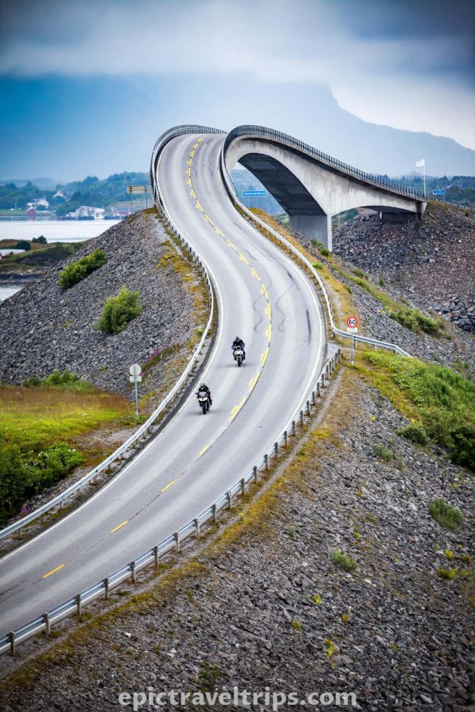
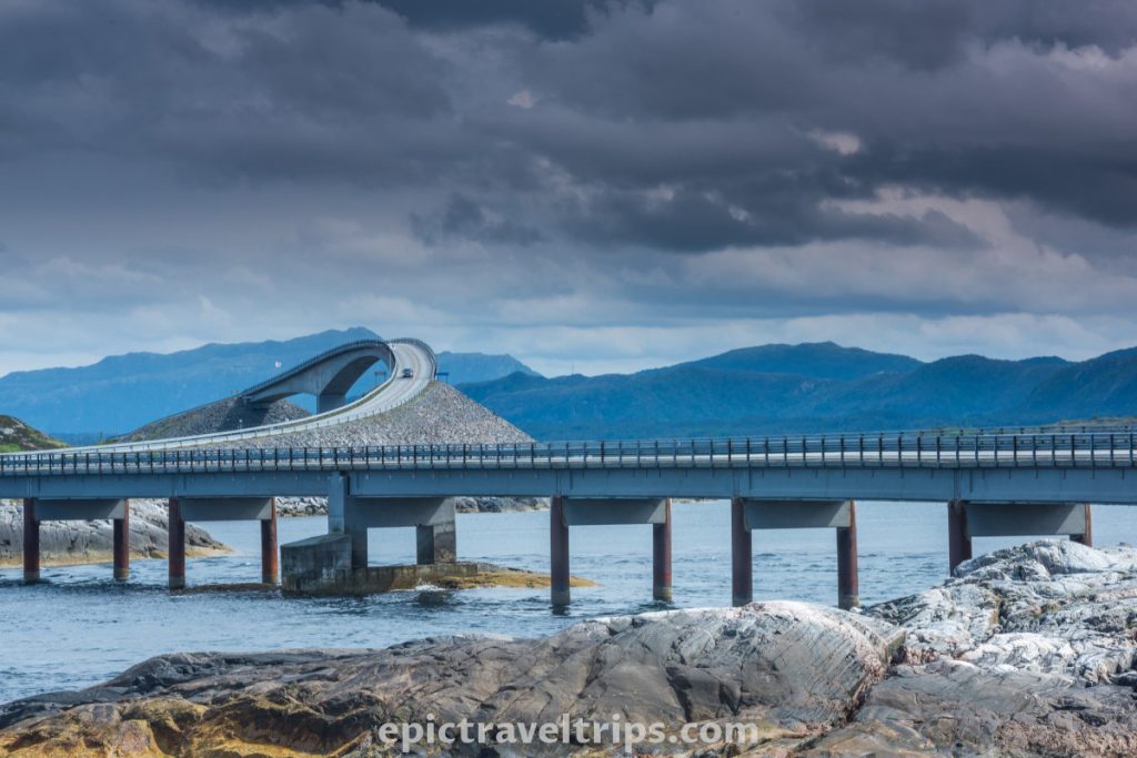
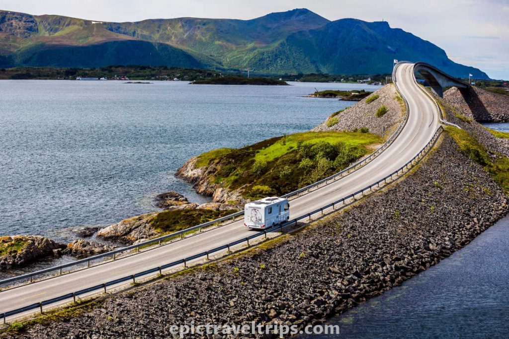
Storseisund bridge (Storseisundbrua)
Storseisund Bridge is the longest of all eight bridges of this Atlantic Road section. It is very tall in the middle and allows maritime traffic below it. Such an unusual shape is a thing appealing to people’s eyes.
It makes a pleasing S-curve as getting to the top, with causeways on both sides, two pillars in the sea, and an arch on the highest point.
Landscape photographers love curves and shape like these for lead-in lines.

Myrbærholmbrua & Skipsholmen Parking
As soon as you cross the Storseisund Bridge, there is a small parking space on the right-hand side (Skipsholmen Parking) just in front of Myrbærholm Bridge (Myrbærholmbrua). If the day is windy, you can take photos of the bridge and big waves splashing into it.
At the bridge on both sides, there are small metal fishing bridges. You can try fishing luck and catch mackerel, cod, pollack, or old shoes. (I am joking about the last part, of course).
Myrbærholmen
After crossing the Myrbærholm bridge, on the right-hand side, when you come from the north (from Kristiansund’s direction), there is a tiny only for a few vehicles parking space. It is a fantastic spot to take photos of splashing waves on both bridges, Myrbærholm & Storseisund.
Other Locations
You can drive further south after the Myrbærholm bridge. There are a few smaller and bigger parking places, but not as attractive spots for taking photos as previously marked.
How Much Is The Atlantic Ocean Road (Atlanterhavsveien) Toll?
Atlantic Ocean Road is free for everyone. However, until 1999 you had to pay the toll.
Where Is Atlantic Ocean Road (Atlanterhavsveien) Located?
Atlantic Ocean Road is in two municipalities (Hustadvika and Averøy) and Møre & Romsdal counties of the West Norway (Vestlandet) region.
The road starts at Kårvåg and finishes at Kjeksa. It is 36 km (22.3 mi) long. However, the most attractive is the 8.3 km (5.16 mi) section between Kårvåg and Hågå, connecting Geitøya, Eidhusøya, and Murbærholmbrua with the main attraction, Storseisund Bridge (Storseisundbrua).
The road and bridges connect many islands between the mainland.
If you click this link and make a purchase, we earn a commission at no additional cost to you.

How To Reach Atlantic Ocean Road (Atlanterhavsveien)?
The Atlantic Ocean Road (Atlanterhavsvegen) is around 125 km (77.7 miles) far from Ålesund, and it takes about two and half hours to reach it, including the ferry between Vestnes and Molde.
You can arrive from the south (Molde direction) by driving on road 64. It takes around a 45-minute drive and 45 km (28 miles) to the beginning of the road from the south side at Bud.
The other option is the northern approach from Kristiansund by driving the same road 64. It takes around a 32-minute drive and 32 km (20 miles) to the begging of the road from the north side at Kårvåg.

Is Atlantic Ocean Road (Atlanterhavsveien) Drive Demanding?
Atlantic Ocean Road is not demanding for most vehicles and in almost all weather conditions. However, crosswinds can be intense sometimes, so high vehicles must drive cautiously. The other minor thing might be waves and splashing water on the road, so drive cautiously in wet conditions to avoid aquaplaning.

How Long Does It Take Atlantic Ocean Road (Atlanterhavsveien) Drive?
The most attractive section is only 8.3 km (5.16 mi) long and an 8-10 minute drive without stopping. As we have mentioned, it is between Kårvåg and Hågå. Only bad weather can make you drive it without stopping.
How much time you will spend discovering the road depends on your desires, how many stops you make, and what you want to do.
The whole 36 km (22.3 mi) Atlantic Ocean Road is around a 45-minute drive one way without stopping.
Where To Park For Atlantic Ocean Road (Atlanterhavsveien)?
There are several parking lots, and all are free of charge. Some are smaller, and some are a little bit bigger. We will mention just a few, starting from the north side (Kristiansund). In addition, almost all the locations are well-marked in advance with brown signs on the road.
Håholmen parking is a good size and on both sides of the road. Just watch for the sign Geitøya and Håholmen.
Eldhusøya parking is the biggest and the most important. It is on the right-hand side (from Kristiansund’s direction), just in front of the Storseisund bridge. It has a refreshment café and toilets. Just pay attention to the Eldhusøya sign on the road.

Skipsholmen parking is just right after crossing the Storseisund bridge. It can be tricky to find a free spot since it is smaller. In addition, it is only on the right-hand side (from Kristiansund’s direction).
Myrbærholmen parking is a tiny parking spot for just a few vehicles. After crossing Myrbærholm bridge, there is parking on the left-hand side but pay attention not to block access to private property. Two smaller parking lots are on the right-hand side, further down the road.
Skarvøya parking is on the right-hand side, and it is easy to recognize since there is a wooden house with grass on the roof and a Norwegian flag.
Another hundred meters (328 ft.) away from Skarvøya parking is a small parking lot on the right-hand side.
Finally, Strømsholmen parking is on the other end of Atlantic road. It is the first parking spot from Molde’s direction. The parking is on the right-hand side (from Kristiansund’s direction). It has no facilities on it.


When Is The Best Time To Visit Atlantic Ocean Road (Atlanterhavsveien)?
Atlantic Ocean Road is the whole year-round opened. Probably, during summer (June-August), it is the best and most visited. However, the weather in this section can be unpredictable due to the proximity of the Atlantic Ocean. Sunny and windy days are probably the best combination. Sun provides clear images, and wind provides those spectacular photos with waves splashing against the bridges and the road itself.
Foggy, cloudy, and rainy days are less desirable and probably not worth visiting the road.
What Is Nearby Atlantic Ocean Road (Atlanterhavsveien)?
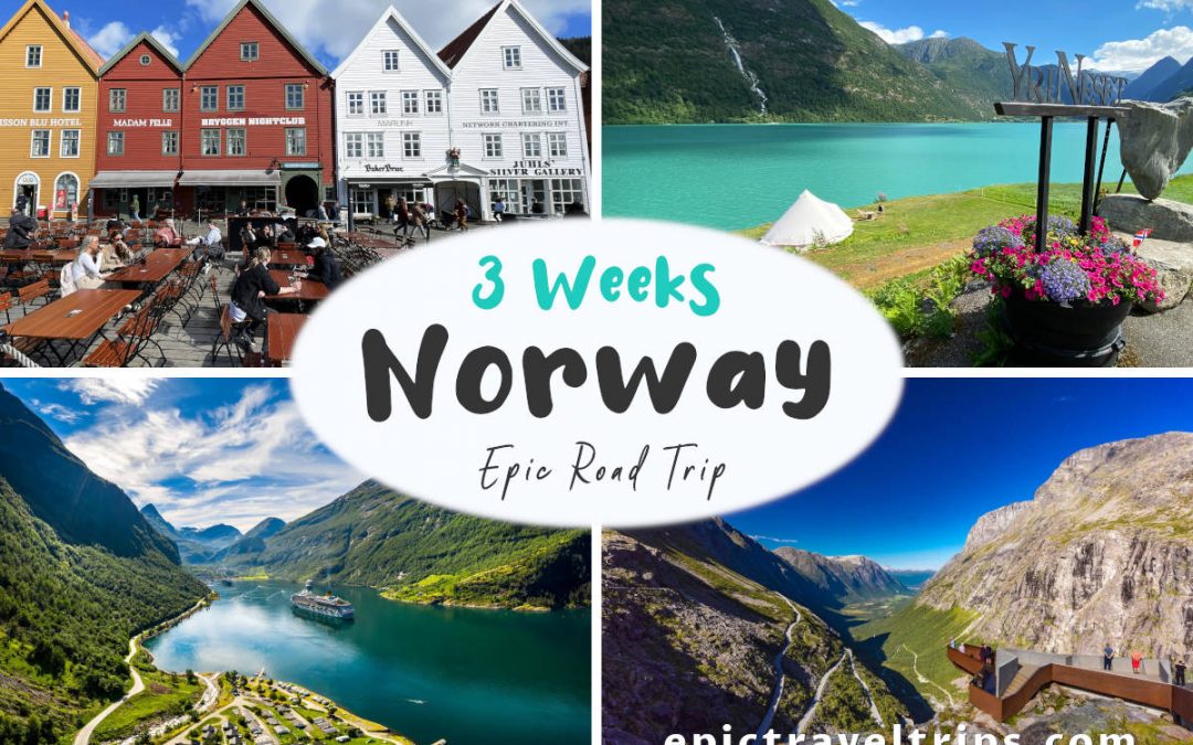
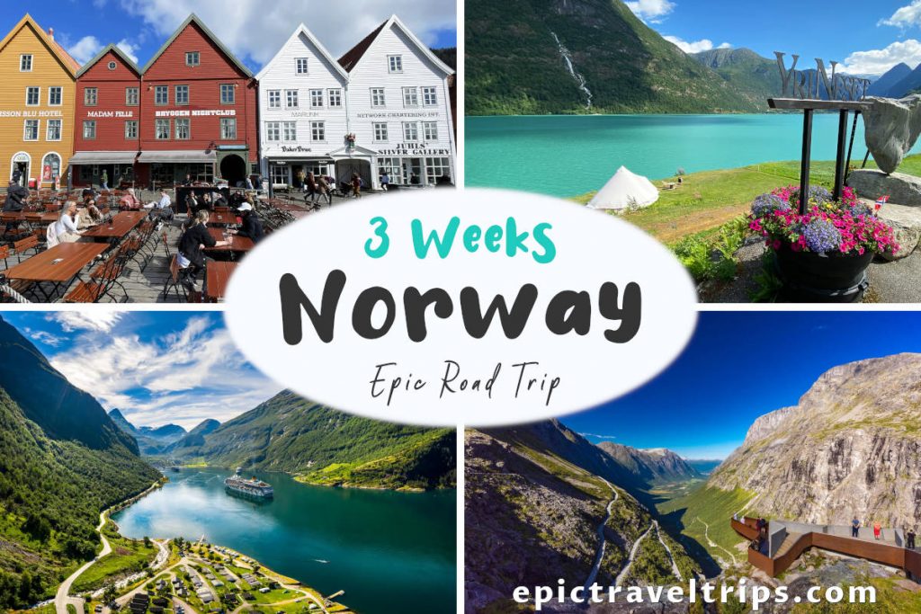
There are several absolute must-visit places nearby, so please do not skip them. All of them were part of our 3-Week Norway Epic Road Trip.
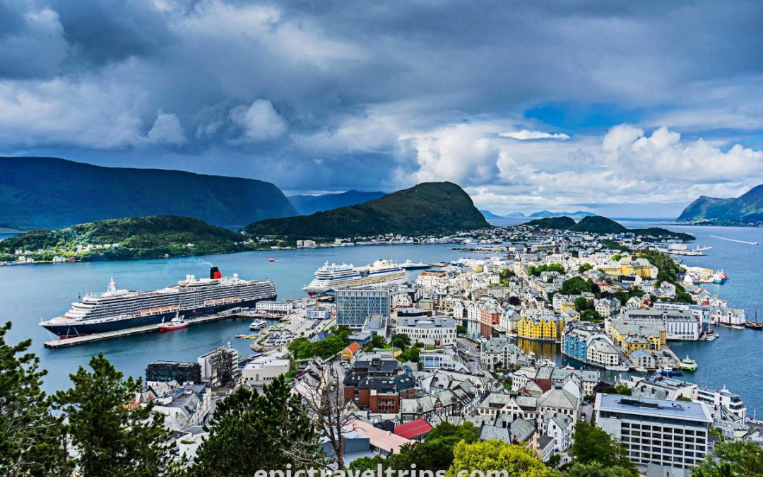
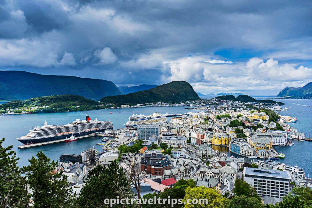
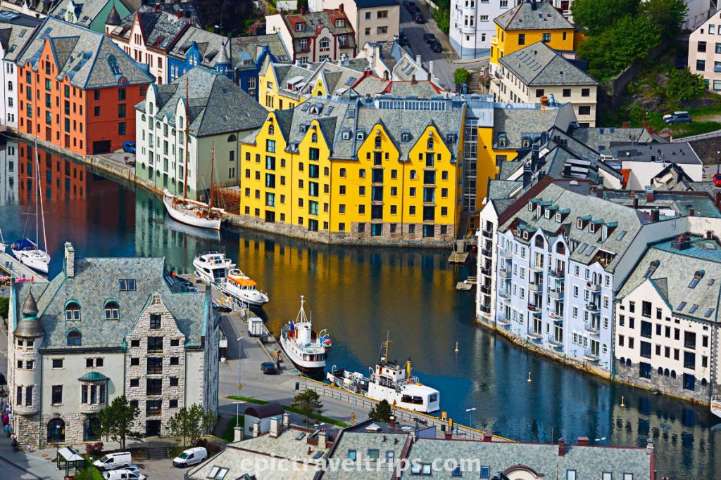
Ålesund
Ålesund has one of the most beautiful city panoramas in Norway. The city’s architecture will not be unnoticeable to your eyes due to the Art Nouveau architectural-style buildings.
We came to the Atlantic Ocean road from Ålesund on our 3-Week Norway Epic Road Trip.
It is just around 126 km (78.3 miles) away and is two and half hours drive, including the ferry crossing between Molde and Vestnes.
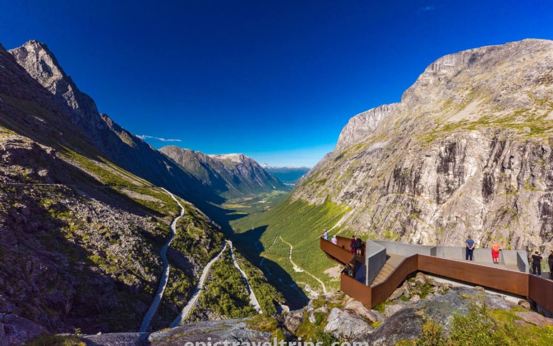
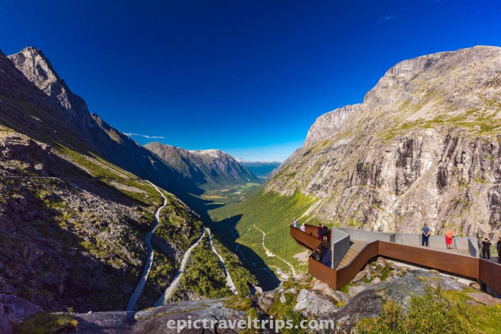
Trollstigen – The Mountain Road To Geiranger
Trollstigen is one of the best winding roads in Europe. The view of the road, mountains, and valley below, from the plateau, is breathtaking. The drive of this eleven-sharp turns road is no less thrilling than viewing it from the top.
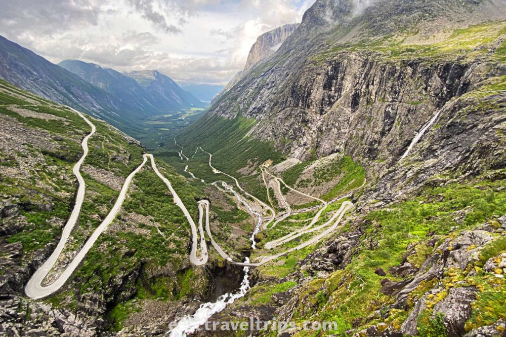
It is 117 km (73 mi) from Atlantic ocean road and is two hours and 30-minute drive including the ferry crossing Åfarnes-Sølsnes.
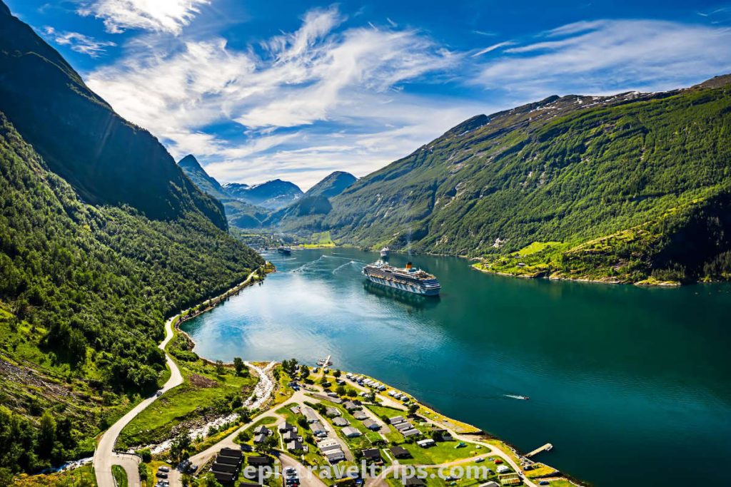
Gerianger & Geiranger Fjord
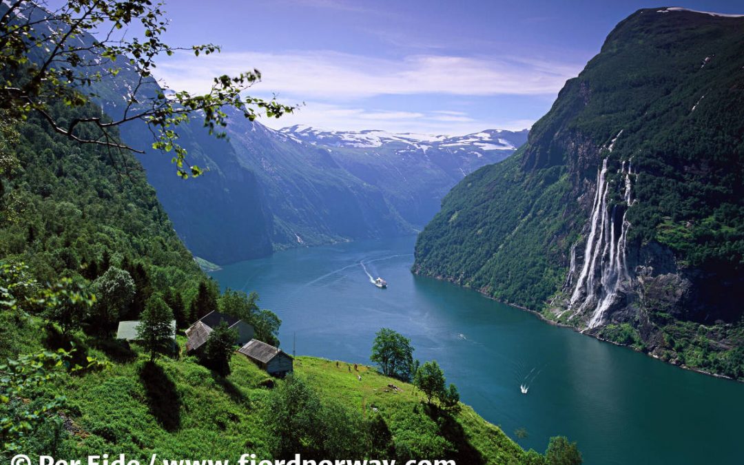
Geiranger is the iconic place where someone wants to experience fjords. There are so many fantastic places to visit around Geiranger (Dalsnibba, Flydalsjuvet, Seven Sisters Waterfalls, Ørnesvingen, and more). Simply, it is a must.

It is around 152 km (94.4 miles) away and is a three-and-half-hour drive one-way including ferry crossings.
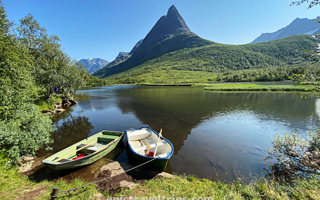
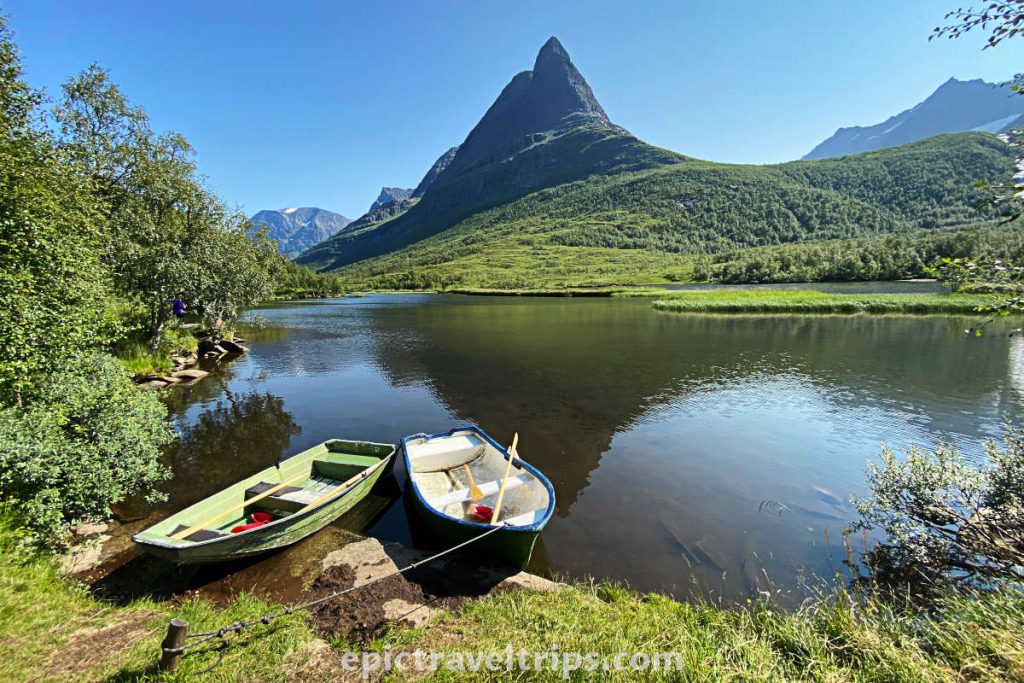
Renndølsetra Hiking – Summer Pasture Farms
Hiking Renndølsetra is more than just a walk to a summer pasture farm. Its location is a fantastic landscape for any nature lover, surrounded by beautiful mountains. Streams and waterfalls flow from the mountains and carve dense green forests. Finally, they meet the beautiful lake as their final destination.
Renndølsetra was our next destination on our 3-Week Norway Epic Road Trip.
Atlantic Ocean Road (Atlanterhavsveien) – Our Impressions
The mood for visiting Atlantic Ocean Road depends primarily on the weather conditions. We visited the road in the middle of summer in July. The day was such that half of the sky was blue and the other half covered with clouds, and the wind was not so strong. So we had a chance to take nice pictures of the cloudy sky.
However, we didn’t take those famous photos of the waves crashing against the rocks and splashing the road or bridges.
Next time we will explore the whole Atlantic Ocean Road and not just the most visited part. We are looking forward to a new experience on this unique road.
We wish you an epic trip!