
- What is sætra?
- Raksætra & Oppheimssætra Hike
- Where are located?
- How To Reach?
- Is it difficult?
- How Long Does It Take Hiking?
- Where To Park?
- When Is The Best Time To Visit?
- What’s Nearby?
- Our Impressions
Hiking Raksætra & Oppheimssætra is fantastic, and we would like to share it with you. Although we have lived in Norway for many years, we have postponed this trip many times.
Finally, we made it, and the impressions were fantastic.
What Are Raksætra & Oppheimssætra?
Raksætra & Oppheimssætra are summer pasture farms. Such farms are seasonal facilities for livestock farming and utilize grazing in areas don’t suitable for a year-round settlement. Pasture farms usually belong to a much bigger farm. The rest of the farm is at lower altitudes in the landscape, where the operating season is much longer and often all year round.
Milk production and processing into dairy products (cheese, creams, butter, etc.) are essential operations on such farms.

Raksætra & Oppheimssætra Hike
Raksætra Hike
The hike is 1.1 km (0.68 miles) long (one way), and it has 260 meters (853 ft.) climb at the altitude of 540 meters above sea level (1 772 ft.).
The hike starts on the forest road that leads to Loen Skylift (Cable Car) and Hoven restaurant. Forest road is in reality gravel road and even cars with permission drive to the cable car and restaurant. After around 200 meters (656 ft.), the path turns off the road and continues upwards. The track winds its way up through a pine forest. After around 600 meters (1970 ft.), turn left. After another 150 meters (490 ft.), the path crosses the river.
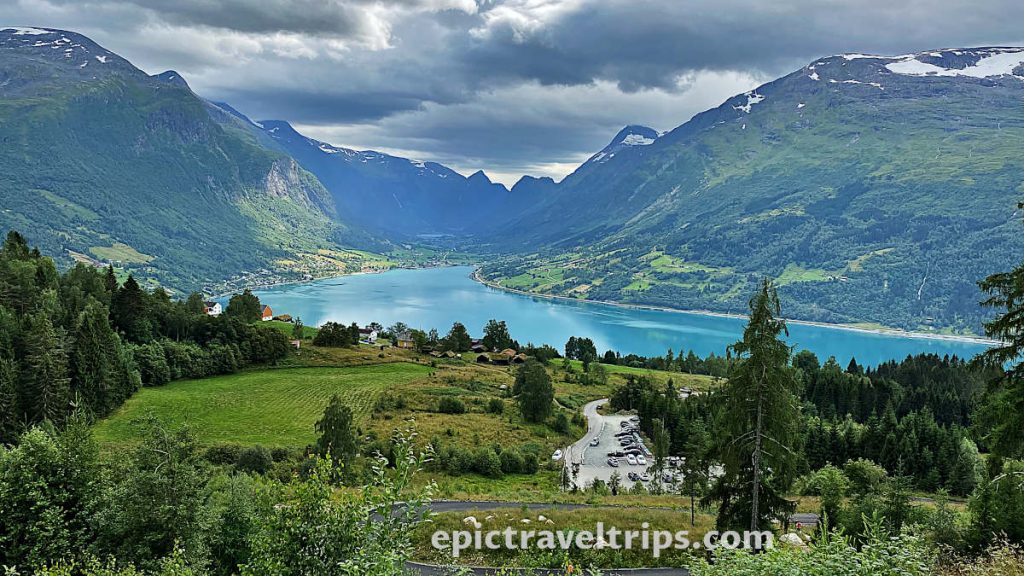
We can see the parking lot in the photo above, where we parked our car. If you look at the photo closer, you will see the parts of the dark asphalt road, which is the next hike’s section.
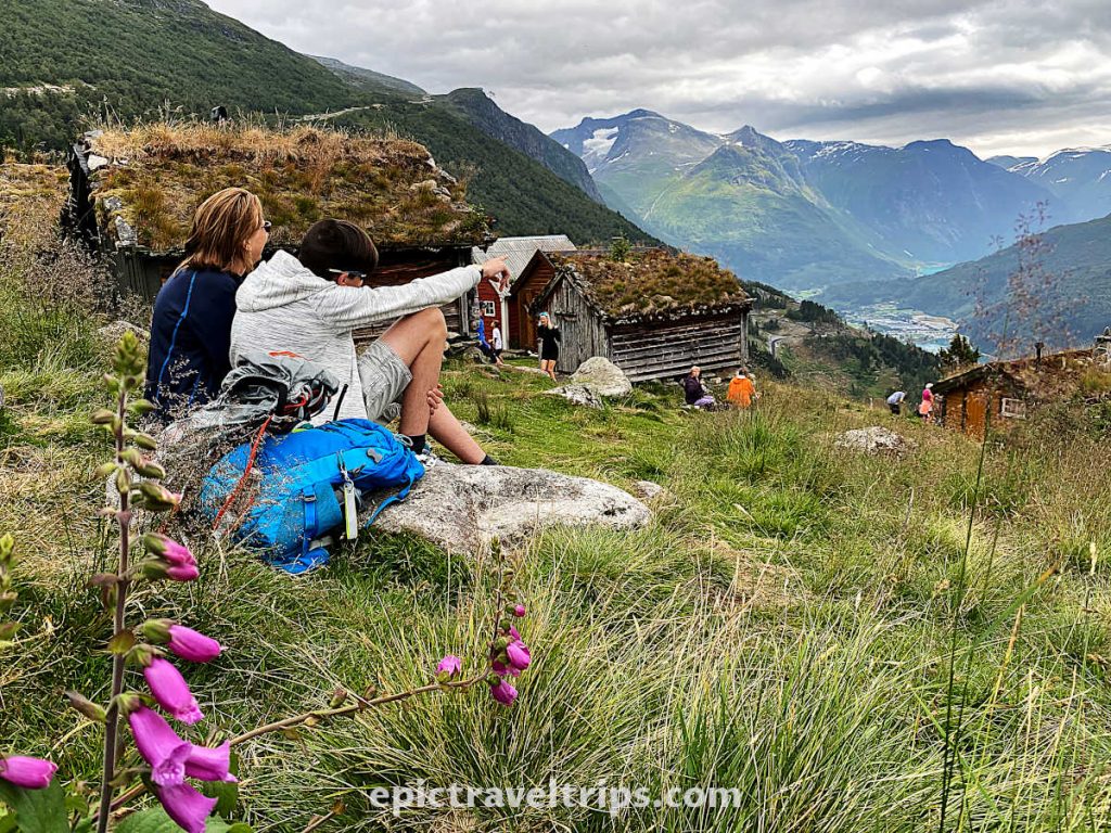
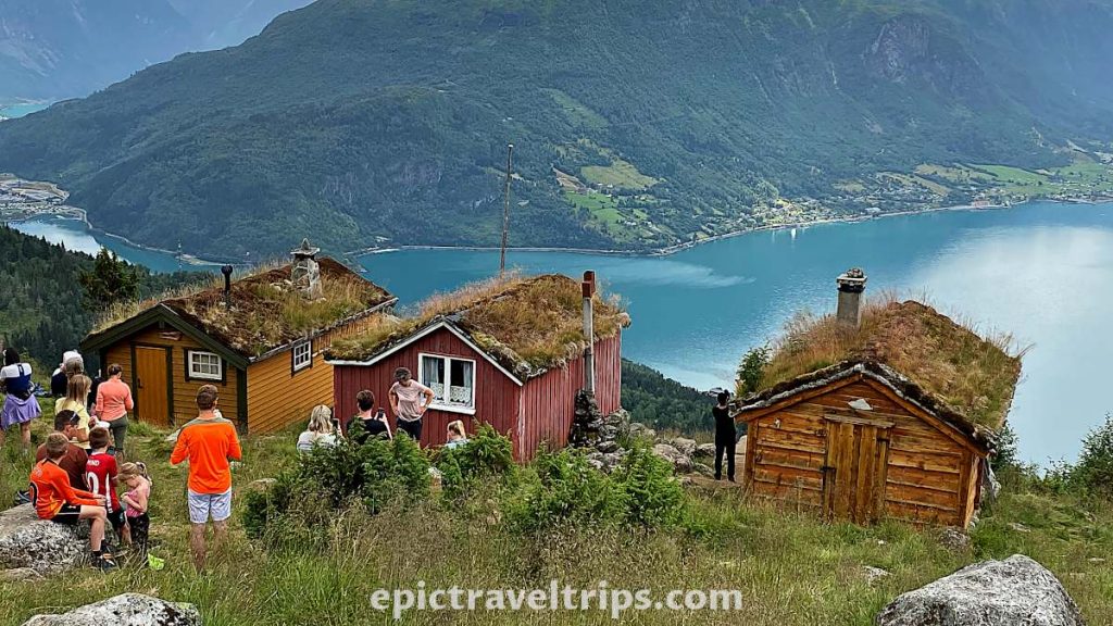
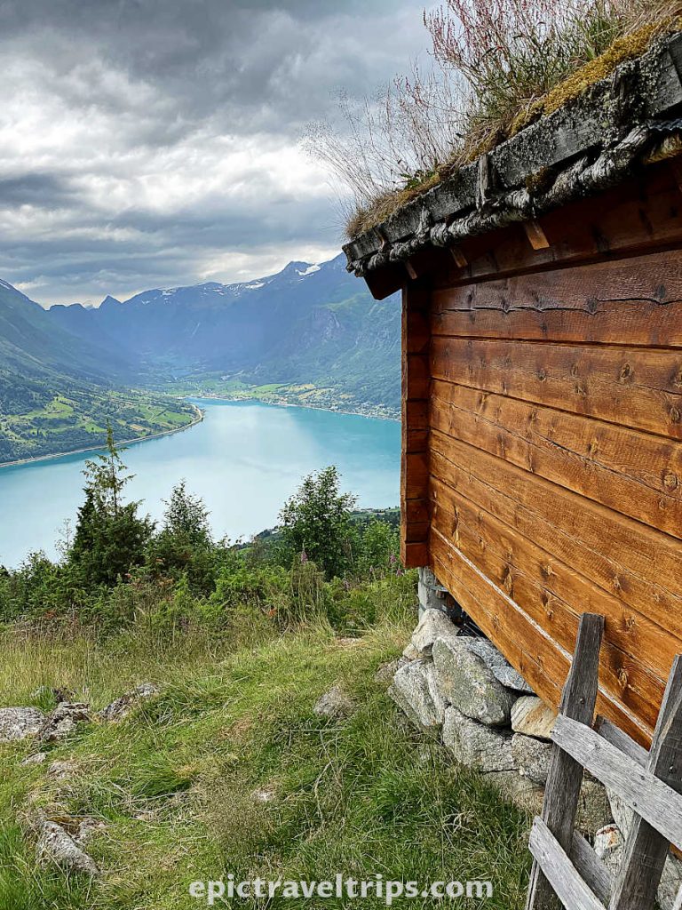
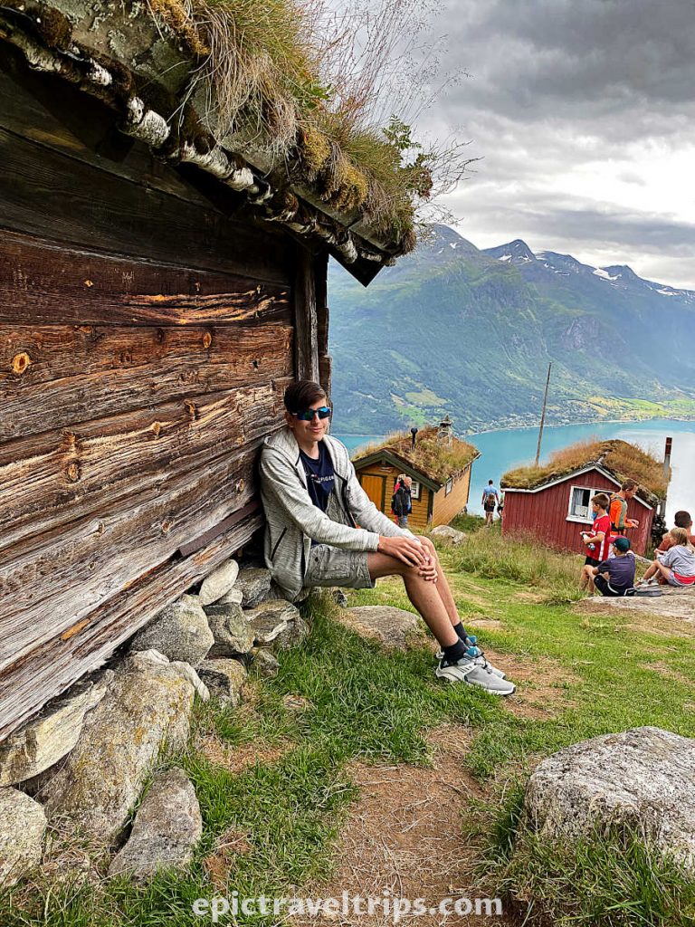
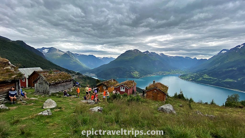
Raksætra farm is situated around 250 meters (820 ft.) past the river.
Finally, you will have a fantastic view of the fjord, the valleys, and the mountains everywhere.
You can walk from Raksætra farm further up to the Oppheimssætra.
We walked up from Raksætra to reach the forest road from the start of our hike and came back walking down that road. At least, that was our plan. Instead, we walked further up and reached Oppheimssætra by accident. From Oppheimssætra, we walked down to the forest (gravel) road and back to the parking.

Oppheimssætra Hike
The hike is 1.2km (0.75 miles) long (one way), and it has 400 meters (1312 ft) climb at an altitude of 640 meters above sea level (2 100 ft.).
The hike starts at the same position as Raksætra Hike on the forest road that leads to Loen Skylift (Cable Car) and Hoven restaurant. Forest road is in reality gravel road and even cars with permission drive to the cable car and restaurant. After around 200 meters (656 ft.), the path turns off the road and continues upwards. The track winds its way up through a pine forest.
Follow the path straight up. One passes the third crossroad at the Lias, and at the fourth crossroads, one encounters a forest road (the same forest road we started this hike) for the second time but walks straight up 100 meters to the Oppheimssætra.
It is possible to walk from Oppheimssætra to Raksætra as we described above but in a reverse direction.
Alternatives
There are several alternatives to hiking these trails.
One is to take Loen Skylift (Cable Car) and walk down the road until seeing the sign to go into the woods to Raksætra. The path to Oppheimssætra is shorter and easier to find since the farmhouses are visibly above the road. First comes Oppheimssætra turn, and later is Raksætra turn.
It is about a 2.5 km (1.55 mi) downhill walk from the skylift until the turn to Oppheimssætra farm.
Another option is to ride a bicycle (preferably electrical) from the parking using only the forest road to Loen Skylift (Cable Car) and Hoven restaurant. There is a sign on the left-hand side where you need to enter the woods to reach Raksætra. Here you can lock and leave a bicycle. The rest of the way is easy to walk through the woods section.
The path to Oppheimssætra is further up on the left-hand side as well. The farmhouses are visible from the road and above the road.
Where are Raksætra & Oppheimssætra located?
Raksætra & Oppheimssætra are in the Vestland county of the Western Norway region, close to the Stryn administrative center, and the nearest village is Loen.
Here are a few distance, time, and roads practical info:
- Oslo: 483 km (300 miles), 7 hours drive, Roads (E6 and 15)
- Bergen: 290 km (180 miles), 5 hours drive, Road (E39 and includes a ferry crossing)
- Ålesund: 138 km (86 miles), 3 hours drive, Road (E39 and includes a ferry crossing)
- Geiranger: 80 km (50 miles), 2 hours drive, Roads (15 and 63)
- Stryn: 11 km (6.8 miles), 15 minutes drive, Road (60)
If you click this link and make a purchase, we earn a commission at no additional cost to you.
How To Reach Raksætra & Oppheimssætra?
Unfortunately, there are limited transportation options to reach this wonderful place.
By bus: No bus lines are driving to the starting point for this hike.
By Car, Motorcycle, or Campervan: A car and a motorcycle are the best options to reach the parking space.
Driving from Stryn to the end of the Rake village, there is a sign for Oppheim to turn sharp left.
Driving from Innvik, Olden, and Loen to just about the beginning of Rake village, turn right at the sign for Oppheim.
From the Oppheim sign, follow the narrow steep road (3 km, 1.86 miles). At the end of the road is a parking space. Parking space is a starting point for the hike.
An alternative is to take Loen Skylift (Cable Car) and walk down the road until seeing the sign to go into the woods to Raksætra. The path to Oppheimssætra is shorter and easier to find since the farmhouses are visibly above the road. First comes Oppheimssætra turn, and later is Raksætra turn. It is about a 2.5 km (1.55 mi) downhill walk from the skylift until the turn to Oppheimssætra farm.
Is It Difficult Hiking To Raksætra & Oppheimssætra?
The usual answer is: “It depends.”
Both tracks are easy walks, according to the trekking association. That means you don’t need climbing ropes, special alpine skills, or equipment.
However, it is 240 meters (787 ft.) elevation for Raksætra and 400 meters (1312 ft.) for Oppheimssætra.
That was a steep slope, at least for us, since we were not in great shape. However, we took breaks often and walked at our own pace. Frequent dehydration was helpful as well. Eventually, we managed to reach the farm.
Be aware that weather conditions can be a vital factor in how fast you hike.
How Long Does It Take Raksætra & Oppheimssætra Hiking?
Everyone is in different physical conditions, so it is not easy to estimate the time needed.
My best advice is to take your time, walk at your own pace, take short breaks, dehydrate frequently, and enjoy being in nature as long as possible for you.
Nature does not hurry, yet everything is accomplished. – Lao Tzu
However, to give some estimates from our own experience so you can have a reference. We believe an hour up to Raksætra is more than enough, and going down is much faster.
We spent an additional half an hour from Raksætra to Oppheimssætra. It is important that walking down the gravel road back to the parking is longer compared to walking back through the forest.
You have to calculate additional time driving to the parking lot, paying for the parking, preparing for the hike, and actual time spent at the farms taking photos and enjoying.
Where To Park For Raksætra & Oppheimssætra Hiking?
There is a parking lot at the end of the road. It is the starting point for the hike as well. If you are wondering how to get to the parking lot, we have already described it. (How To Reach?).
When Is The Best Time To Visit Raksætra & Oppheimssætra?
Norway is a country with unpredictable weather and especially in the mountains. The best chance of having sunny weather is during the summer. However, Norwegian summer is shorter compared with many other countries. June, July, and August are the best months to visit.
Take into account that most Norwegians take a summer vacation in July. So expect July to be high of the season and overcrowded.

What Is Nearby Raksætra & Oppheimssætra?
From Raksætra is a fantastic panoramic view of the area and Innvik fjord. So you can see how everything looks mind-blowing.
Many places are worth visiting close by, and we spent three days wandering, exploring, and discovering around.
Here are some of our top picks:
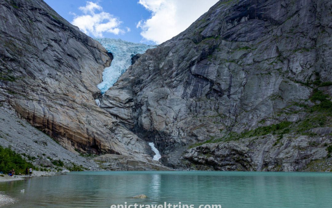
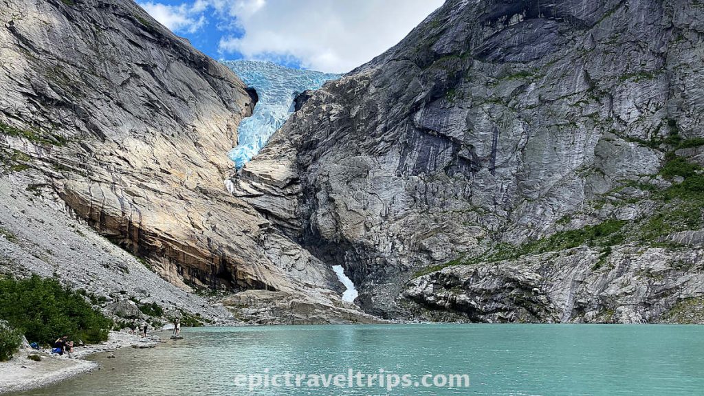
Briksdal Glacier (Briksdalsbreen)
Who knows how long this glacier will last? Every year is smaller and smaller…
Oldevatnet Lake
Oldevatnet Lake is emerald green, and it is just marvelous. Green grass, blue sky, and white clouds with surrounding mountains are just the perfect addition to this stunning landscape.
If you drive to Briksdal Glacier (of course, plan your trip using our guide), you cannot miss it. We stopped by the Olden Gytri camping to take this fabulous and colorful photo.
Floen Lake
Another landscape photo-looking lake, but it is smaller than Olddevatnet. Again, if you drive to the glacier you cannot miss it.
Loen River & Lake (Loenelva & Loenvatnet)
Loen River and Lake are on the way to our next landscape suggestion Breng – Wooden Farm Houses (Breng Seter).

Photo from © Sergey Bogomyako
Breng – Wooden Farm Houses (Breng Seter)
The design of Breng wooden farmhouses (Breng Seter) is similar to Raksætra & Oppheimssætra. However, they are near the lake and easily accessible. No hiking is needed.
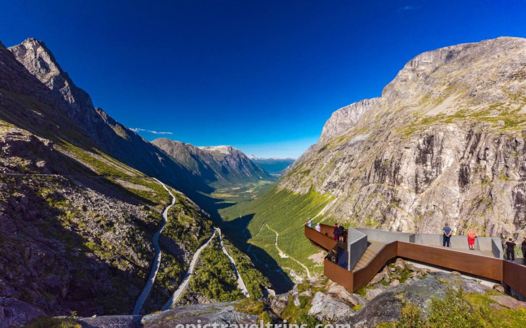
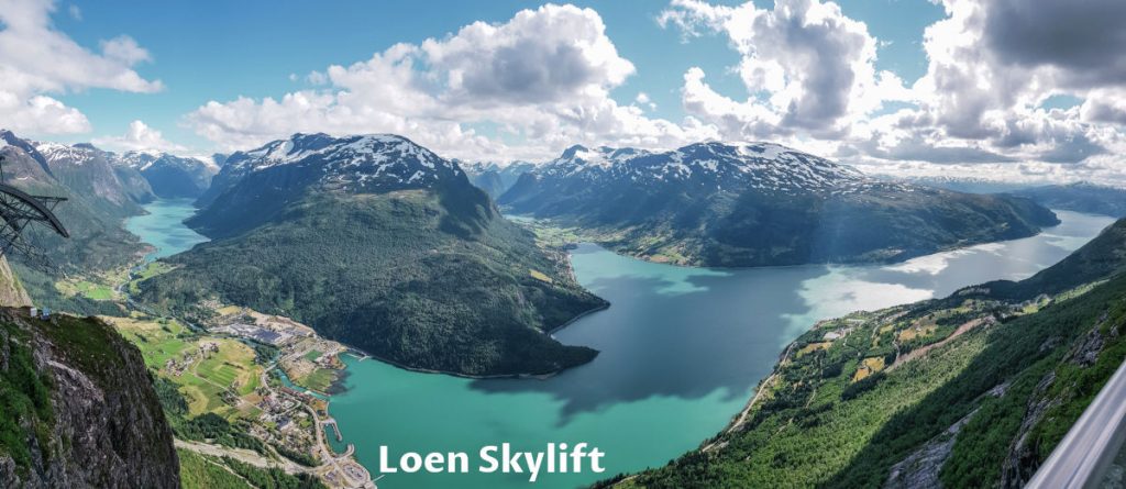
Loen Skylift (Cable Car)
The fastest way to get a mind-blowing view of the Innvik fjord, Olden, and Loen Valley is to take the cable car. However, not the cheapest.
Photo from Loen Skylift shows the magnificent view from the top in its glory.
On the left-hand side, we can see Loen Lake, its valley, the river, and the place itself. The most dominant is Innvik Fjord, part of the much bigger Nordfjord. The valley in the middle of the photo is Olden Valley where Oldevatnet Lake, Floen Lake, and Briksdal Glacier are.
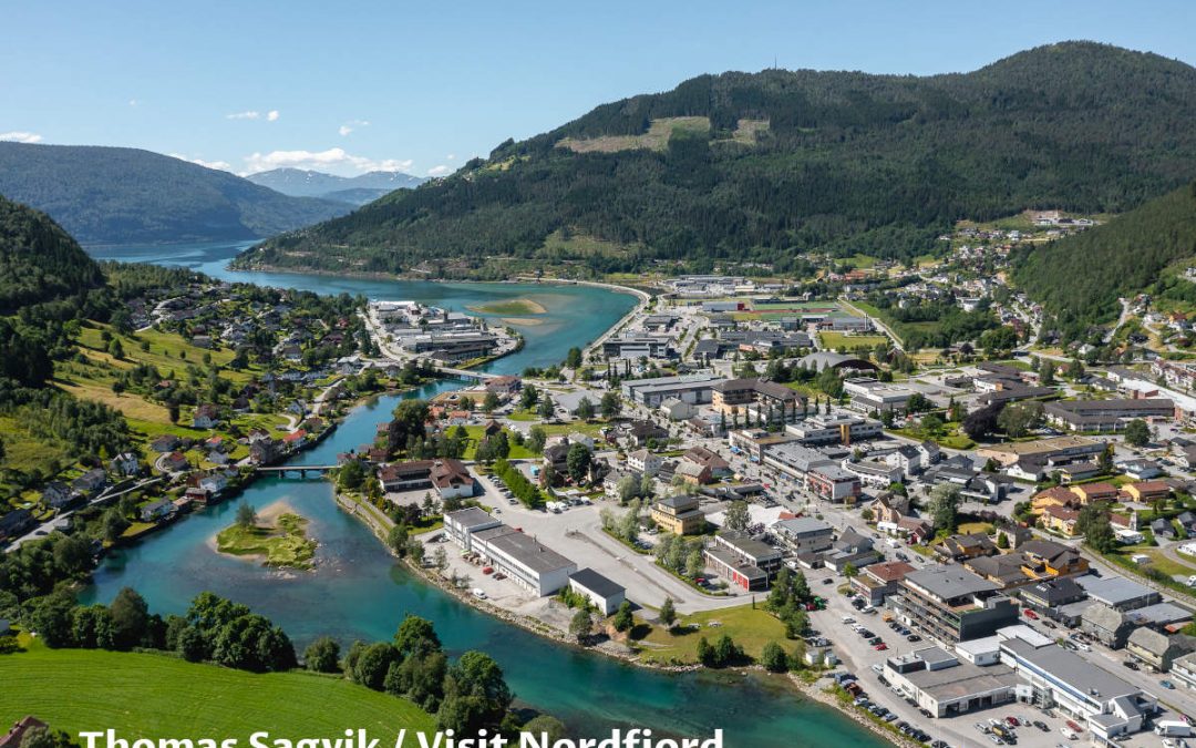
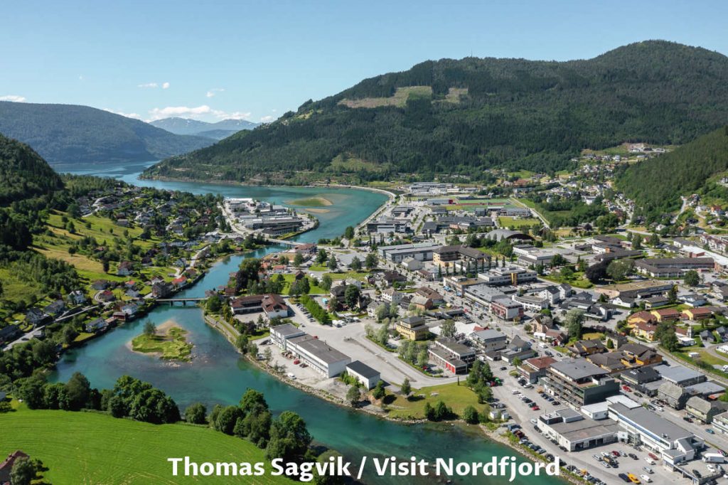
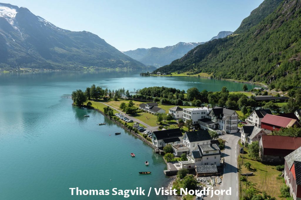
Stryn
Stryn is the administrative center of the region. It offers many restaurants for dining and grocery shops for resupplying.
Photo from Thomas Sagvik / Visit Nordfjord shows us Stryn city, river, and a small part of the Nordfjord.
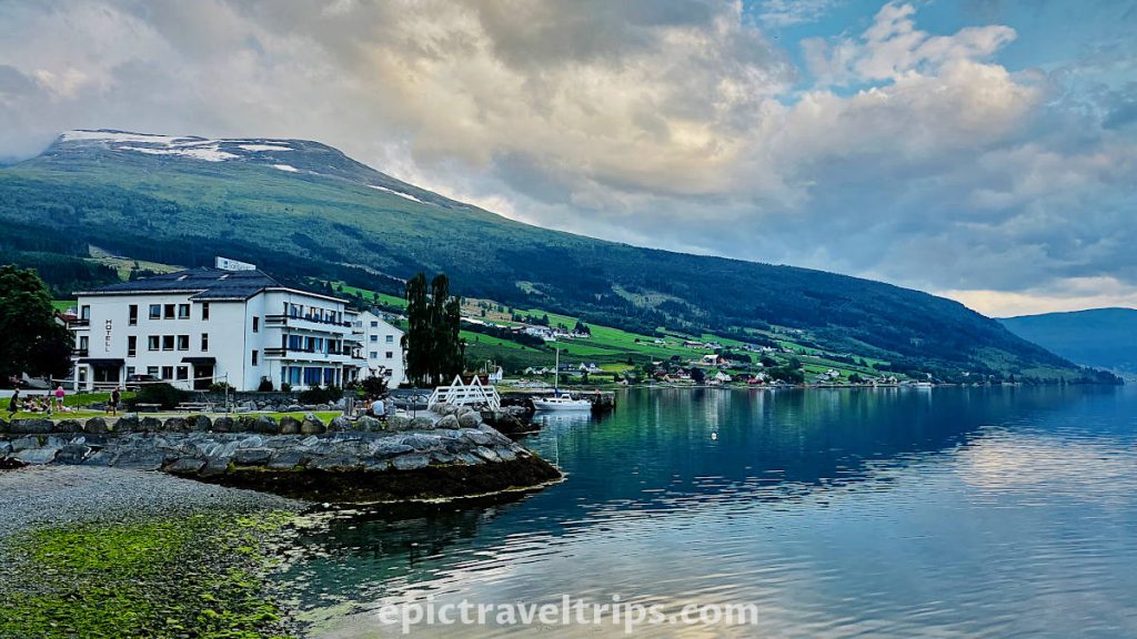
Innvik
Innvik is a small village just half an hour’s drive from Stryn, and some 34 km (21,1 miles) separates the two. It is an accommodation alternative to the more busy Stryn. We stayed in Innvik Fjordhotell. It was a perfect spot on the fjord shore. We recommend it as a budget option compared with higher prices in Stryn and Loen.
If you click this link and make a purchase, we earn a commission at no additional cost to you.
Hjelle
A charming village on the shores of Oppstrynsvatnet Lake is another opportunity for memorable landscape photos. It is convenient to stop by, especially if you drive further to Geiranger or Oslo via Otta.
Thomas Sagvik / Visit Nordfjord was lucky enough to get this fantastic drone photo on a sunny and bright day when the lake water was very calm.
Old Stryn Road (Gamle Strynfjellsvegen)
Old Stryn Road (Gamle Strynfjellsvegen) is part of the road engineering history through this rough terrain over the mountains. Now is predominantly a tourist attraction.
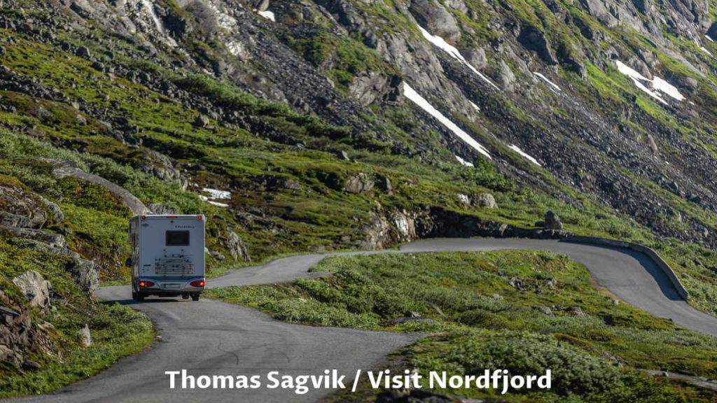
Photo from Thomas Sagvik / Visit Nordfjord shows us a glim of this piece of history.
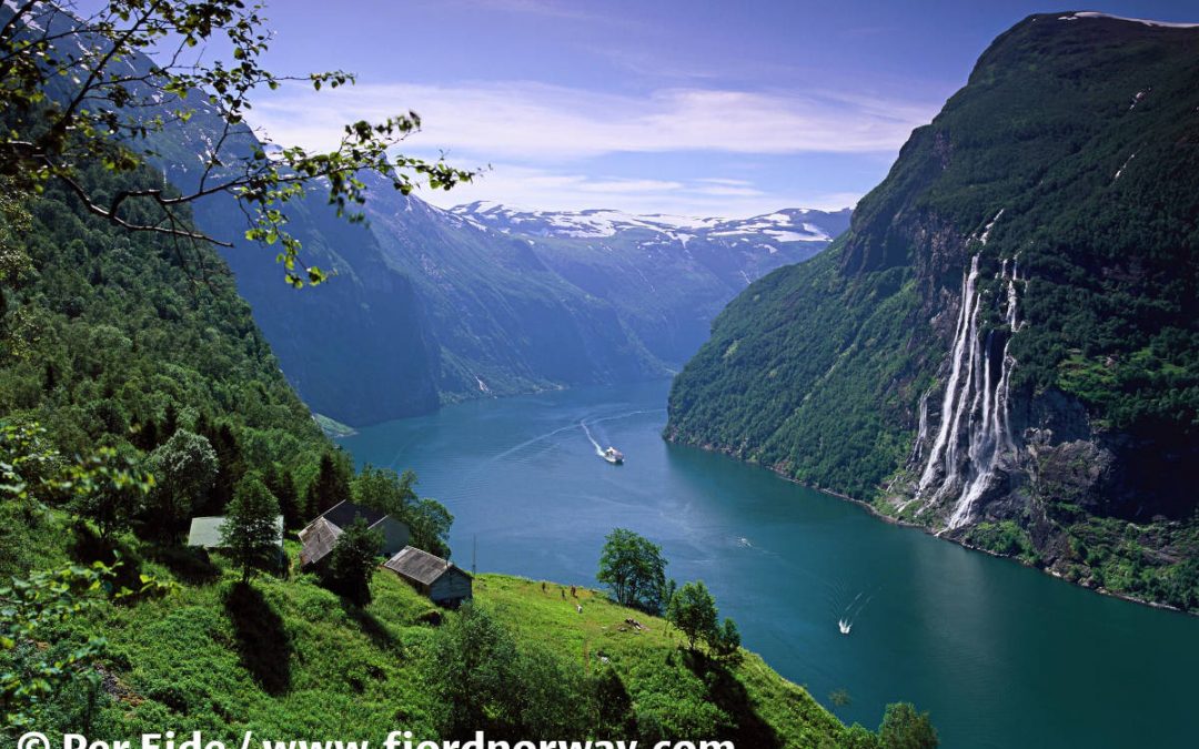
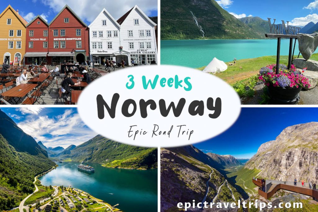
Geiranger Fjord
Geiranger was our next destination on our 3-Week Norway Epic Road Trip. It is an iconic place when talking about fjords in Norway. Simple, it is a must to experience fjords at their best. Luckily, Geiranger is a short 75 km (46,6 mi.) and one hour and twenty minutes drive from Stryn.

Our Impressions
Hike both Raksætra and Oppheimssætra come with a bonus. It is a stunning panorama view of the whole region.
Is it difficult? It is maybe on the tough side (at least for us), but it is well worth the effort.
We will definitely come back to the Stryn region to further discover the natural beauty gems.
Hopefully, this article will inspire you to come and visit this place one day.
We wish you an epic trip!