
- What is Vindhellavegen?
- Vindhellavegen Hike
- Where is Vindhellavegen located?
- How To Reach Vindhellavegen?
- Is it difficult Hiking Vindhellavegen?
- How Long Does It Take?
- Where To Park?
- When Is The Best Time To Visit?
- What Is Nearby Vindhellavegen?
- Vindhellavegen – Our Impressions
Hiking Vindhellavegen is fantastic & easy, and we would like to share it with you. Although we have lived in Norway for many years and have driven several times nearby Borgund, we did not know about this hidden gem.
But now that is changed, and nothing will be the same. We are rich for a small piece of history. So you can be as well.
What is Vindhellavegen?
Vindhellavegen is the part of King’s Road (“Kongevegen over Filefjell” or just “Kongevegen”) and probably the most visited part of it. The purpose of King’s Road was to connect Oslo (Christiania at that time) with Bergen. The build year of the road was 1790.
While we drove this section of Highway E16, many signs pointed to King’s Road (Kongevegen) sightseeing attractions.
However, Vindhellavegen is a failed project and not just once but twice. The failure was the too-steep build combined with winter conditions in Norway. It was just too big of an obstacle for horses and carts to come down during cold winter ice days.
Even “modernization” with the latest engineering technology in 1840 by building an extra turn and stone walls to support the road was not enough. It was, again, just too steep.
To our delight, it is not a failure after all, and it is left to tourists to admire it while walking with a magnificent view from the top.
Vindhellavegen Hike
Vindhellavegen hike is around 2.2 km (1.37 miles) long one way. You can walk both from the north and south side.
Vindhellavegen Hike From The Northside
There are two pathways from the north side. For both, the starting point is the Visitors Center of Borgund Stave Church.
Walk from Visitor’s Center down the Fv630 road (watch for the traffic) in the opposite direction of Borgund Stave Church. After 500 meters (0.31 mi) on the left-hand side, there is a sign for Vindhellavegen and a small forest path. Follow this path. Eventually, you will reach the top and the winding road.
The other pathway to hike from the north side is to cross the street from Visitor’s Center and walk to Borgund Stave Church. Walk between Borgund Stave Church and New Church. Follow the signs through the forest. Eventually, you will join the Vindhellavegen pathway (previously described) at one point.
Vindhellavegen Hike From The Southside
From the south side, the starting point is a marked parking lot some 5 minutes drive further down road Fv630 (4 km, 2.5 miles) from the Visitor’s Center of Borgund Stave Church.
Vindhellavegen Hike – Practical Info
The hike from the north side is less steep and a lot easier since the climb is only 75 meters (246 ft.). The south side elevation is 168 meters (551 ft.) above sea level.
However, the south side is the more attractive and the main reason tourists walk this tour.
The lowest point is at 314 meters (1030 ft.), and the peak is at 476 meters (1561 ft) above sea level.
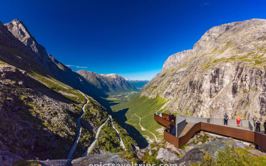
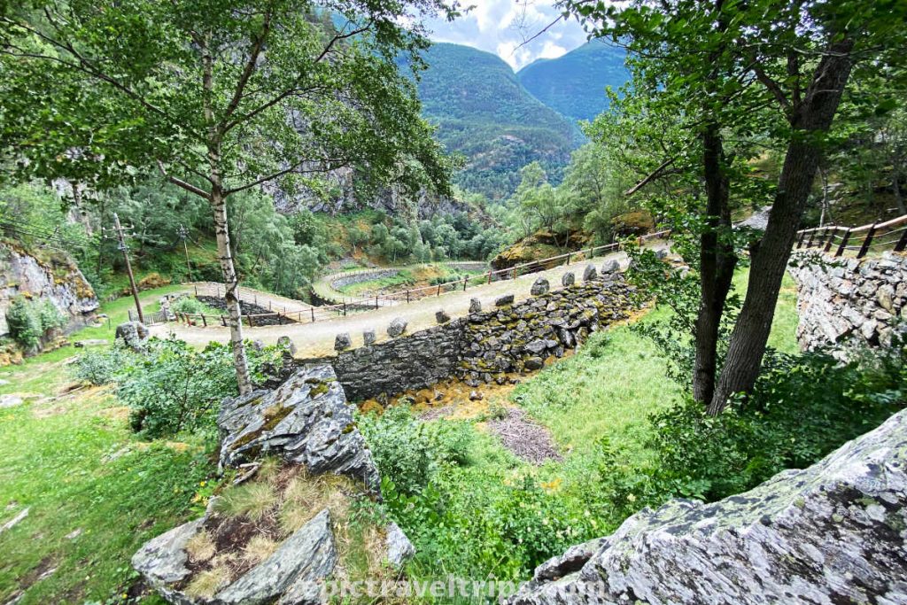
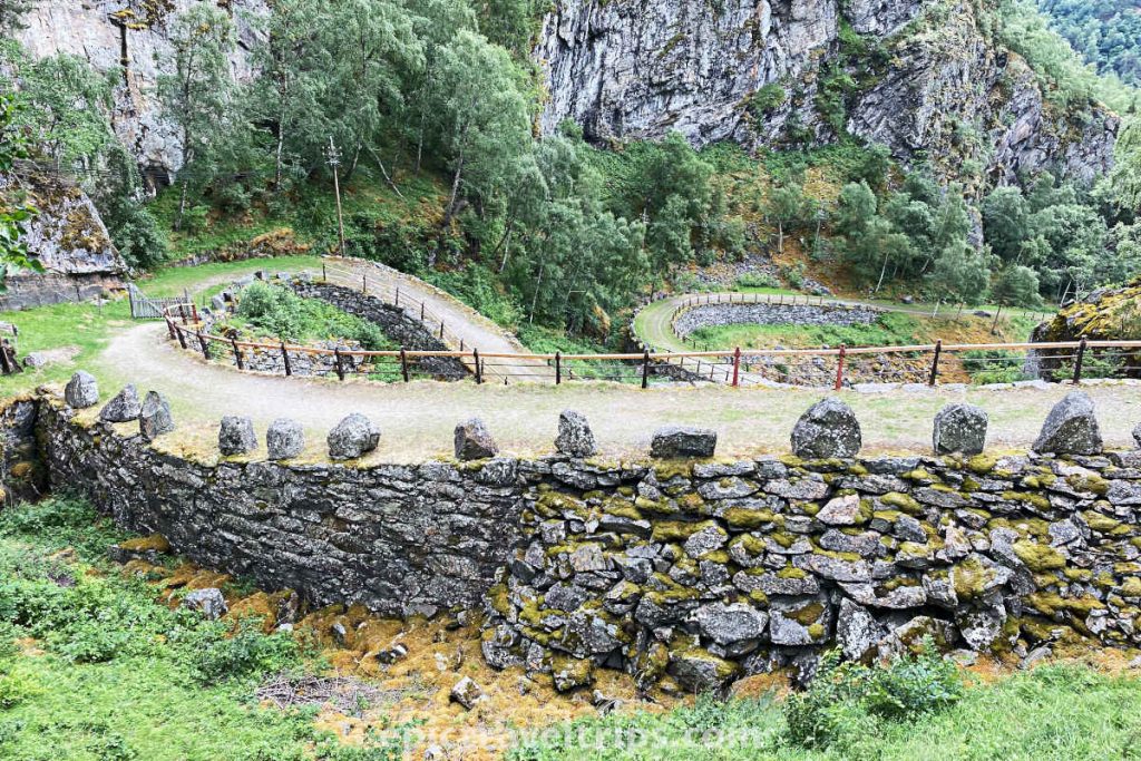
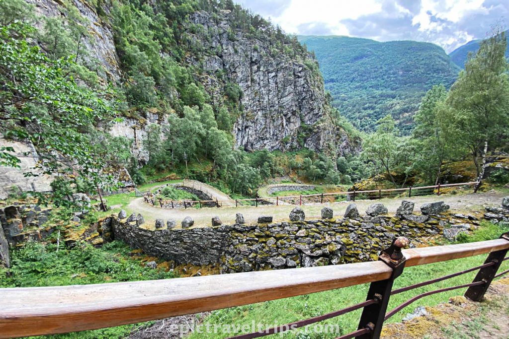
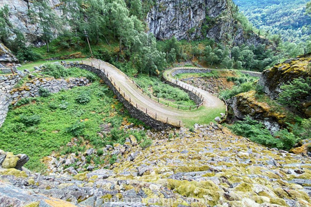
The steepest but most attractive hike part consists of four 180 degrees bends. High stone walls support the road built high up in the terrain. On the side, there are metal and wooden rails as a security barrier and stone rocks on the other side.
Surrounding mountains, dense woods, the stream at the bottom, and the sky above tuck the road. Remarkably, the road blends well with the surrounding nature. Only birds have a more impressive view of the road from the air.

Selfies in 1901
Can you imagine how the car was a modern technological wonder in 1901? Maybe you are asking yourself why I am mentioning this. There is a stone marking the year 1901. It was the year the first car tourist crossed this road, and his nickname was Netherland Beduin.
The stone is on the south side of the trail near the parking.
Where is Vindhellavegen located?
Vindhellavegen’s location is in the Vestland county of the Western Norway region in the proximity of the Lærdalsøyri administrative center.
Here are a few distance, time, and roads practical info:
- Oslo: 300 km (186,4 miles) south of the church, 4 hours 30 minutes drive, Road (E16)
- Bergen: 220 km (136,7 miles) west of Borgung, 3 hours 30 minutes drive, Road (E16)
- Flåm: 55 km (34 miles) west of the church, 55 minutes drive, Road (E16) – drive through 24,5 km (15 miles) long Laerdal Tunnel.
- Lærdalsøyri: 27 km (17 miles) north of the church, 30 minutes drive, Road (E16)
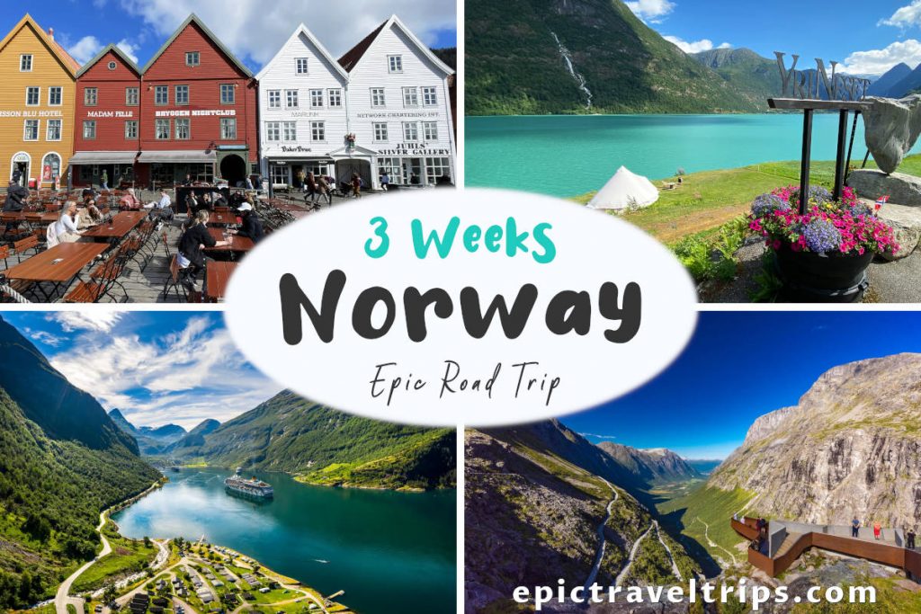
Lærdalsøyri was our base for exploring this area on our 3 Weeks Norway Epic Road Trip. We stayed at the budget hotel Lærdal Ferie- og Fritidspark. We further controlled our budget by resupplying in the local grocery shops and making our own food in the common kitchen.
If you click this link and make a purchase, we earn a commission at no additional cost to you.
How To Reach Vindhellavegen?
There are limited options to reach Vindhellavegen. The car is by far the most convenient mean of transportation.
By Car: From Oslo, exit from the E16 highway before the Borgundstunnelen tunnel. Drive the road 630 for about two minutes (1.6 km, 1 mile). Parking is at the Visitors Center of Borgund Stave Church if you want to hike from the northern side.
If you want to hike from the south side, drive 5 minutes further (4 km, 2.5 miles) down the same Fv630 road. There is a small parking lot on the right-hand side.
From Bergen, Voss, and Flåm, exit from the E16 highway just after the Seltatunnelen tunnel and before the Borgundstunnelen tunnel. Drive the road Fv630 for about 4 minutes (2.7 km, 1.68 miles), and the parking is on the left-hand side to hike Vindhellavegen from the southern side.

If you want to hike from the northern side, it is better to exit Highway E16 after the Borgundstunnelen tunnel. Drive the road Fv630 for about two minutes (1.6 km, 1 mile). Parking is at the Visitors Center of Borgund Stave Church.
By Bus: There is a bus line 103 from the Lærdalsøyri bus terminal (near the Kiwi grocery shop), and it takes 45 minutes to reach Borgund Church.
By Train: Vindhellavegen is not on the national railway network. The closest railway station is at Flåm. From there probably need to switch to the bus to Lærdalsøyri using the Vy Bus operator. Finally, take the local bus line 103.

By airplane: The nearest airport is Sogndal Airport, a one-hour 15-minute drive by car from Vindhellavegen. Widerøe operates several daily flights to both Oslo and Bergen.
If you click this link and make a purchase, we earn a commission at no additional cost to you.

Is It Difficult To Hike Vindhellavegen?
The Vindhellavegen hike is not a demanding tour for the majority of hikers. The hike from the north side (from the Borgund church) is much easier compared to the hike from the south side.
We saw several families with small babies in prams so the track is family-friendly. However, we did not see disabled people in wheelchairs so we do not know if the path is accessible for them.
Always take into consideration unpredictable Norwegian weather
How Long Does It Take Vindhellavegen Hiking?
Everyone is in a different physical condition, so it is not easy to estimate the time needed individually. We believe 45 minutes to one hour are more than enough for one way hike.
Our best advice is to take your time, walk at your own pace and enjoy being in nature as long as possible.
Time spent in nature is priceless.
We don’t inherit the earth from our ancestors, we borrow it from our children. – Native American proverb
Where To Park For Vindhellavegen Hiking?
If you hike from the north side, park at the Visitors Center of Borgund’s Stave Church. As far as I remember, parking is free.
On the south side, there is a small parking lot on the right-hand side if driving from Borgund church direction.
When Is The Best Time To Visit Vindhellavegen?
We visited this area in different seasons. On our last visit in late April, there was still snow and ice on the track. So it was not recommended by the guides hiking the track.
So the best time to visit is during the summer. However, Norwegian summer is shorter compared with many other countries. June, July, and August are the best months to visit.
Photos are from our visit in mid-July. It was cloudy and windy with a few sunny moments.
What Is Nearby Vindhellavegen?
There are so many attractions in Vindhellavegen’s proximity, and we have described them in more detail in our Best Things To Do In Flåm article.
Here we will mention a few with short descriptions so you can get the impression of what you can expect.
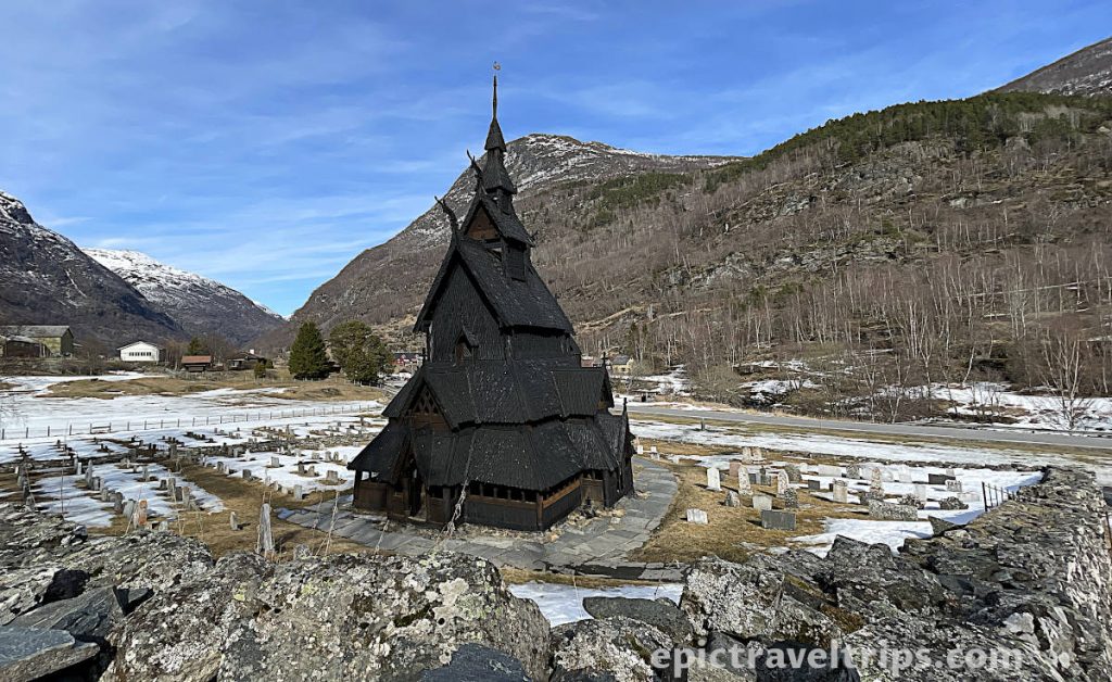
Borgund Stave Church.
Nearby is a Borgund Stave Church. It is well preserved medieval black wooden church with a Viking dragon’s motives and an important historical monument.
So probably the best suggestion is to combine a visit to the church with this hike as a short trip.
Some 55 km (34 miles) from here is Flåm with many tourist attractions such as:
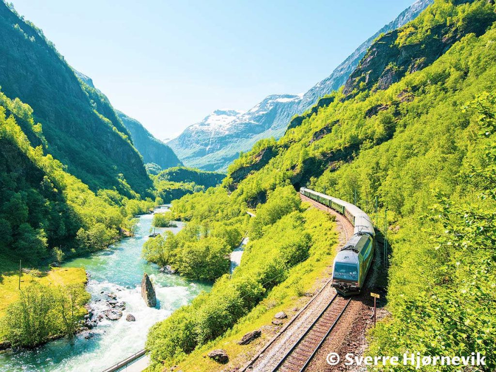
Flam Railway (Flåmsbana)
Flåm Railway is a magnet for tourists in Flåm. It is attractive since it provides an engineering railway construction solution to overcome the high altitude of 866 meters (2841 ft.) in a short distance of only 20.2 km (12.6 mi). Such railways mean fantastic views, extraordinary nature, mountains, rivers, streams, waterfalls, tunnels, bridges, and long-lasting memories. In addition, you can combine a railway tour with zip line adventure, biking, and hiking at your own pace and discover this fantastic natural scenery yourself.
Just look at this beautiful photo by © Sverre Hjørnevik and you will be more than hooked to come and visit this extraordinary place.
Aurlandsfjord
Aurlandsfjord is just an arm of a much larger labyrinth that makes up the largest fjord in Norway, the mighty Sognefjord. The fjord is 29km (18 miles) long. It is deep and narrow. However, Sognefjord is 206 km (128 mi) at the furthest arm, Lustra Fjord.
Flåm is at the end of Aurlandsfjord. Just look at the breathtaking view from Stegastein Viewpoint (described shortly below) over the Aurlandsfjord.

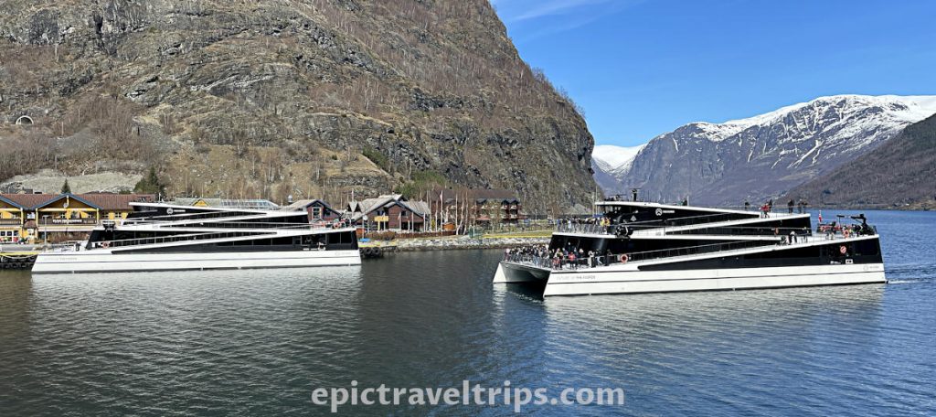
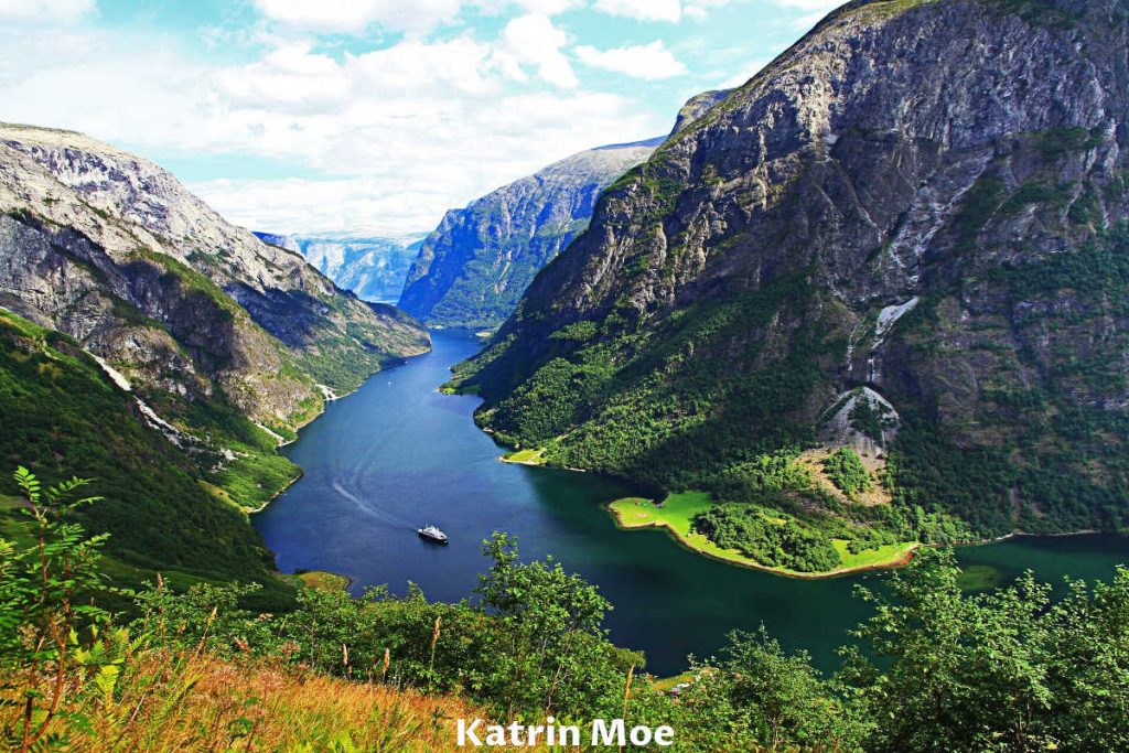
Fjord Cruise Nærøyfjord
Slowly glide the waters of beautiful Aurlands & Nærøy Fjords in hybrid or electrical cruise ships from Flåm to Gudvangen and take the bus ride on your way back to Flåm and round up the trip. The ships have large windows and walkways in the shape of the final parts of the winding trails of the Flåm railway, so you can for sure find a spot to enjoy the view.
Just look at the photo of the beautiful Nærøy Fjord that ends at Gudvangen village.
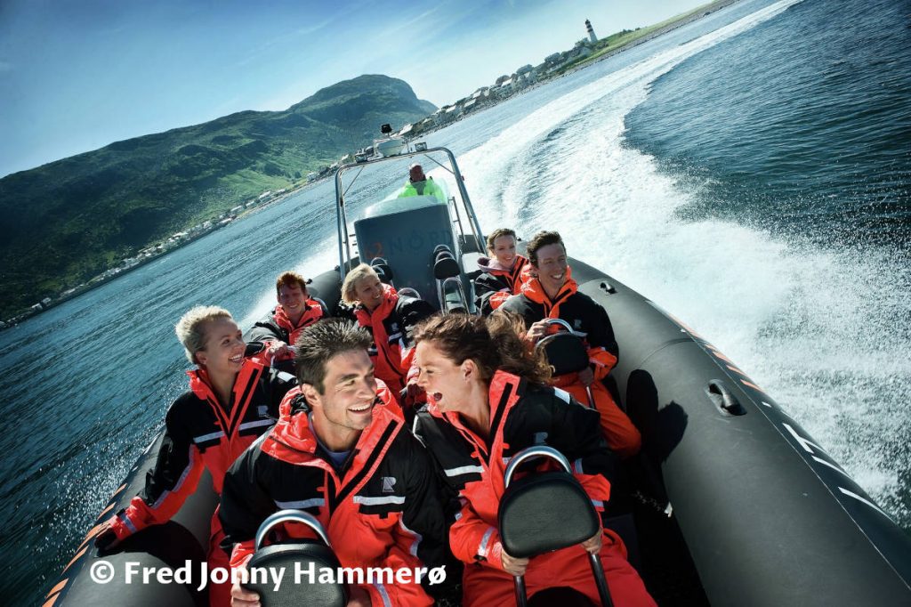
Aurlandsfjord Fjordsafari
Aurlandsfjord Fjordsafari is more suitable for the type of tourist looking for adrenalin and an adventurous experience rather than a relaxing cruise experience. Fjordsafari is one hour and thirty minutes water glide and wave ride on the RIP boats.
Thanks to the photo from © Fred Jonny Hammerø / Møre og Romsdal fylke, we can see how big a thrill the ride is for the passengers.
Flam Railway Museum
The museum is Flåm’s Railway Wikipedia. Many artifacts document the railway’s rich history in the museum. Documents, old photos, exhibition pieces, and even Flåm’s old locomotive are some of them.

Flåm River – Flåmselvi
On a hot day picnicking or camping next to the Flåm’s river is excellent refreshment. The bravest can swim in the water since it can be cold, although some youngsters deny it.

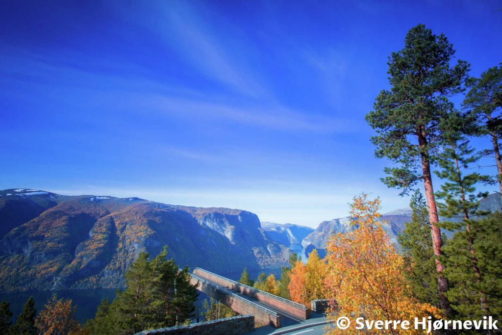
Stegastein Viewpoint
Stegastein Viewpoint provides a panoramic view over the Aurlandsfjord, Aurlandsvangen village, and Aurland River (Aurlandselvi). The built platform is an engineering marvel in itself.
The platform is at a height of 650m (2 130 ft) above sea level. Such extreme height adds to the atmosphere of anticipation to look over the glassy wall and enjoy the panorama to the full extent.
As you can see in this beautiful photo from the © Sverre Hjørnevik, the platform, and the view are magnificent.
You can reach it in one of two ways. The first is to drive from Lærdalsøyri over the mountains on the unique Aurlandsfjellet Scenic Route (The snow road). The second is to exit road E16 after getting out of the long Lærdal’s Tunnel (provided you come from Oslo). Next, drive through Aurlandsvangen village and further up on the narrow, winding road to the mountains.
Aurlandsfjellet Scenic Route (The snow road)
Aurlandsfjellet Scenic Route (the snow road) season is only in the summer months.
The road is 47 km (29 miles) long. At some points, it goes just over 1 300 m (4 265 feet) above sea level. It is probably one of the best locations to get the sense of winter during the summer.
Instead of driving through Lærdal Tunnel to reach Flåm, in our opinion, the snow road is a much-exiting alternative. You can pass by Lærdalsøyri, drive over the mountains (the snow road), visit Stegastein Viewpoint, and finally reach Flåm as the end destination.
Look at the photo below from Fjord Norge / Visit Norway. It was the image we were imagining before driving the road, but…
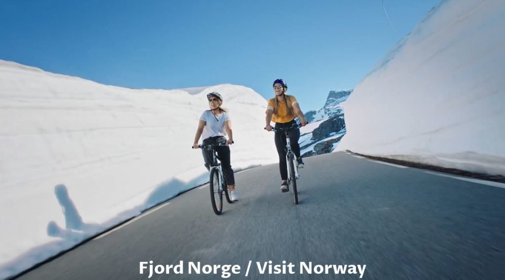
When the season is open, usually the snow is very high, so car drives between the walls of snow on the roadsides.
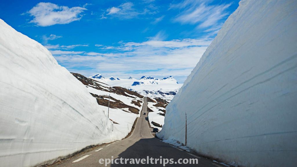
We were not that lucky, and most of the snow melted in the mid of July. Only the short sections were still with pockets of snow. We need to come back earlier in the season.
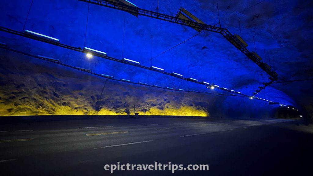
Lærdal Tunnel (Lærdalstunnelen)
On the way to Flåm (from Oslo), it is a 24 km (15 miles) long Lærdal Tunnel. We believe it was, at one point, the longest tunnel in the world, but we are not quite sure. However, to make driving through the Laerdal tunnel less boring, in several places, caves with blue lights on the walls and yellow ones on the edges were built to give the impression of the rising sun.
Lærdalsøyri
Lærdalsøyri is a small place tucked between steep knife-cut mountains. Lærdal River on one side of the valley slowly runs into the mirror-calm bay water. The bay is part of the much bigger fjord. Our hotel location is at the edges of the bay. It is popular among campers as overnighting place.
The sunsets are fantastic here. Sun, on the way, down hides behind the mountain on the left. Suddenly it appears and warms the bay for some time. Like a shy guy disappears behind the steep mountain edge on the right.
If you click this link and make a purchase, we earn a commission at no additional cost to you.
Vindhellavegen – Our Impressions
We have filled our lungs with fresh mountain air climbing up the pathway at our own pace. At the same time, we sunbathed on sunny sections of the path and cooled down in the shade sections. At the top, as a reward, we experienced a fantastic view of the winding stone path below us. Vindhellavegen was a highlight of our first day in this area.
We wish you an epic trip!